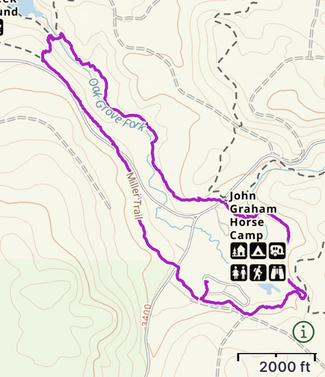
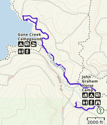
Clackamas Lake Horse Camp
|
Location: Clackamas Lake Horse Camp, no address available
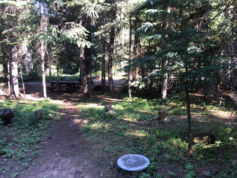
Facilities: Vault toilets, manure goes in garbage dumpsters in plastic bags, fire pits and picnic tables at each site Camp Site Amenities: picnic table, fire pit, Site Type: 1 Pull-through site at site 4, all others back in Water: Water Spigot at one end of camp Footing: Rocky, hoof boots recommended Cell Signal: 1 bar with ATT Dogs: Dogs allowed Other: Weed-free hay required Website: https://www.fs.usda.gov/recarea/mthood/recarea/?recid=53354 Reservations: https://www.recreation.gov/camping/campgrounds/232834 |
|
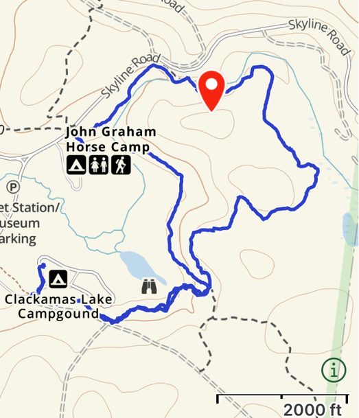
Getting There
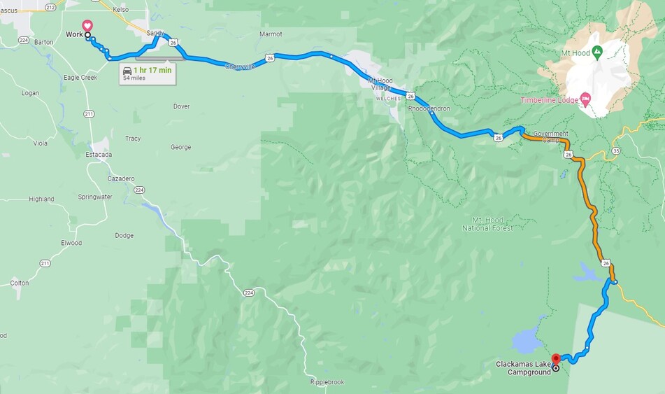
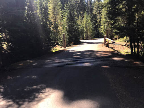
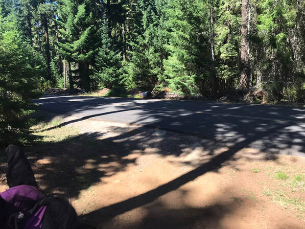
Driving to Clackamas Lake Campsite was super easy! It was 1 hr and 15 minutes from my barn in Boring and the drive was beautiful with smooth, with paved roads the whole way to camp. The hardest part of the trip was returning home and pulling out from the camp road onto Hwy 26 on a Sunday afternoon with traffic. Driving down the mountain was relatively easy. There was a steep section after leaving camp where I downshifted to 2nd gear to keep the horse trailer going slow. There were double lanes almost the whole drive, making it easy for faster drivers to pass me. For mountain driving this was a relatively easy drive. However, I have driven Sam over the mountain passes of Colorado in the snow, so I was very happy to have an easy drive.
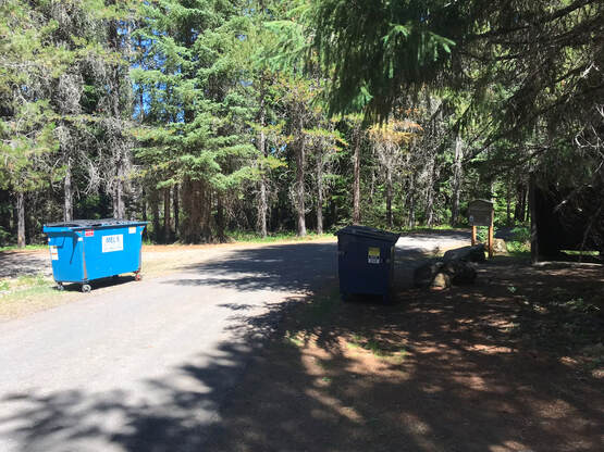
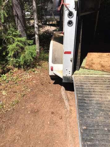
There were vault toilets and garbage bins. I found leaving camp and driving between the two dumpsters with my rig a little daunting. We had enough room, but clearly they don't get enough horse trailers through camp!
Must Brings
1) Garmin Satellite Phone - I only had 1 bar with ATT in camp, so it is always a good idea to have a way to send someone a message in case of trouble.
2) Gaia GPS App - Gaia continues to save me. There were multiple times when the trail signs were hard to interpret. It was easy to start going a direction, then double check with my app to see if I was still on the right trail
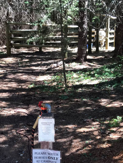
3) 100 foot hose x 2 - Campsite #4 had a water spigot within 100 feet of the corrals. It would have been hard to reach 5, 7, and 8 without joining two 100 foot hoses together. If you are in campsites 17, 18, and 19, I would warn you that you will have to haul water from a far-away spigot or bring your own water. You could also use a muck bucket on wheels to haul water from the spigot. I would bring a hose with a fork or y attachment that also allows you to fill up buckets or water bottles. Our spigot was the only water supply for the first half of the campsites and the Y attachment made it easy to share.
4) Muck bucket with wheels and plastic bags - The camp host wanted me to dump my manure in a plastic bag and then dump it in the garbage bins.
5) Fly protection - we rode in early August 2022 and the mosquitos and flies were not bad. We tend to ride from 7am-11am before the bugs wake up
2) Gaia GPS App - Gaia continues to save me. There were multiple times when the trail signs were hard to interpret. It was easy to start going a direction, then double check with my app to see if I was still on the right trail
3) 100 foot hose x 2 - Campsite #4 had a water spigot within 100 feet of the corrals. It would have been hard to reach 5, 7, and 8 without joining two 100 foot hoses together. If you are in campsites 17, 18, and 19, I would warn you that you will have to haul water from a far-away spigot or bring your own water. You could also use a muck bucket on wheels to haul water from the spigot. I would bring a hose with a fork or y attachment that also allows you to fill up buckets or water bottles. Our spigot was the only water supply for the first half of the campsites and the Y attachment made it easy to share.
4) Muck bucket with wheels and plastic bags - The camp host wanted me to dump my manure in a plastic bag and then dump it in the garbage bins.
5) Fly protection - we rode in early August 2022 and the mosquitos and flies were not bad. We tend to ride from 7am-11am before the bugs wake up
Horse Campsites
|
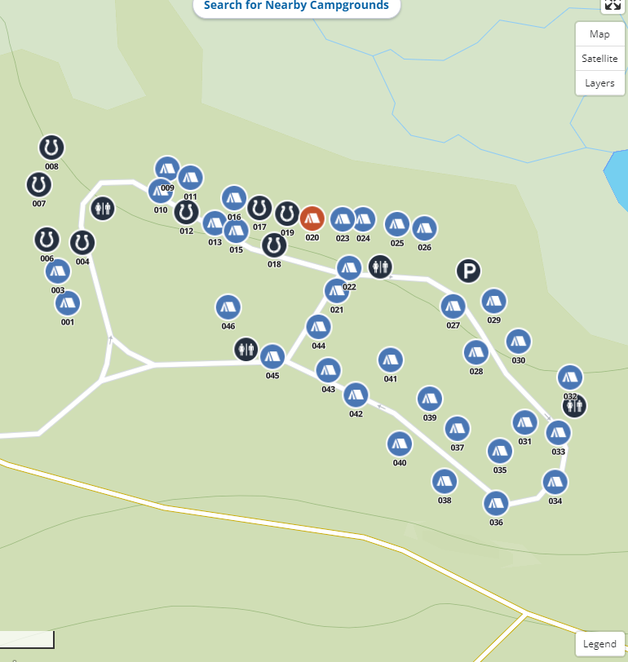
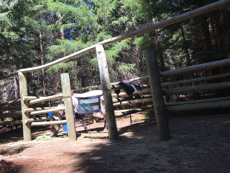
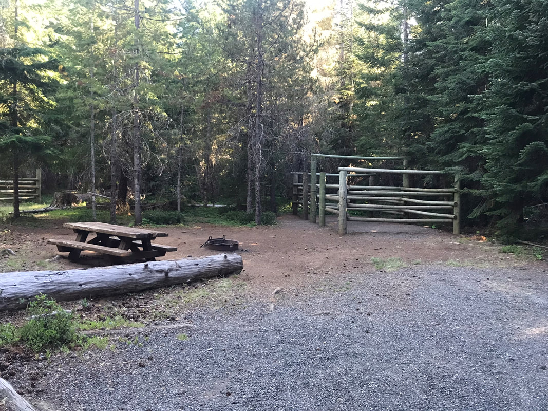
Clackamas Lake may be a secret gem of a horse campsite! I decided to camp here because I could not find any good, detailed information about this place online. All I knew was there was a pull-through site at #4. I Site four was wonderful! It had a water spigot within 100 feet of the horse corrals and was close to the restrooms and the dumpster. The entrance sign says that horses are allowed at sites 1-19 but only, 4-8, 12, 14, 17 and 18 had horse corrals. The horse sites 4, 5, 6, 7 and 8 were nice and more secluded from the rest of the campground. During our visit Sam was the only horse there. All of the equestrian spots were taken by non-horse users. This is unfortunate because it is a really nice campsite! Site 4 was nicer than any of the sites at Joe Graham with water and a pull-through! The only downfall to not camping at Joe Graham was we were farther from Timothy Lake. I had some really nice rides through the forest so I wasn't too concerned about this.
The corrals here are wooden corrals with chain gates but they seem larger than the typical OET wooden corral. I would still like to see flexible/convertible corral designs but it was nice for Sam to have slightly more room. The reservation system had a minimum # of horses for each site, which was weird since it said you should have 3 horses to stay in site #4. We disregarded this as a government mistake, and made reservations anyways. If this is valid, then it is outdated and unreasonable. This means people with 1 horse are discouraged to make reservations. This just ensures that non-horse campers continue to take-over "reserved" horse-sites. |
|
Horse Campsite Details
- Site 1: Back in tent site
- Site 2: Not on campsite map, camp host with 2 horse corrals
- Site 3: Back in tent site
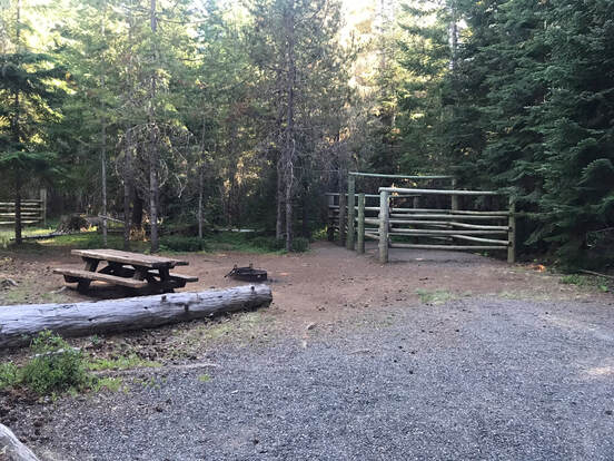
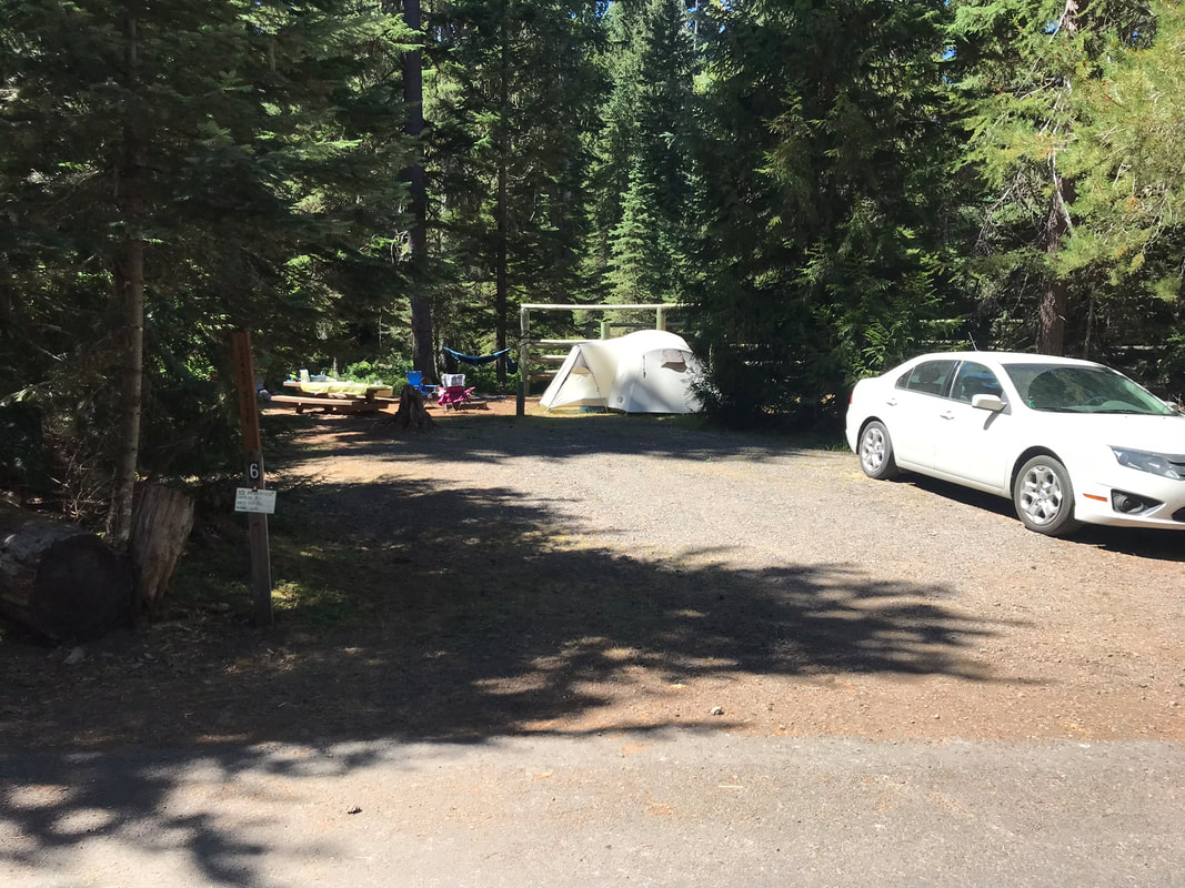
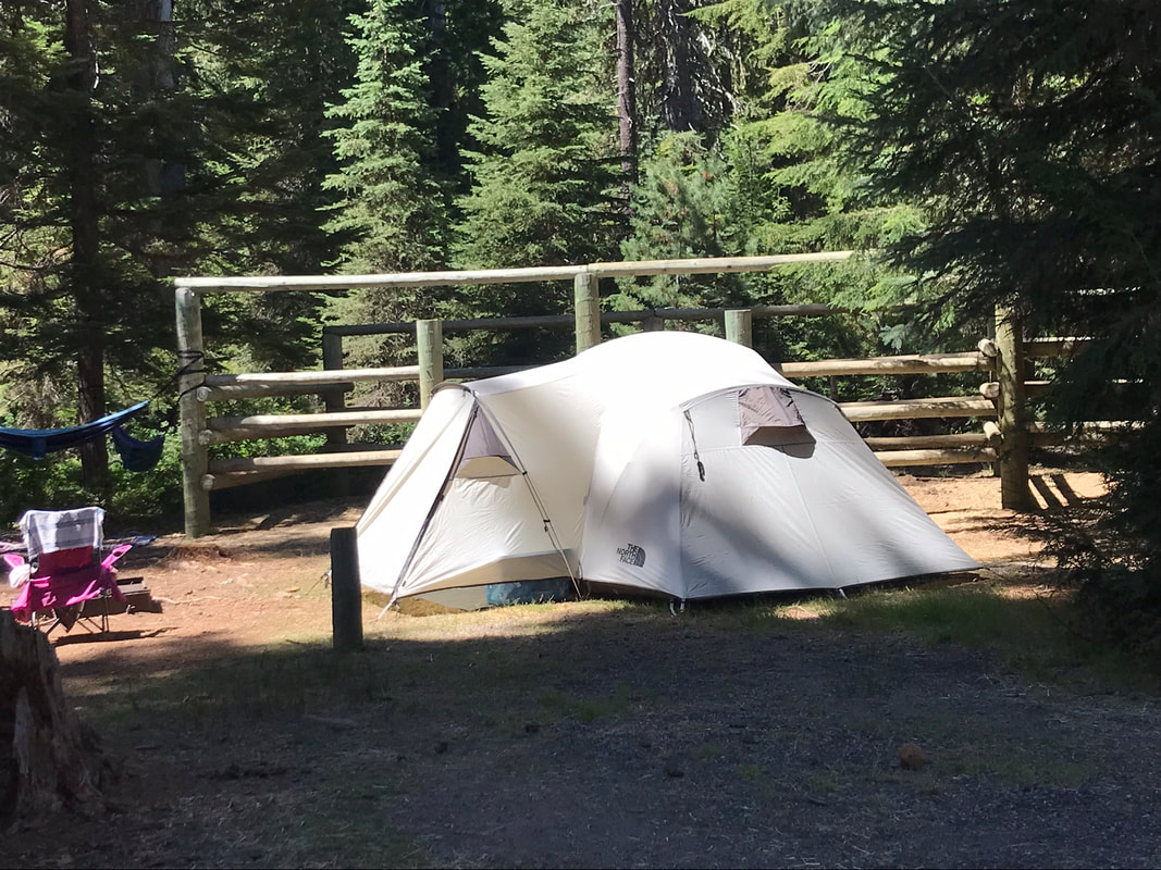
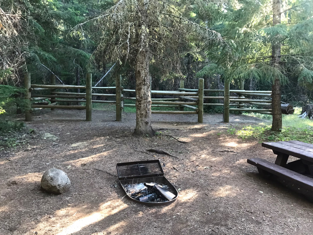
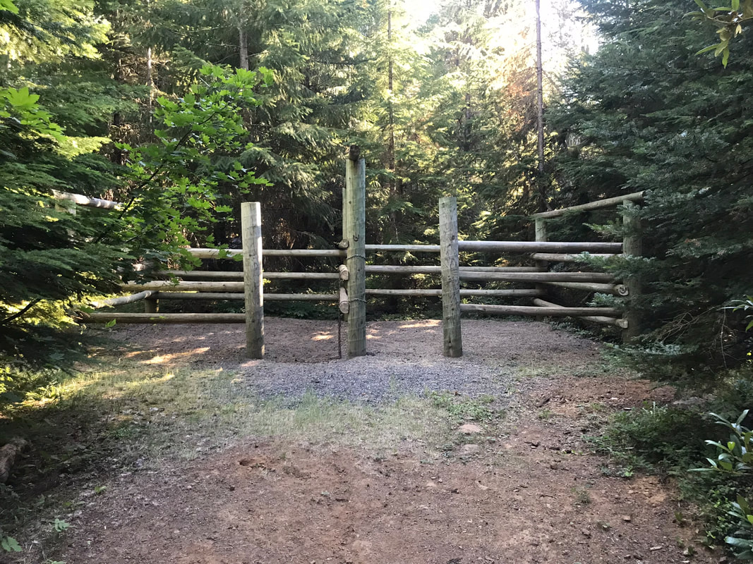
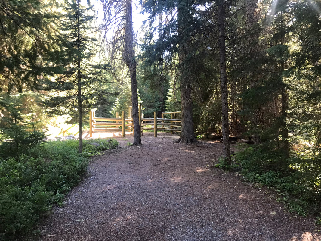
- Site 4: 55 feet long, pull-through, 4 in-line wooden horse corrals, close to tent sites 3, 1, close to horse site 6, spigot within 100 feet of corrals. Close to restroom and dumpster
- Site 5: Not on campsite map, 2 horse wooden corral, back-in
- Site 6: 50 feet long, back-in, 2 horse wooden corral close to tent sites 3, 1, close to horse site 4
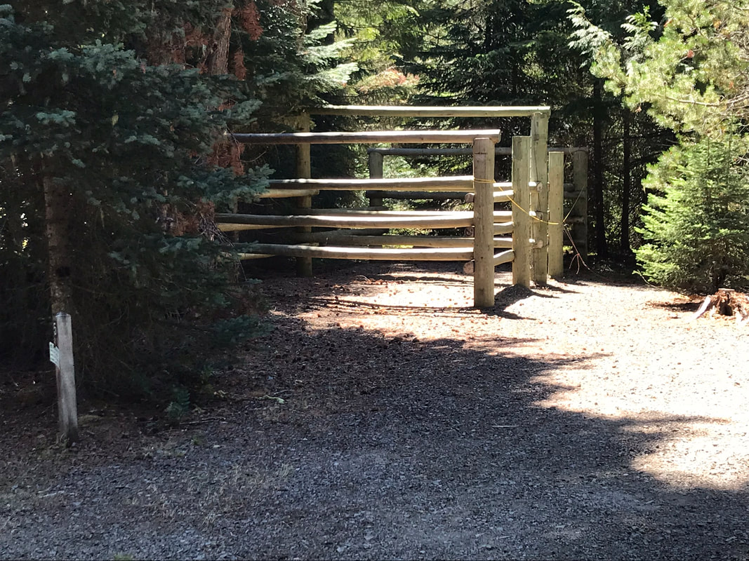
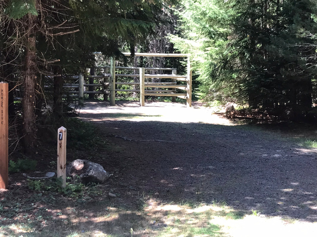
- Site 7: 50 feet long, back-in, 2 wooden horse corrals
- Site 8: 30 feet long, back-in, 2 wooden horse corrals
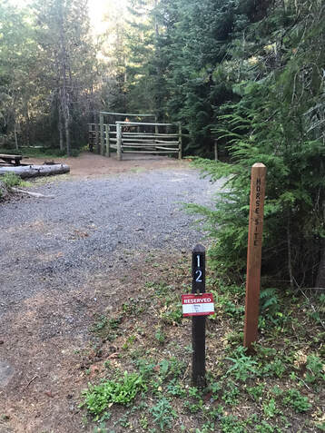
- Site 12: 50 feet long, back-in, 2 wooden horse corrals, surrounded by tent sites, far from other horse sites
- Site 14: 45 feet long, back-in, 3 wooden horse corrals in-line
- Site 17: 55 feet long, back-in, 2 wooden horse corrals, close to site 18 with nice trail between the 2 sites
- Site 18: 50 feet long, back-in, 2 wooden horse corrals, close to site 17
- Site 19: I didn't see this site with horse corrals but it is listed as a horse site, I may have missed it.
Horse Campsite Photos
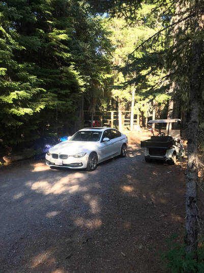
Site 2, Camp host site with 2 horse corrals. There was an additional water spigot next to the camp host site.
|
|
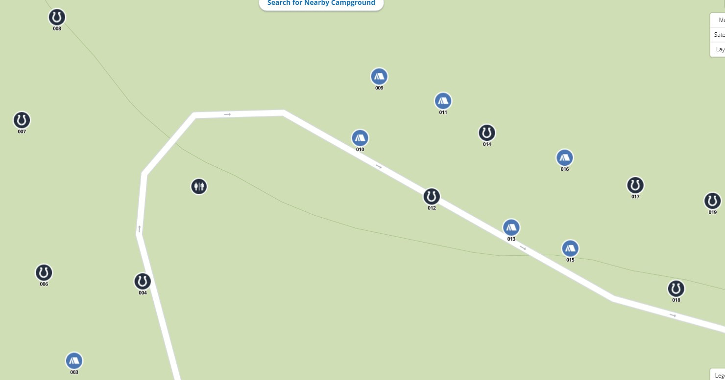
Campsite 4, next to the camp host and water spigot, the only pull-through horse site. I of course managed to hit a large tree root when I parked.
|
|
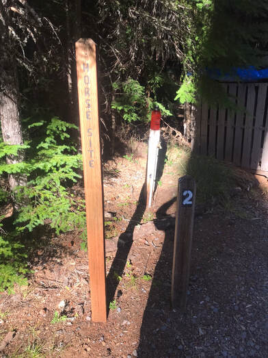
Site 4 had 4 in-line wooden horse corrals. It was neat to have them in-line. This arrangement could solve a lot of horse drama if you had two horses that were not good nose to nose.
Below: A picture of the distance from the spigot by site #4 to the horse corrals.
Campsite 5
|
|
Site 6
|
|
Site 7
|
|
Site 8
|
|
Site 12
|
|
Site 14
|
|
Site 17
|
|
Trail between site 17 and 18, good sites to get for a small group.
Site 18
|
|
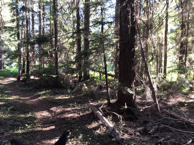
Riding
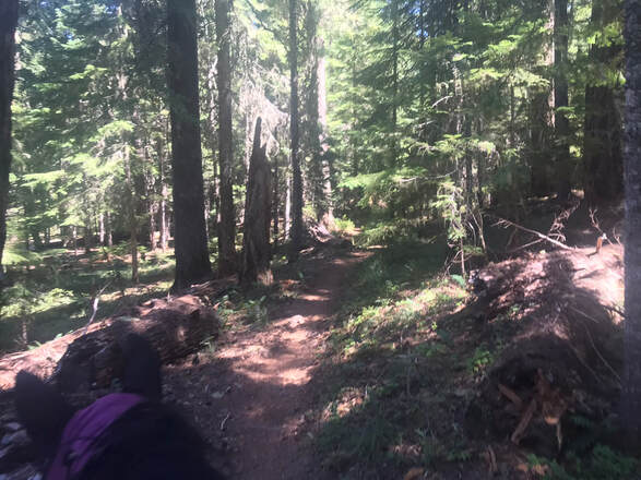
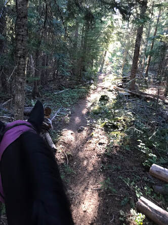
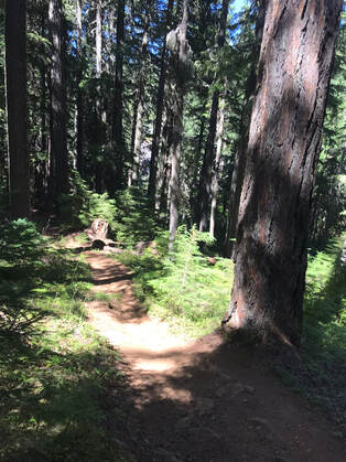
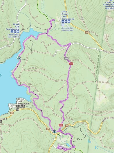
The trails take you through beautiful pine forest. The footing is rocky in places but mostly level. There were some rolling ups and downs but not a lot of steep inclines. The most common place to ride is around Timothy lake but this is not necessary. There are some easy loop trails staying closer to the Clackamas Lake campsite. My sweet spot is about 2-3 hours of riding.
Rides < 5 Miles Long
Headwaters Trail to PCT
|
GPS Track
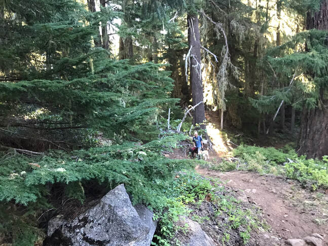
Mileage: 4.2 miles Time Taken: 1 hr 45 minutes Ascent: 175 feet It seems that a lot of people were hiking up toward Timothy lake. I had a great time doing a shorter loop ride through the forest near Clackamas Lake Campground. The trail was lovely, and quiet. We did not see any other hikers or bikers. This would have been a great loop to bike as it was not as rocky as the other trails. We rode this trail our last day at camp. I always want a shorter, easy loop the day we trailer home. We rode the loop counter-clockwise. The waypoint on the map marks a confusing point on the trail where you take a right turn onto a gravel road and then pick up the trail again to the left of the gravel road. Having a GPS and Gaia saved us. We walked in the wrong direction, checked our map and could see we were headed away from the trail. On the section of trail close to Skyline Road we passed a few campsites and had noise from the road. Other than that section the trail was very quiet and peaceful. There was a large tree down close to Skyline Road that I was tempted to have Sam jump, but we wised up, and found an easy way around. |
|
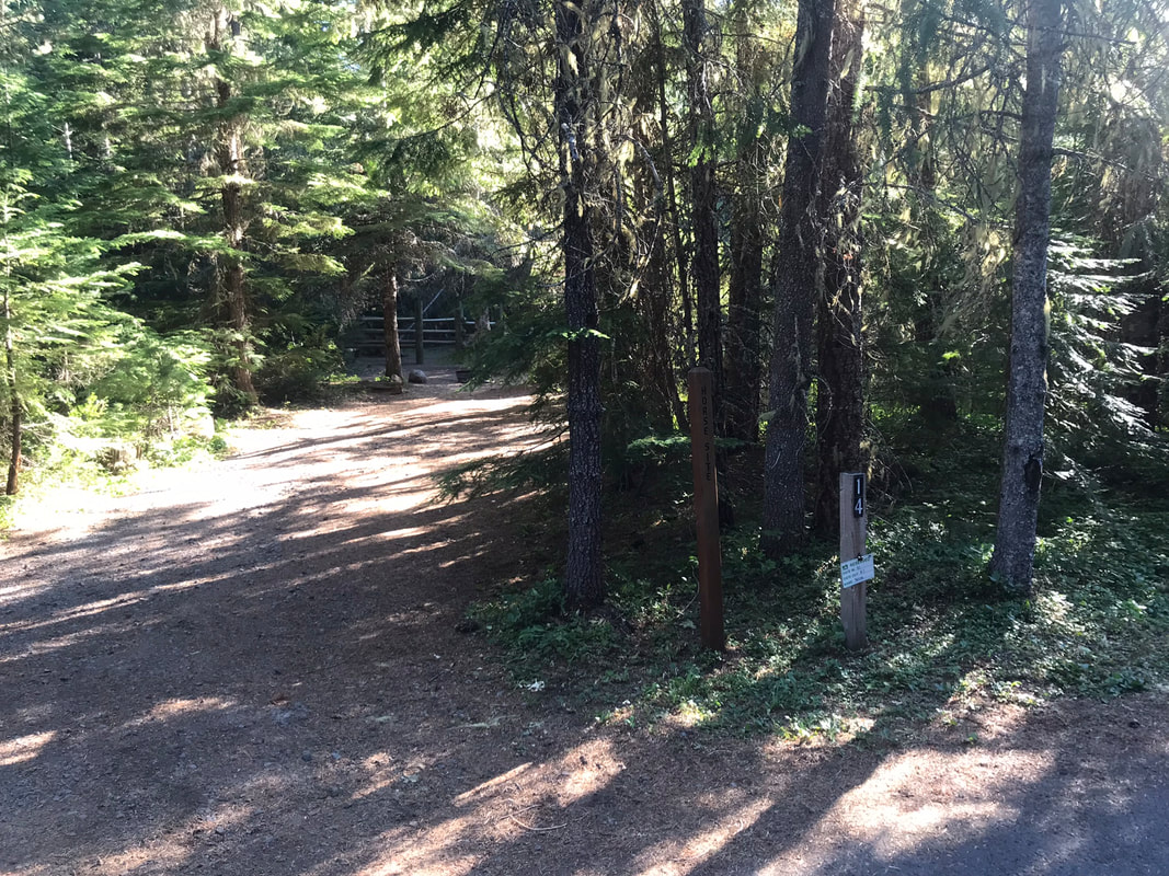
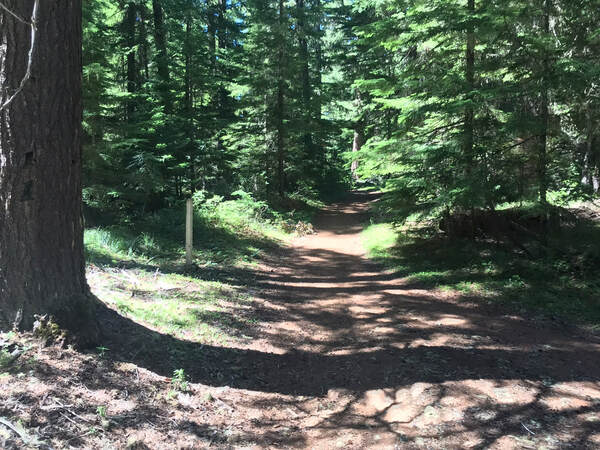
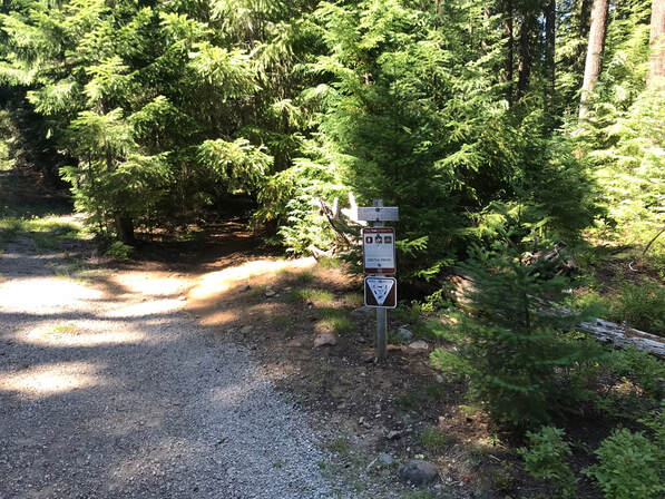
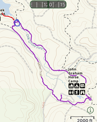
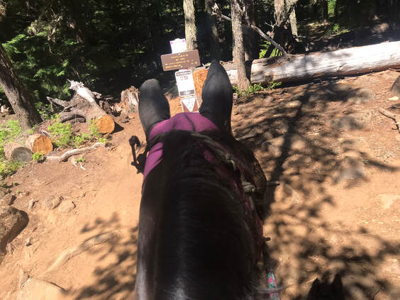
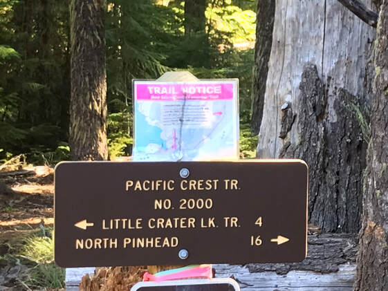
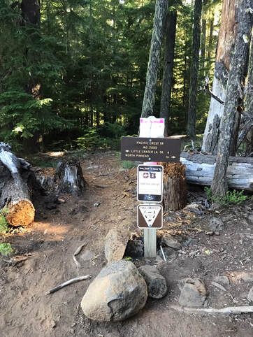
One way to pick up the trail is to the left of the entrance road to the left of the cattle guard up on the hill. You then decide to go left, around Clackamas lake or right the most direct way to Timothy Lake. For this route we went left to follow the Miller Trail to the PCT to Headwaters Trail
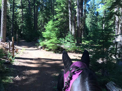
As the trail first goes left away from camp there are remnants of a barbed wire fence on the left. It is a good idea to stay on the trail. You pass some campsites on the left as well that may have people moving around tents.
|
|
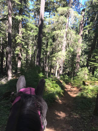
This was a lovely short forest loop that brought you through forest and meadows and it was mostly flat. There were some good soft spots for trotting as well.
Miller Trail to PCT Loop
|
GPS Track
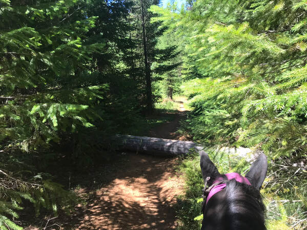
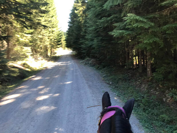
Mileage: 4.6 miles Time Taken: 1 hr 50 minutes Ascent: 254 feet I rode this with Sam our first day at camp. The Miller Trail was the fastest way to get to Timothy Lake going right or clockwise from camp. The biggest challenge with this trail is the road-crossings. We crossed the road 3x and rode next to the road for at least 150 feet. There was very little traffic but the cars we saw were going very fast. I do not recommend riding this route unless your horse is good with traffic. After riding the North Shore of Timothy Lake I would want to stay away from the South Shore. I could see boats, tents, campers, boaters and lots of activity on the South Shore that was distracting to Sam even with us far away on the North Shore. We did not attempt to ride on the South shore but instead did a some-what scary river crossing to rejoin the PCT and follow it clock-wise, until it took us back to the Miller Trail right outside of camp. |
|
The Miller trail had wider parts and single-track. We saw a few down trees we could step over.
|
|
We crossed the road at least 3 times. Cars drive fast here so be careful! It was well signed and easy to find the trail after the road crossings.
|
|
We came to the T with the Timothy Lake Trail and the Miller Trail. I decided not to go further around the south shore of the lake and went right instead. I also chose to go right because it was an enticing long downhill.
|
|
|
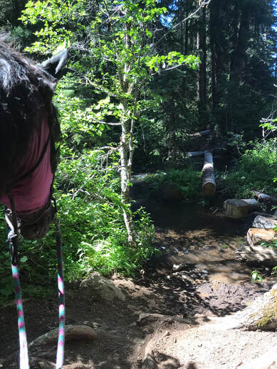
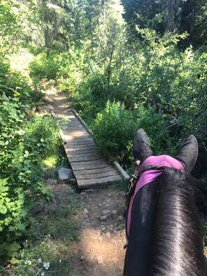
This decision brought us to the junction of the Southshore Trail and the PCT. There was a sign letting me know horses were not allowed on the Southshore Trail but were allowed on the PCT. However, there was this bridge.....
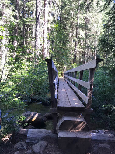
We decided to cross the river instead. I led Sam to help him trust me. The river crossing was rocky and slippery. At this point we were at the blue circle of the river crossing and scary bridge. The red trail to the left is the Southshore Trail where horses were not allowed. I wish I had a guide book that could have told me to avoid the left leg of the Miller Trail. So, I am at least here to let you know what you would be facing.
|
|
After a successful water crossing the trail was well signed and we were on the PCT. The fork right in front of Sam is a new trail not on my map or in the guidebooks. It is a bike friendly connector that goes from this fork to the north side of Timothy Lake so bikers can reach Crater Lake or also go all the way around Timothy Lake. We decided to stay on the PCT which does not allow bikes.
|
|
We had a challenge crossing this bridge. Bridges without rails can be a challenge for Sam. I dismounted and led him. The next ride he crossed the bridge in both directions without hesitation.
Overall I enjoyed this short loop. I like the challenge of bridges and water crossings and Sam is excellent with cars. I would not do this ride with a family or with green riders. The Headwaters Trail is a much easier loop!
Rides > 5 Miles Long
PCT to Timothy Lake Trail to Forest Road 4280
|
GPS Track
Mileage: 8.4 miles Time Taken: 3 hrs 45 minutes Ascent: 488 feet This was our attempt at the typical ride to Timothy Lake. The only challenge was camping at Clackamas Lake added 5 miles round trip to our ride. It was 2.5 miles to reach the Timothy Lake Trail from Clackamas Lake Campground. I usually get tired after 2-3 hrs of riding and my husband Jon was walking on foot with the dogs. We found a lovely place to eat lunch at Timothy Lake to make it all worth it. The trail was rocky in places and lots of tree roots or knee busters to watch. We also had to cross Skyline road which had fast moving cars periodically pass. We considered going back on Forest Road 4280 but it was a gravel road with cars and bikers. We both decided we liked the PCT better so we cut back down via a connector trail to retrace our steps via the PCT Trail. |
|
The trail was pretty flat until we crossed Skyline Road. Then the PCT started to have some nice rolling hills. The footing was pretty rocky and Sam had to pay attention to his steps. We passed the junction of the Southshore, PCT and Timothy Lake Trails and continued north on the PCT.
|
|
We found a good spot by the lake to stop for snacks.

I wanted to try a different route home so we took a connector trail up through some campsites to the Forest Road 4280. We quickly decided this was a bad choice. There were lots of cars and bikers on the Forest Road 4280 so we took another connector trail back down the hill to the PCT. We retraced our steps on the PCT to the Miller Trail to get back to the entrance road for Clackamas Lake Campsite.
1916 Trail to PCT or Little Crater LakeTotal Miles:
11.7 miles without detour to Little Crater Lake, 12.9 miles with detour Ascent: 1942 with Little Crater Lake, 1727 without Little Crater Lake GPS Track I have not personally ridden this route. I was not a fan of the gravel road that parallels the PCT but the 1916 trail looks like a single-track. According to other hikers and bikers the 1916 trail #537 is for bikers so they can ride a full 15 mile loop around Timothy Lake. So, if you ride this trail by horse, be prepared for bikers. One lovely thing about the PCT is that no bikes are allowed.
|
|
Rating
I was pleasantly surprised by Clackamas Lake Campsite. The horse sites were functional, the corrals were larger than expected and I happened to luck out and get a pull-through site next to a water spigot! The trail choices were a little limited due to the distance from Timothy lake, but it forced me to ride in different directions and I found the wonderful shorter loops outlined above. Horses need to take back this campsite! It is close to Portland, an easy drive, and would be a lovely place for a group to camp.
