Flying M Horse Camp
|
Location: Flying M Horse Camp, 23029 NW Flying M Rd, Yamhill, OR 97148
Facilities: Porta Potty, picnic tables, fire pit, Camp Site Amenities: hitching posts, 2 metal corrals Site Type: parking in large meadow, able to turn around Water: bring your own or use creek Footing: Rocky, hoof boots recommended Cell Signal: No cell signal Dogs: Dogs allowed Other: Weed-free hay appreciated, not specified by hosts, pack out or disperse manure, also not specified by host Website: https://www.facebook.com/flyingmranch/ Reservations: 503-662-3222, [email protected], calling is best, leave a message and they will return your call, Prices: Camping is $25 a night + $5 a horse, bring cash, no cards accepted Guided Trail Rides: Reber's Ranch, Jessica, 503-662-3694, $25 with your horse, $45 with their horse |
|
Reservations
To make reservations it is best to call. This was hard for me. I could go on-line and make a reservation for a state park and not talk to a single human and get an instant confirmation. I was weighing going to a state park and having an instant confirmation vs. going somewhere new and taking a risk.
I called because I saw sun in the forecast but I was only 1 day out before I needed a response. I also messaged the ranch on Facebook and did get responses but not very timely responses and with not a lot of specific information. I still don't know if I could have dispersed my manure. I figured when in doubt pack it out, so I will recommend that to you as well.
This place is so wonderful and beautiful and I really want to continue to ride here. It is amazing to have so much land to ride on and I will absolutely be back. I will give you all the information that I wish I had prior to my trip. The Mule Skinners Club does a lot of trail clearing here. Thank you to them for making the trails even passable at all this early in the season! I rode here in February of 2023 on a rare warm weekend.
Getting There
When I saw the forcast for partly sunny with a 50 degree high in Feburary I thought it would be a good time to do a quick trip to fight off the Oregon winter blues. Flying M seemed to be a good choice. It was closer than the beach and I was ready for some forest riding. When I googled directions outside of rush hour the time to get there was 1 hr 34 minutes.
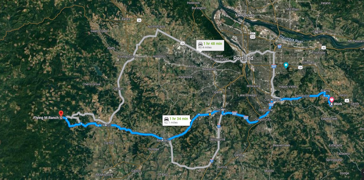
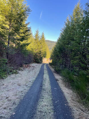
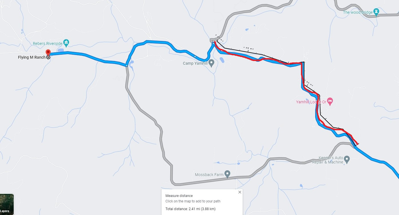
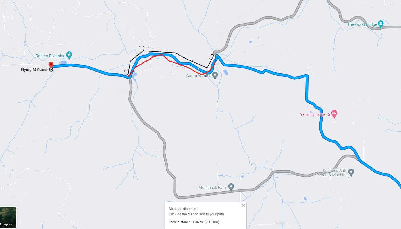
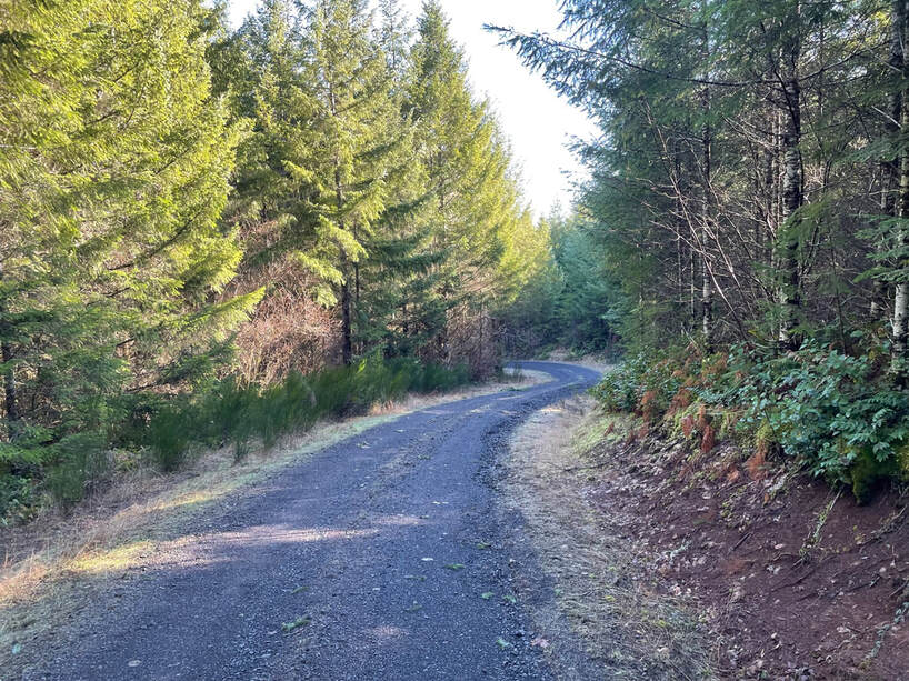
The hardest part of the drive was the last 4 miles. At this last T Oakridge spits with Fairdale. I chose to go right on Oakridge. Oakridge was 2.4 miles of gravel road. After the sharp turn it became 1.6 miles of periodic potholes. This last 4 miles took about 20 minutes. In June of 2023 I have learned that Fairdale is NOT trailer friendly and has a lot of potholes and washboard sections. Part of why I am writing this chapter is to give you information to make your trip a little easier.
|
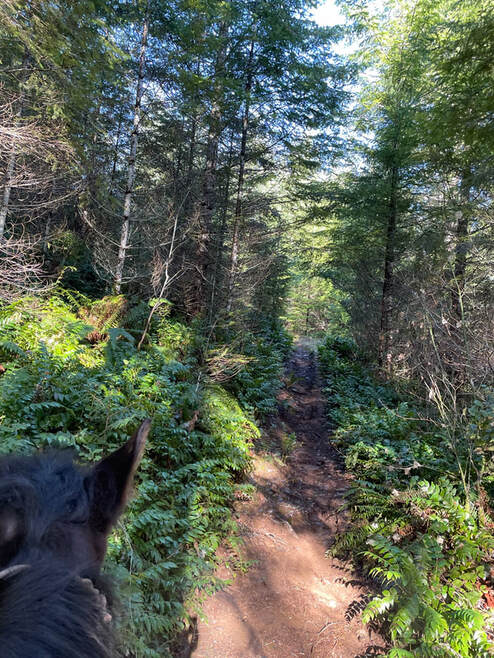
Gravel road for the first 2.4 miles
|
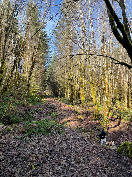
Potholes for the last 1.6 miles
|

Must Brings
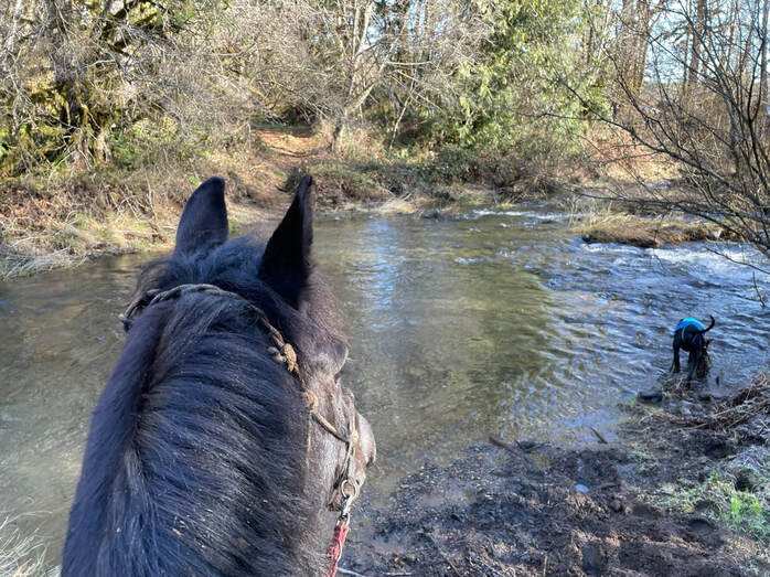
1) Water- there is a creek but it is a short walk and Sam drinks a ton of water, bring human water as well.
2) Bucket Loo - There is a porta potty at the campsite, 2 in total. One didn't have a roof, not really a problem, but it was much easier using a bucket.
3) Extra Muck Bucket - I saw signs of manure being dispersed around camp. We packed ours home with us. Having a muck cart and an extra muck bucket really helps when you have to pack manure out.
4) Gaia GPS! - This was essential to having any kind of idea of where you were relative to any know trails. The trails are marked with orange flags for scheduled Mule Skinner rides and they may be taken down after these rides. This is a big area and many of the singletracks look the same. The logging company marks areas with pink flags so don't follow any pink.
5) Satellite phone - There is no signal for most of camp. If something happens and you are up in the hills it would be great to have an SOS button. Make sure your subscription is turned on before you head out to camp.
6) Extra cell phone battery charger - your Gaia maps are no good if your cell phone dies
Horse Campsites
When you first arrive pull in and stop at the office on the right to check-in, sign your name on the clip-board and pay. Next, continue on the road past the fire-station and up into the meadow. There is a land-line phone in the office/barn if you need to use a phone in case of emergency. Don't let the cats out.
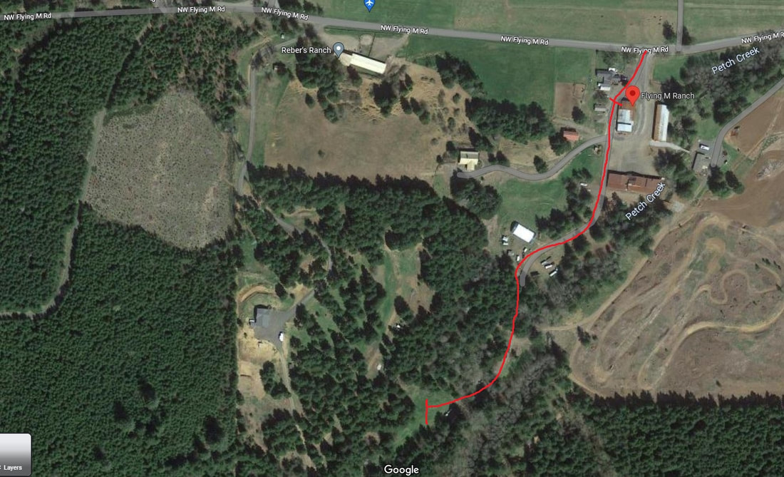
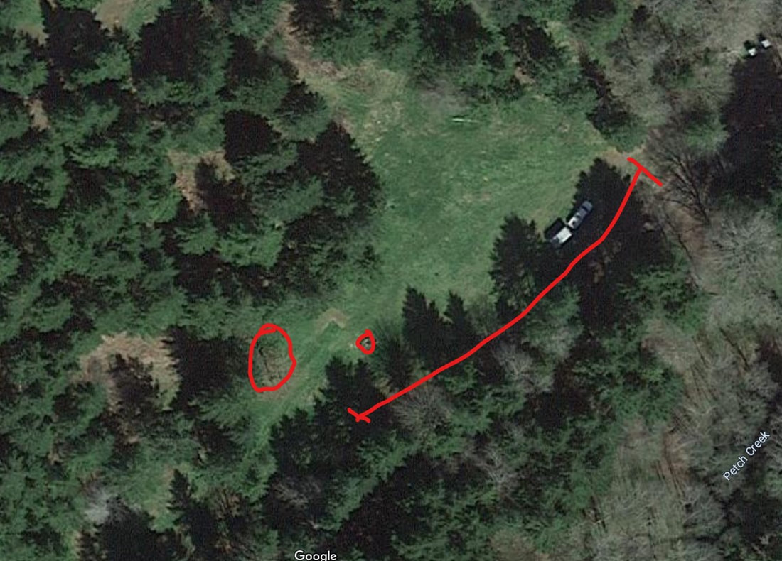
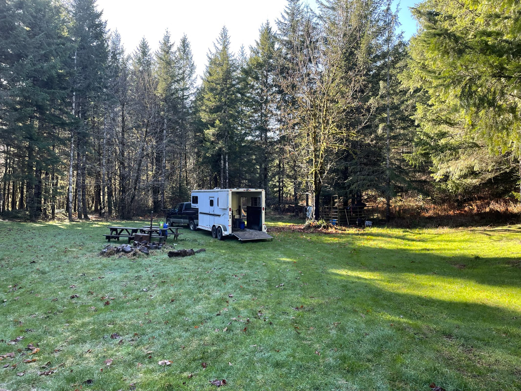
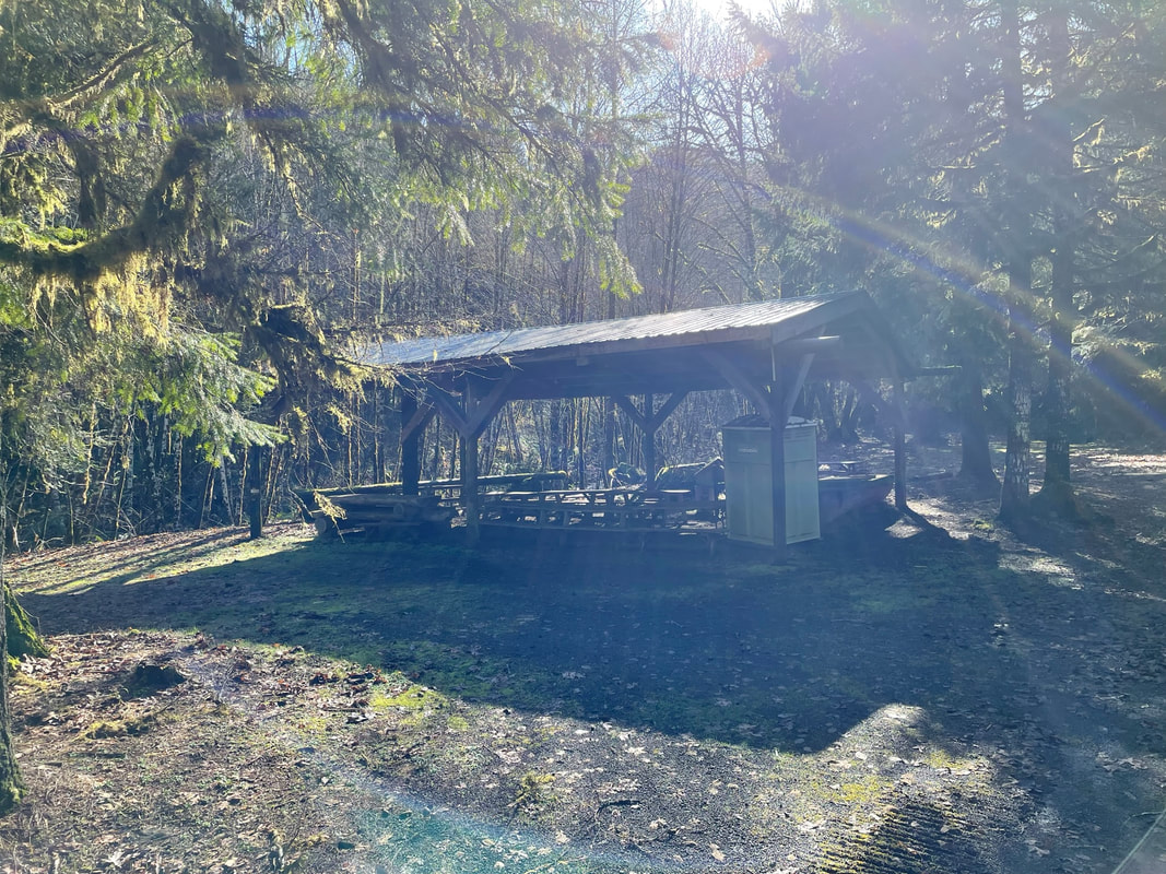
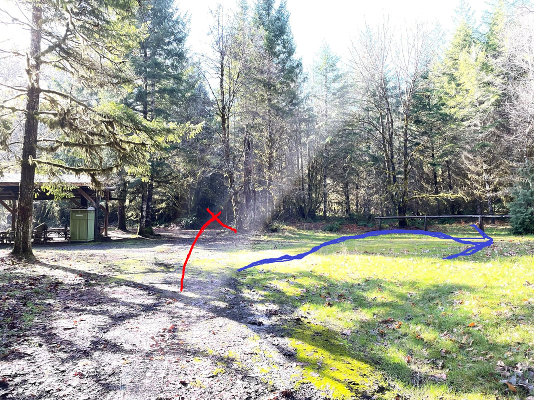
There is one big meadow but no set sites. There are picnic tables set in various locations but the horse pens are in the southern edge of the meadow. There are 2 metal horse pens. The horse pens and fire pit are circled in red. This meadow is gorgeous and right next to the trails. It was private, beautiful and we had it all to ourselves. The red line shows the best place to park your trailer. You can make a big circle around the firepit to exit the meadow.
Campsite video link
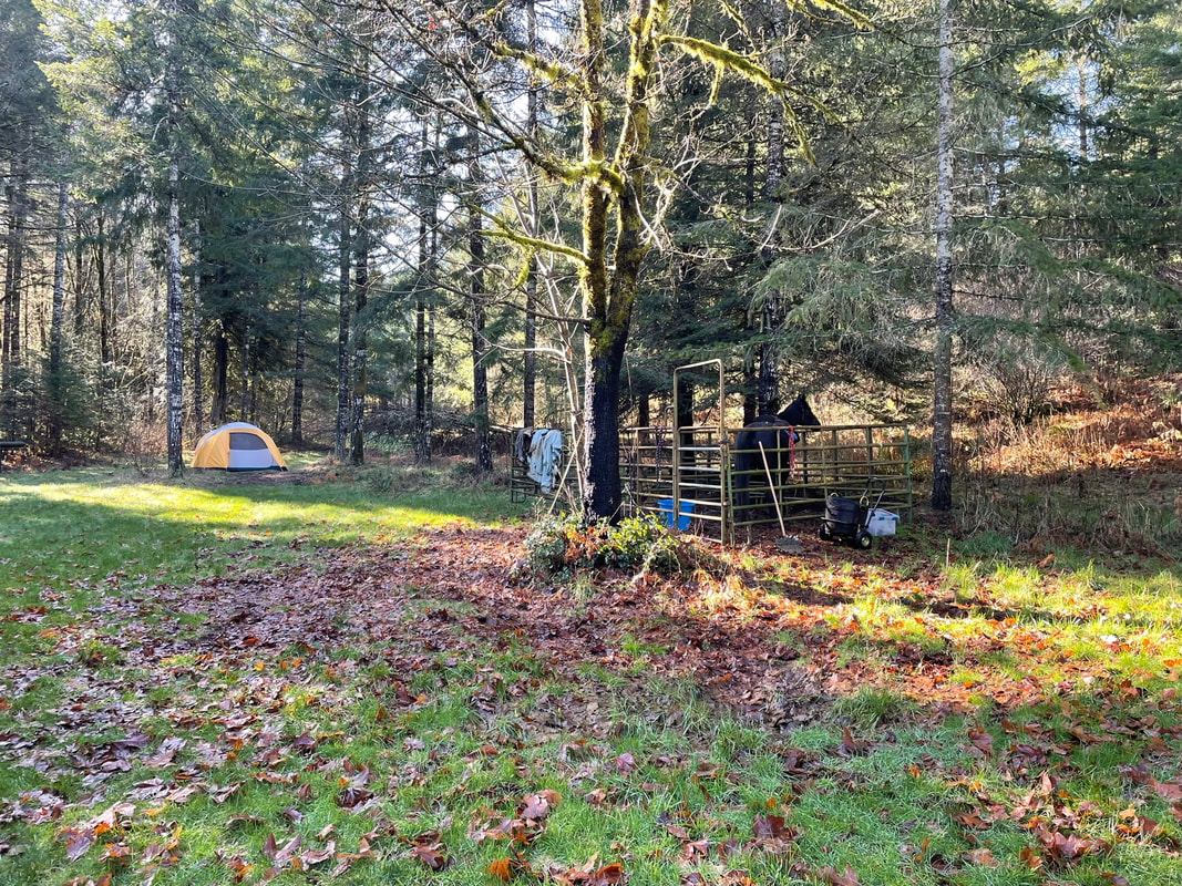
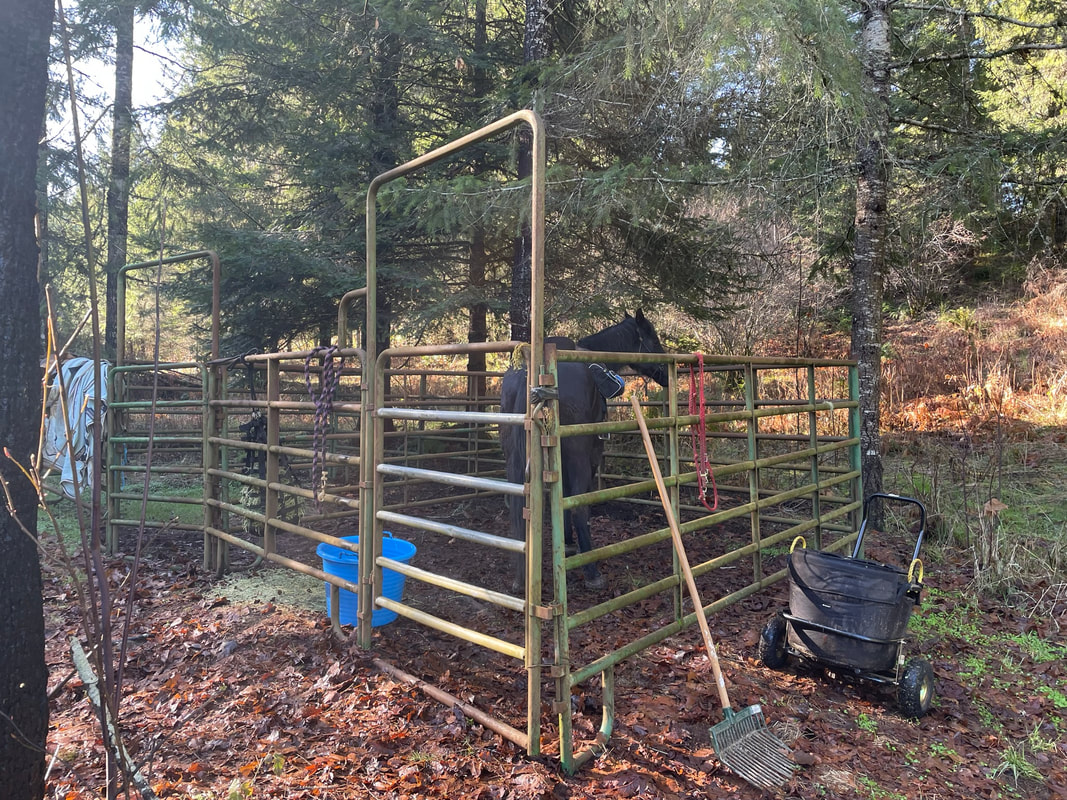
I was excited that there were two metal horse corrals available for camper use. They seemed to be roughly 12 x 12 feet and had sturdy metal gates. There was no real level place to pitch a tent. We found a site that was only slightly sloped. I sleep in a camp chair but Jon sleeps on an air mattress and he said he kept sliding downhill all night.
I was excited that there were two metal horse corrals available for camper use. They seemed to be roughly 12 x 12 feet and had sturdy metal gates. There was no real level place to pitch a tent. We found a site that was only slightly sloped. I sleep in a camp chair but Jon sleeps on an air mattress and he said he kept sliding downhill all night.
|
|
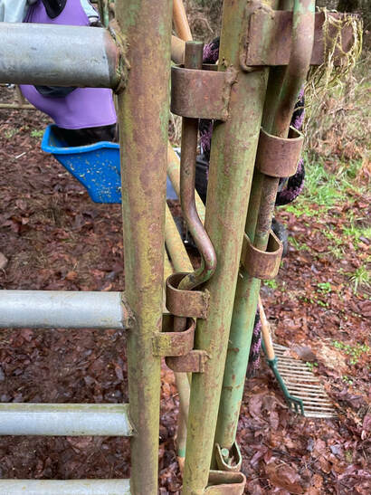
Below the gate hinge, a sturdy pin that hold the gate closed. Much better than the state park terrible chain gates!
The meadow was immense and wonderful to watch our dogs zoom around and chase each other. I parked between the picnic table and the horse corral. I should have parked on the left side of the picnic table so I could see Sam from the picnic table. Instead we ended up sitting in our camp chairs next to Sam in the horse corral.
|
|
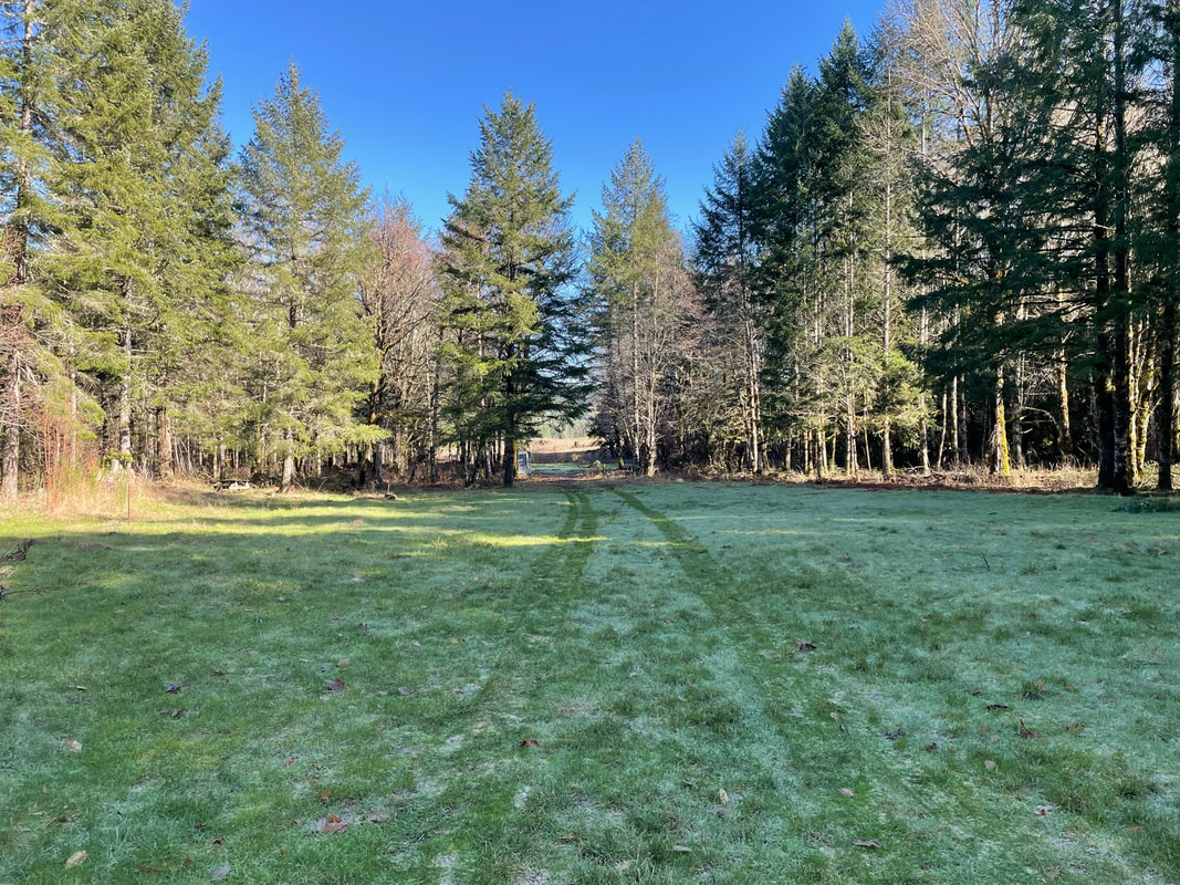
Below a fire pit and some kind of grill. Just south down the road there was a covered picnic shelter.
|
|
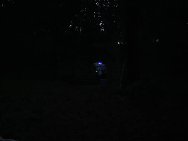
I got some new blue LED light bracelets for Sam and could see him in the dark from across the meadow.
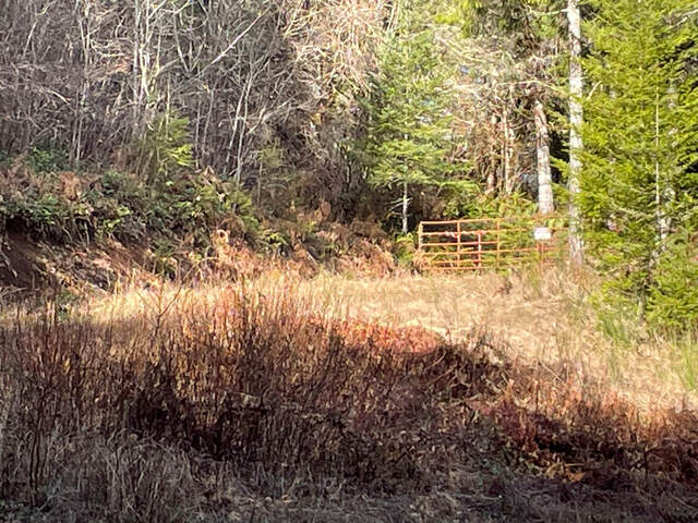
As you go south from the campsite the first gravel road that goes up to the right is the driveway of a private residence. There is an orange gate with a no trespassing sign. This is not the trail.
Riding
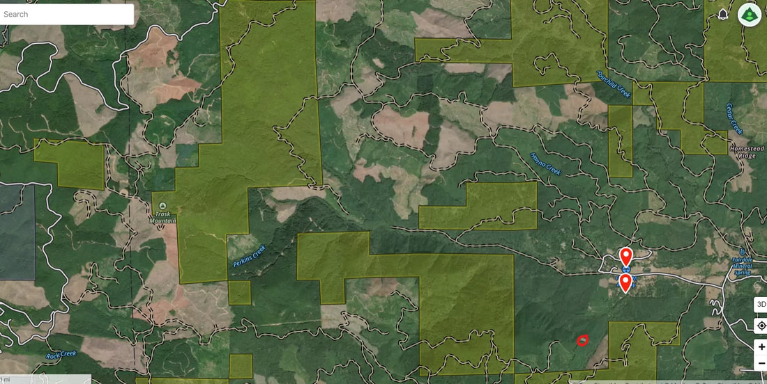
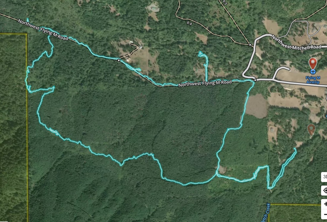
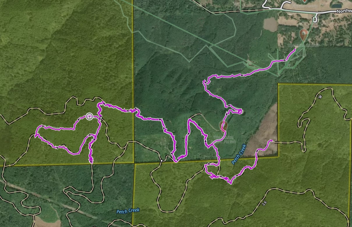
Here is an overview of some of the major logging roads south of camp. This view is what I saw on Gaia when I used the Gaia Satellite with labels layer. When you zoom in there are even mile markers for the logging roads. I oriented myself by looking for the clearing at the top right part of the map. The trail back to camp is right below this clearing. I circled the clearing in red.
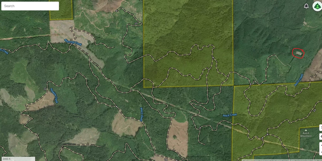
Of course when I was out riding I did not have a great idea of the big picture compared to where I was located. Again, one of my goals in writing this chapter is to make sure you are more prepared than I was.
The waypoint in the top right is camp. The red lines are single tracks that led to the logging roads. The first sharper right from camp is the better way to the logging roads. The red line that goes straight from camp along the creek turned out to be more of a deer trail with ankle buster rocks.
The waypoint in the top right is camp. The red lines are single tracks that led to the logging roads. The first sharper right from camp is the better way to the logging roads. The red line that goes straight from camp along the creek turned out to be more of a deer trail with ankle buster rocks.
Here is the Northern section of map around Flying M. The clearing that is close to the trail back to camp is circled in red. There is a summer trail that crosses the main road and crosses the creek twice that explores the northern section of the map.
Riding
So, I will admit up front that I like having maps, I like having trails marked, I want to know how far I am going to ride and how hard it will be. This was nothing like that. If you are an "explorer" you will love this. I am so lucky that my husband Jon walked the dogs on the ground with me and Sam. He truely saved me multiple times on this trail.
I have big time "getting lost" anxiety. Growing up I lived next to a vast open space. One day my mom and I and my yellow lab took a walk. This was before the days of google maps and GPS. We missed our turn, 4 hours later and we are out of water, my dog is panting and hardly walking and we wandered around the hills of northern California until we come down into a town 45 minutes away from home. I blame all my anxiety on this event. So, if you want to feel lost, don't look at the map but please have it with you in case of emergency. Even better, click on my GPS track links and download them to your phone so you can follow along or know where you are relative to the trail!
I have big time "getting lost" anxiety. Growing up I lived next to a vast open space. One day my mom and I and my yellow lab took a walk. This was before the days of google maps and GPS. We missed our turn, 4 hours later and we are out of water, my dog is panting and hardly walking and we wandered around the hills of northern California until we come down into a town 45 minutes away from home. I blame all my anxiety on this event. So, if you want to feel lost, don't look at the map but please have it with you in case of emergency. Even better, click on my GPS track links and download them to your phone so you can follow along or know where you are relative to the trail!
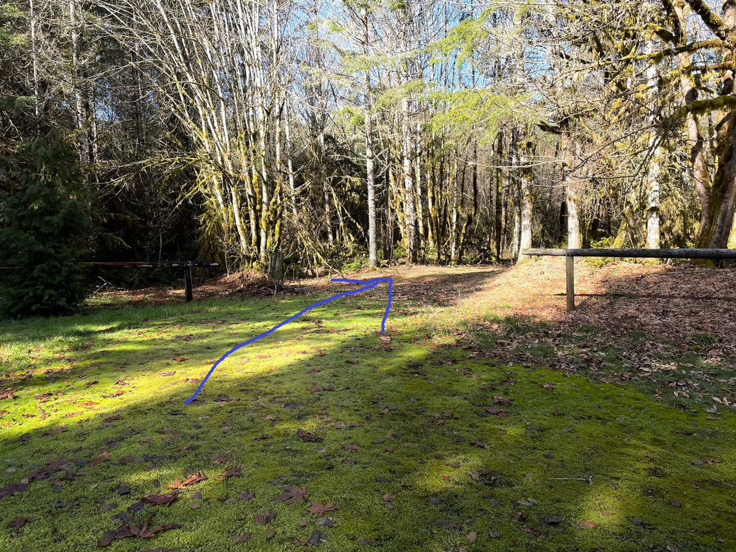
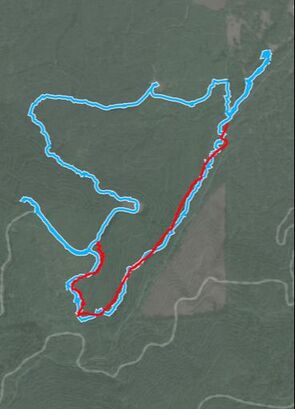
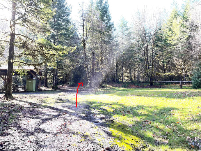
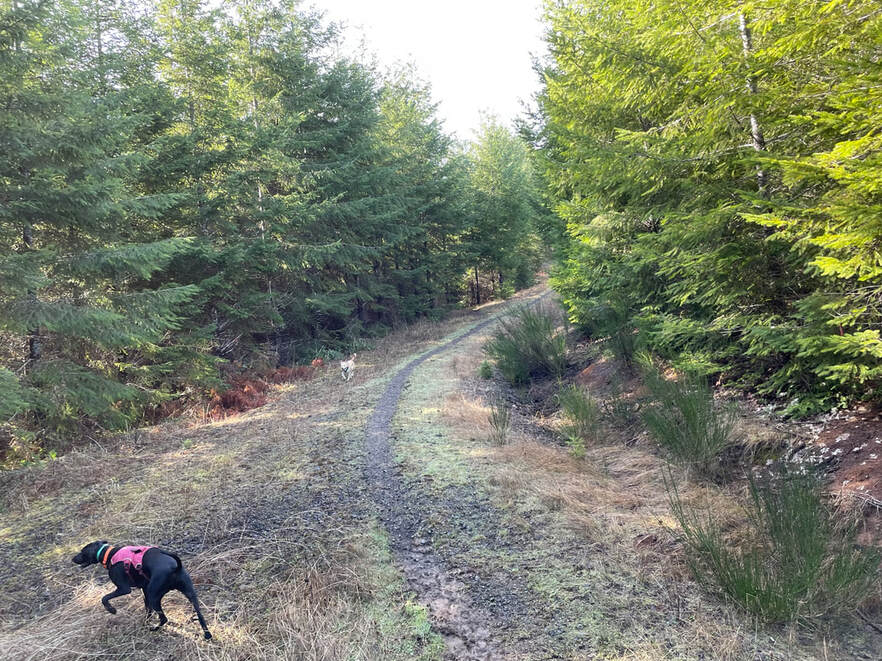
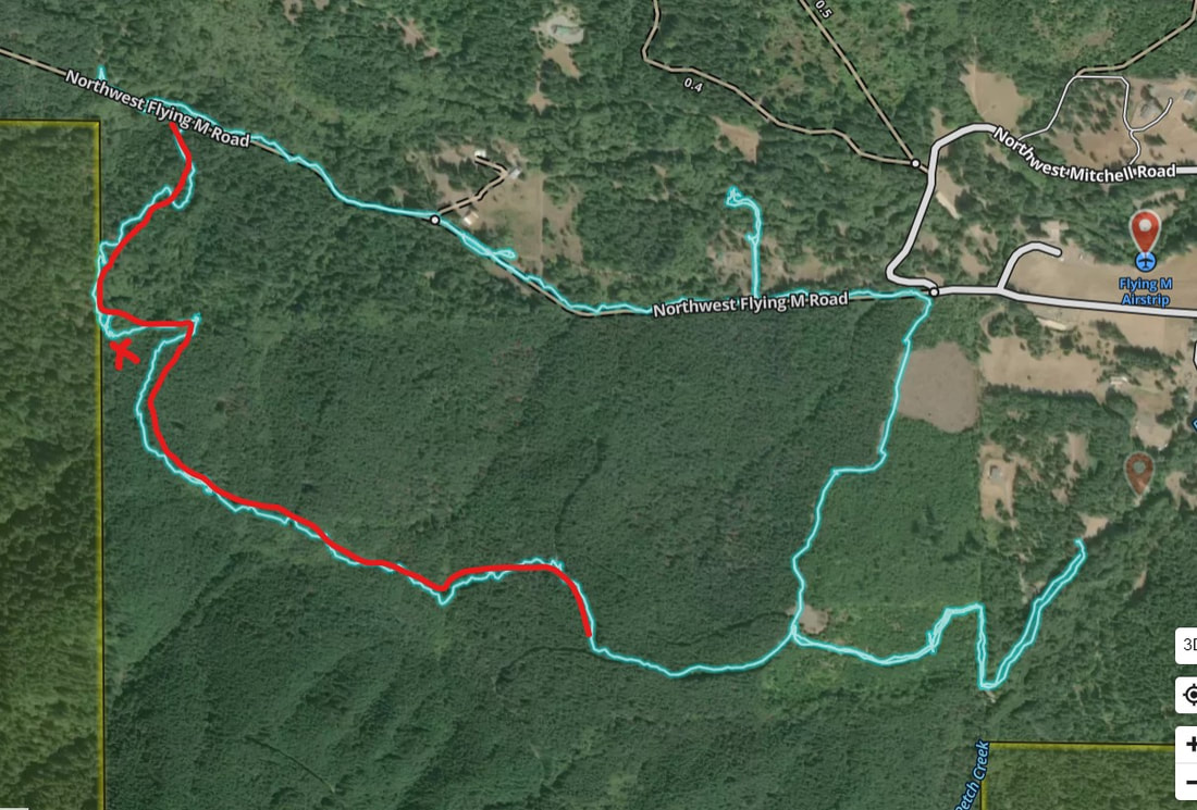
To get to the riding trails walk south from the campsite. You will reach a picnic shelter. If you continue straight and take the middle fork you end up on a deer trail that is like riding along a rocky and steep creek. This option is shown in red. To find the shortest way up to the gravel roads go right towards and between the hitching posts as a sharp right as shown by the blue arrow. This is a singletrack that meets up with the gravel roads. Take a left at the first junction of singletracks to ride the shortest way up to the gravel roads and the clearing circled in red in the map above.
|
|
Riding Options
Deer Trail to Logging Roads
|
Total Miles: 3.91 miles
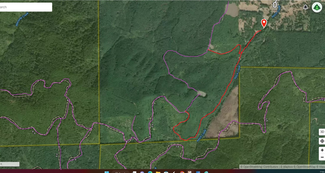
Time Taken: 1 hr 45 min Ascent: 859 feet GPS Track Link It is very possible I was verbally directed the right way up to the gravel roads. However, I still took the "wrong" way on our first ride at Flying M, so I will tell you all about it. On the map the red line is the "deer trail" single-track" and the blue is the gravel road. The trail was beautiful and mostly straight up to start. It took Sam's edge off after trailering and he was breathing pretty heavy at the top. All of the ascent was on the red single-track deer trail. We went left at the first fork but reached a gravel road that dead-ended into a sketchy single-track so we turned around to make it home before it got too late in the day. |
|
Below my ride started by taking the route marked in red at the fork below. It was the middle fork and not the trail on the far left.
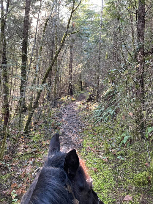
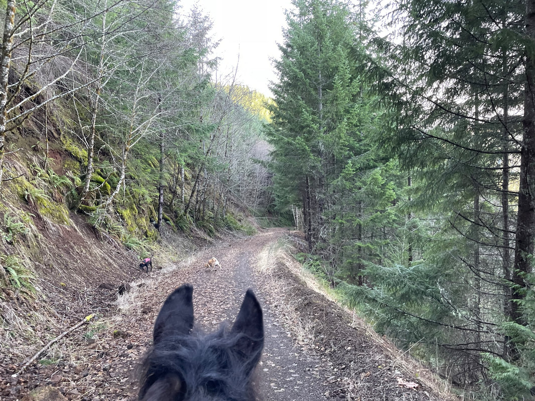
Most of the trail was really pretty! It was a narrow singletrack on the side of a creek which is one of my favorite types of trails. It started to get a little steeper. Towards the top we were scrambling over river rocks and going at a pretty good incline. Sam is a mountain goat and he has had a lot of experience climbing these types of trails in Colorado. My husband needed a few breaks and the dogs were in hog heaven running back and forth between Sam and I and my husband. I don't have any pictures of the harrier parts of the trail as I give Sam his head and hold on to my shit strap.
I also really like trails along cliffs, not right on a cliff but with a good view of a cliff on one side. It just really makes something inside me feel deeply happy. It could be from all my Colorado riding or from growing up in the Northern California hills. There was a section where I got my wish and I had my husband leash the dogs so no-one decided to explore off the side of the hill unintentionally. I go first and I carry a walkie-talkie. This comes in handy so I can warn my husband about the trail or any sudden drop-offs.
I also really like trails along cliffs, not right on a cliff but with a good view of a cliff on one side. It just really makes something inside me feel deeply happy. It could be from all my Colorado riding or from growing up in the Northern California hills. There was a section where I got my wish and I had my husband leash the dogs so no-one decided to explore off the side of the hill unintentionally. I go first and I carry a walkie-talkie. This comes in handy so I can warn my husband about the trail or any sudden drop-offs.
I was very relieved to come out to this gravel road! We could have gone right or left on the gravel road. After exploring a dead end gravel trail we chose to go right to find the way back to camp and get my bearings.
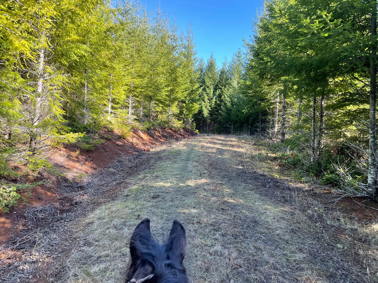
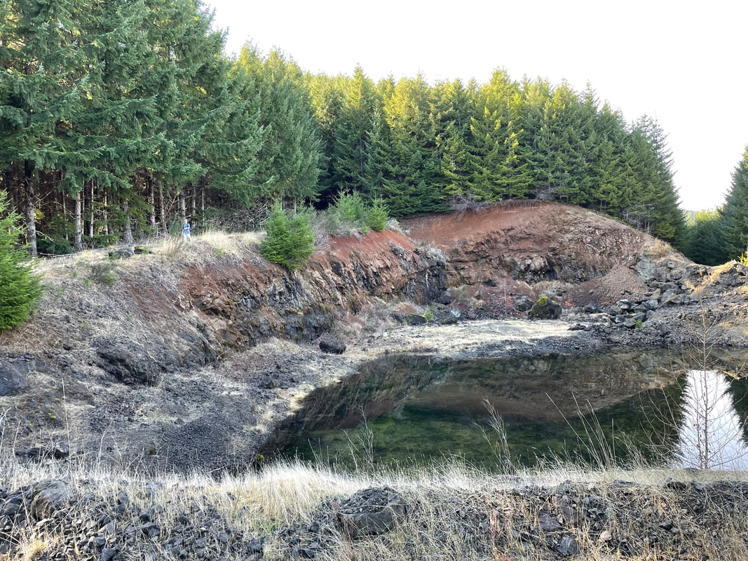
We passed some kind of old quarry that formed a pretty lake. I enjoyed riding the gravel roads. Sam wore boots but the leaf and grass cover made the road a little softer.
|
|
|
Below is the more narrow road just south of the clearing circled in red on the map that went downhill to join up with a short single-track that took us back to camp. The single-track was really muddy but we didn't have to go far. We took a right at the T of single-tracks to chose a less muddy path back to camp. The trail back comes out between the rows of hitching racks by the picnic shelter.
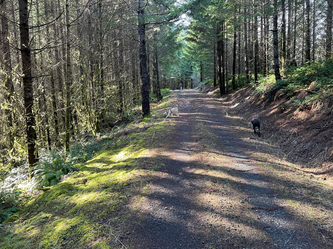
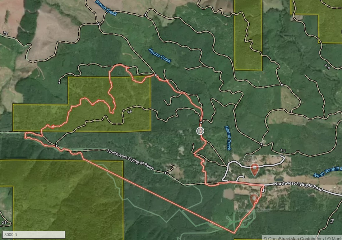
Riding North on Mostly Gravel Roads
|
Total Miles: 5.03 miles
Time Taken: 2 hr 12 min Ascent: 564 feet GPS Track Link On the lower right map you can see the blue track is gravel roads. This part of the trail was fine and happy. The short out and back was us walking down to the creek, Jon saying "I think I can cross that" and me saying "hell no". Last time Sam and I crossed a creek Jon fell in the river and scraped himself up. The river was higher than I would have liked and I had no plans for dealing with an injured husband and hypothermic dogs out where we had no idea how far we were from camp with no cell phone reception. The blue track ended at a big gate on the Flying M road. I could see horses used to go around the gate but there was a pile of rocks blocking us from going around. I did not want to ride any single-tracks due to the deep mud but we needed to head back to camp. We found a single-track on the left just before the gate that headed up-hill. The red is a single-track. It was lovely but you can see where we veered off the trail there was 2 downed trees in a row. They were big trees and we had to walk through the brush around them. Jon broke some branches for me and Sam to do this. Luckily Sam knows we are his herd and would just freeze when he was unsure and wait for Jon to move or break the branch that gave him pause. We were riding in February, the trail was muddy and we lost all 4 boots on the single-track. Again, Jon picked them up as we lost them and I now carry an empty back-pack just to carry these silly boots. Sam really needed the boots for the gravel roads but could not keep them on in the bogs on the single-track. |
|
We rode through the hitching posts, up the single track and to the right at the first T then took a right to ride pass the clearing and continue down the gravel road. This part of the trail was lovely and safe.
We went downhill to meet up with the Flying M Road.

After going along Flying M road for a short distance we thought the trail turned right along a fence-line and was going to cross the creek. This is where Jon thought he could do this and I said absolutely not. Sam could have crossed it but I was worried about the next spot of creek crossing and how cold our dogs would be after swimming the creek. So, we back-tracked and continued down Flying M road.
We found a closed gate on Flying M road with the openings on the side blocked off by large rocks. Luckily a short distance back there was a single-track going up-hill in the direction we needed to go back to camp. The trail was lovely but we hit a section of 2-3 downed trees in a row that we had to bush-wack around. Luckily Sam freezes when he is nervous, no bolting, no bucking, just freezes. Jon was able to break some branches and help guide us around the downed trees. I don't have any pictures of the sketchier sections of trail as I was trying to soothe and encourage Sam.
The trail was beautiful after passing the section of downed trees. I would have enjoyed it more if I didn't have the getting lost in the wilderness trail anxiety. Sam was having a good time, kept a good pace and enjoyed apples and fresh grass along the way. After stressful sections he recovers rapidly. I can tell he feels better once we start moving again and he starts begging for more apple slices.
Riding South
Total Miles: 8.82
Total Time: 3hr 57 min
Ascent: 1545 feet
GPS Track Link
This is a public track available on Gaia. We did not ride this route on our recent trip. Thank you to whoever posted this track. It really helps to see the possible routes on your phone as you are navigating. If you do not ride the short out and backs this loop is more like 7 miles long. Riding south there are many more loop options on gravel roads. I tend to always ride to the right. Next time I am going to go left on the first gravel road T and explore all of the southern gravel road routes.
North River Crossing Loop
Total Miles: 6.97 miles
Time Taken: 3 hrs 20 min
Ascent: 876 feet
GPS Track Link
Thank you to whoever posted this public Gaia track. The straight section returning to camp may be an error. Sometimes when the GPS cannot record your position it just makes a line between the last two available locations. My guess is that the return leg was on a single-track that zig-zagged back to camp. I would love to have more information about this track from other more local riders.
Rating
I really enjoyed the logging roads. I am going to withhold my regular criticism because I love private horse camps that allow you to access logging roads. I really want this place to keep existing! If there were yurts with heat it would be even more amazing! If you are not sure about the trails then arrange a guided ride with Jessica on your own horse. I can't wait to go back in dryer and warmer weather to explore all the beautiful single-tracks. Thank you to the Mule Skinners for clearing the trails and I hope some of the single-tracks become rideable as the summer of 2023 approaches! I would love to go back with e-bikes so Jon could ride his bike with the dogs off-leash while I ride Sam. This place could be heaven on earth!
