Gibson Prairie Horse Camp
|
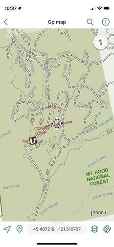
Location: Gibson Prairie Horse Camp, no address available
Facilities: Vault toilets, stock tank (long hike) Camp Site Amenities: no garbage, no potable human water Site Type: 2 back-in 3 pull-through Water: stock water a hike from camp but not recommended Footing: Rocky, hoof boots recommended Cell Signal: intermittent on trail, none in camp Dogs: Dogs allowed Other: Weed-free hay required, manure pit wheelbarrow provided, free camp, managed by forest service and maintained by backcountry horsemen Website: https://www.fs.usda.gov/recarea/mthood/recarea/?recid=53190 Reservations: first come first serve |

|
Getting There
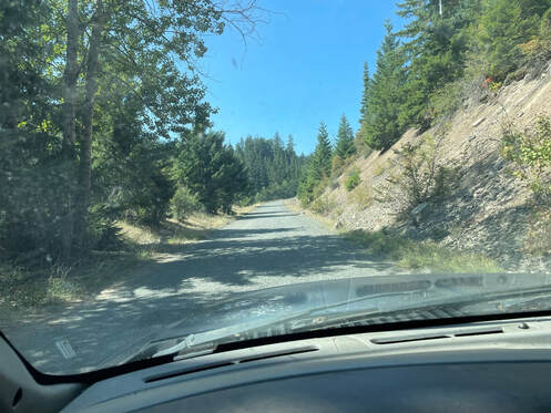
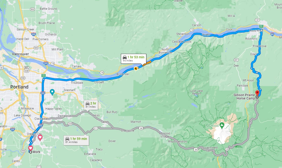
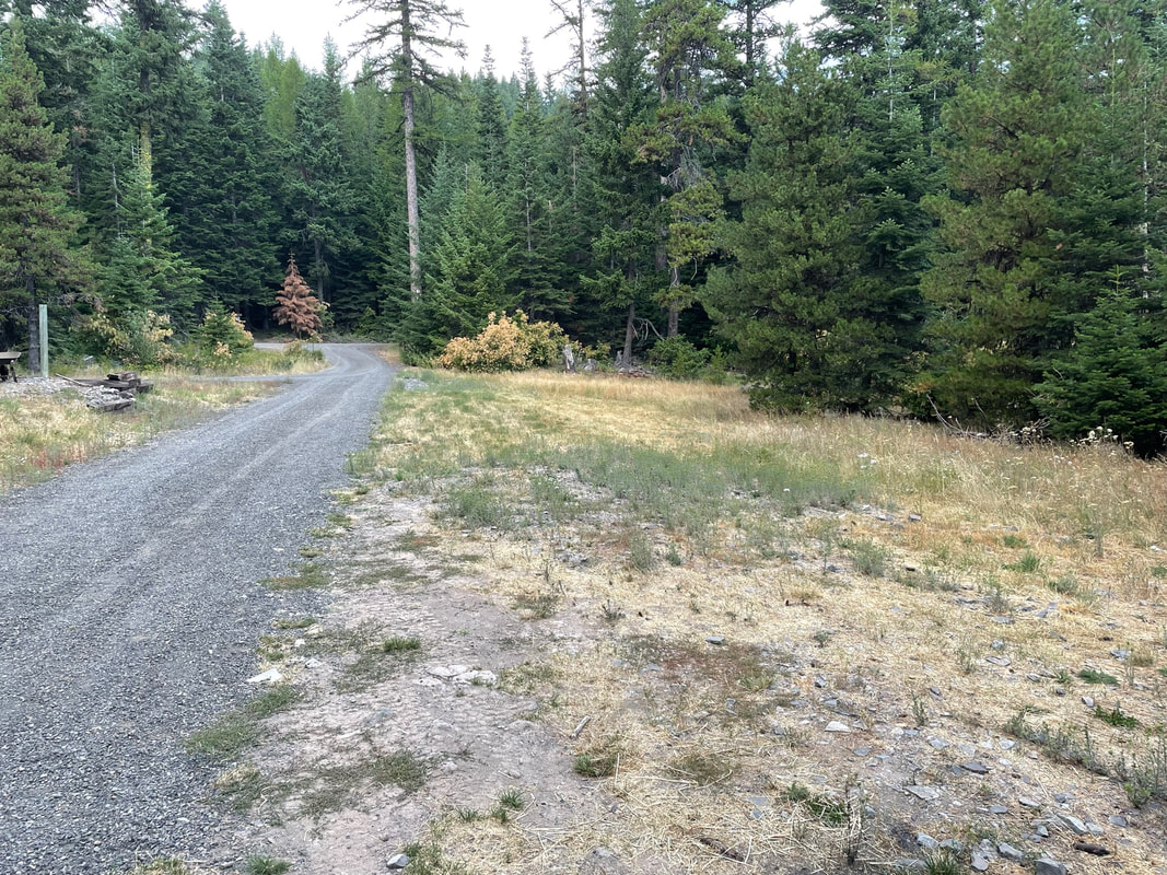
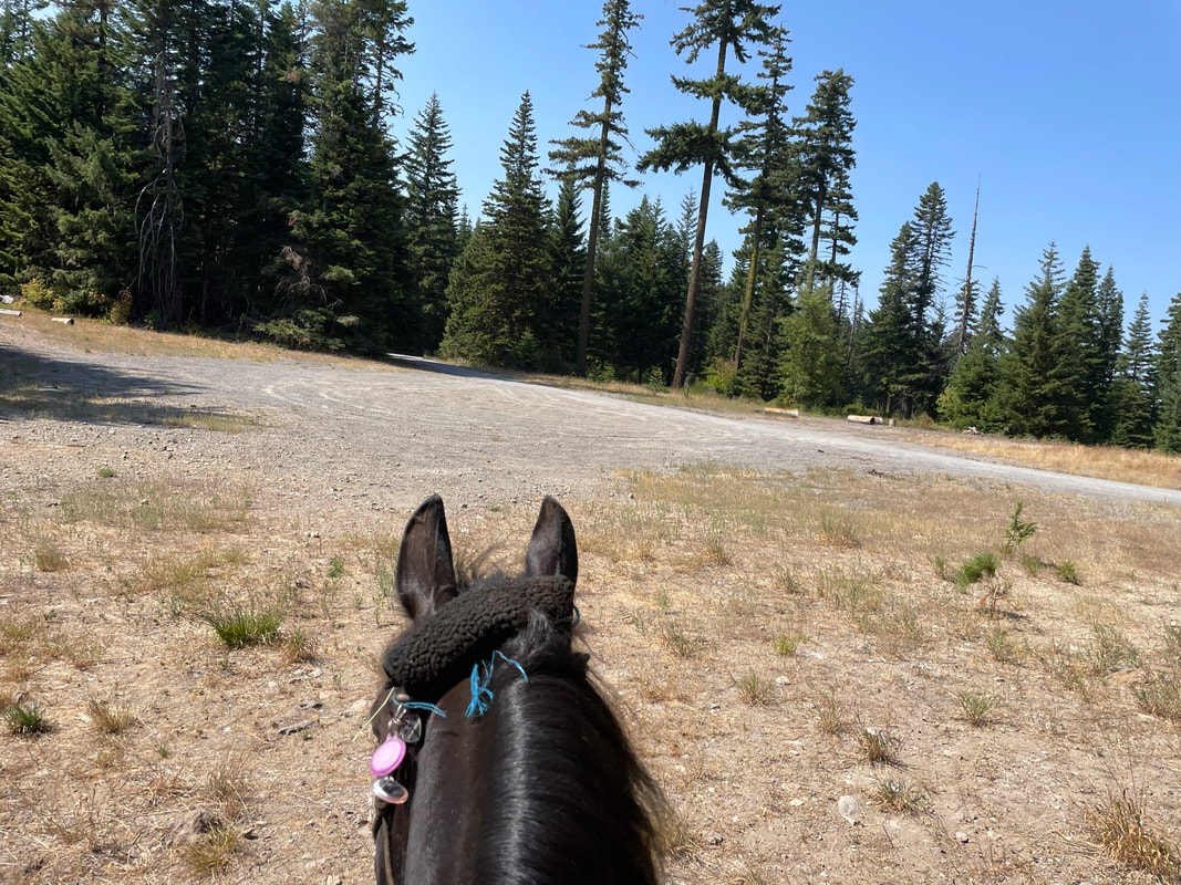
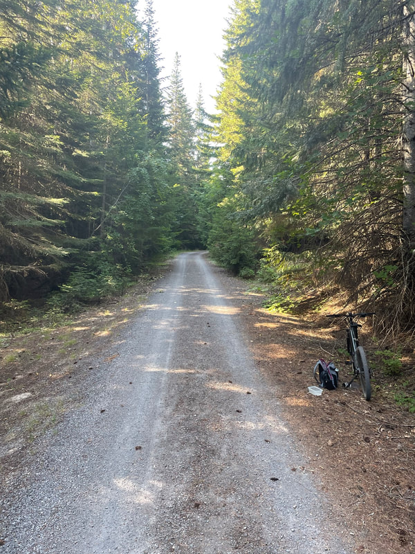
I traveled 205 N to 84 East to 35 S to Pine Mount Road. The drive to camp was easy and 84 East is very nicely paved and a smooth ride for my horse. I took a left from Hwy 35 onto Pine Mount Road. The road into camp was mostly paved. There were 2 miles of non-consecutive gravel road. It is a bit of a tease reaching the first section of gravel. After about a mile you pick up the paved road again. There were deep pot-holes on the paved section that I mostly could straddle. The gravel road section prior to the Gibson Prairie Trailhead was nicely graded but the section of gravel after the trailhead was not and had many larger potholes. The curvy camp road had some blind turns on a 1-way road and I did a lot of honking going around turns. My honking paid off as I alerted a fast moving SUV to my presence before it flew straight into my F350.
|
|
Must Brings
1) Satellite Phone - There is no cell service in camp. There were times I got service out on the Mustang trail.
2) Water - There is stock water a hike from camp but it is gross and way too far to carry buckets.
3) Insect Repellant - In late August there were bees in camp. We didn't see any on the trail but we ride in the mornings.
4) Downloaded Visitor's Map - Gaia does not have the BCHO trails.
2) Water - There is stock water a hike from camp but it is gross and way too far to carry buckets.
3) Insect Repellant - In late August there were bees in camp. We didn't see any on the trail but we ride in the mornings.
4) Downloaded Visitor's Map - Gaia does not have the BCHO trails.
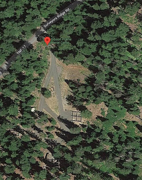
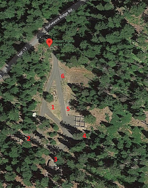
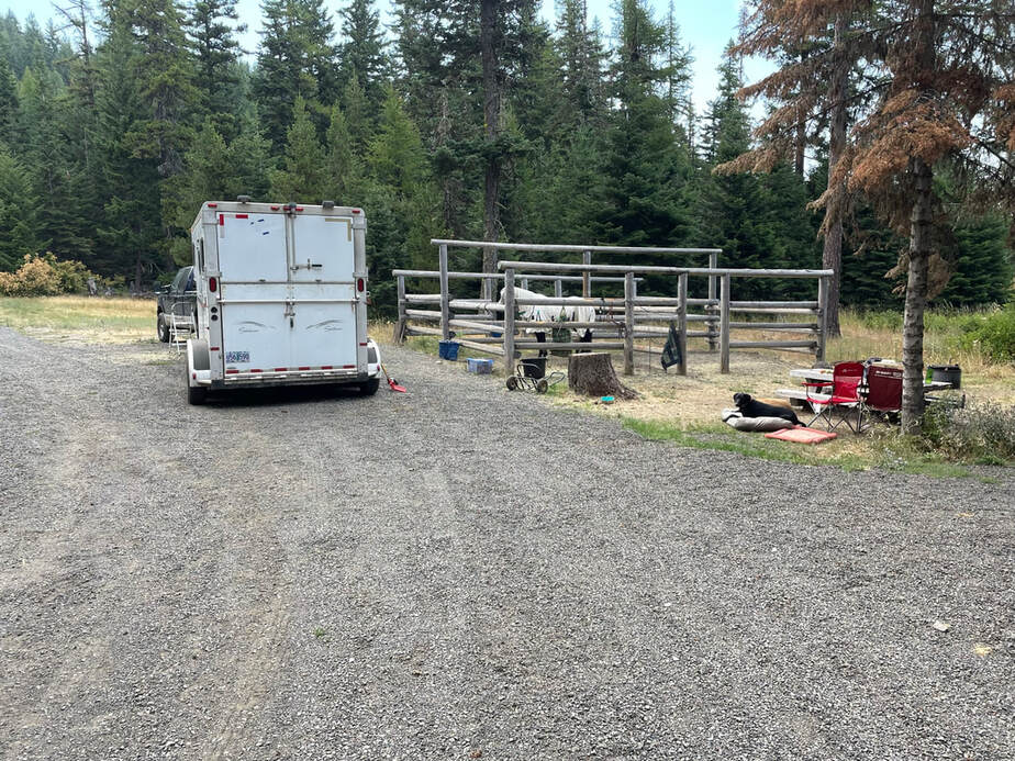
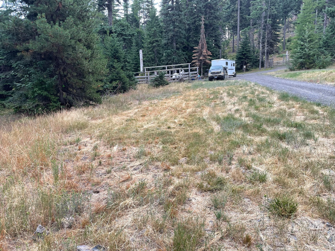
Horse Campsites
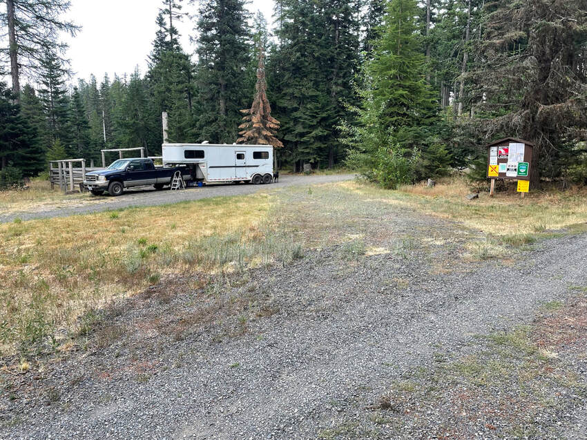
Three groups of 4 horse corrals. Non reservable and a very well kept secret. There are 6 possible parking areas. Sites 1 and 6 do not have corrals but would be great if you can hi-tie or have a portable corral.
|
|
Parking Area 1: Pull-through, room for a hi-tie or portable corral, no corral provided.
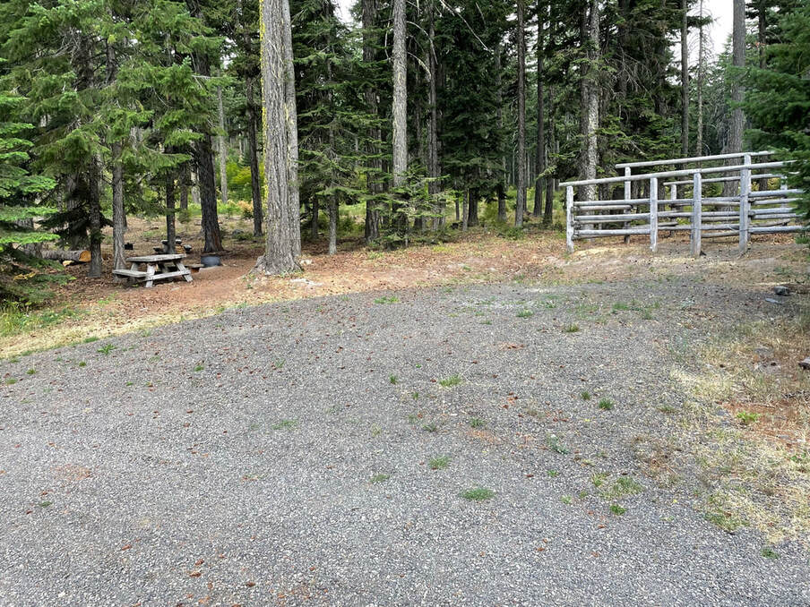
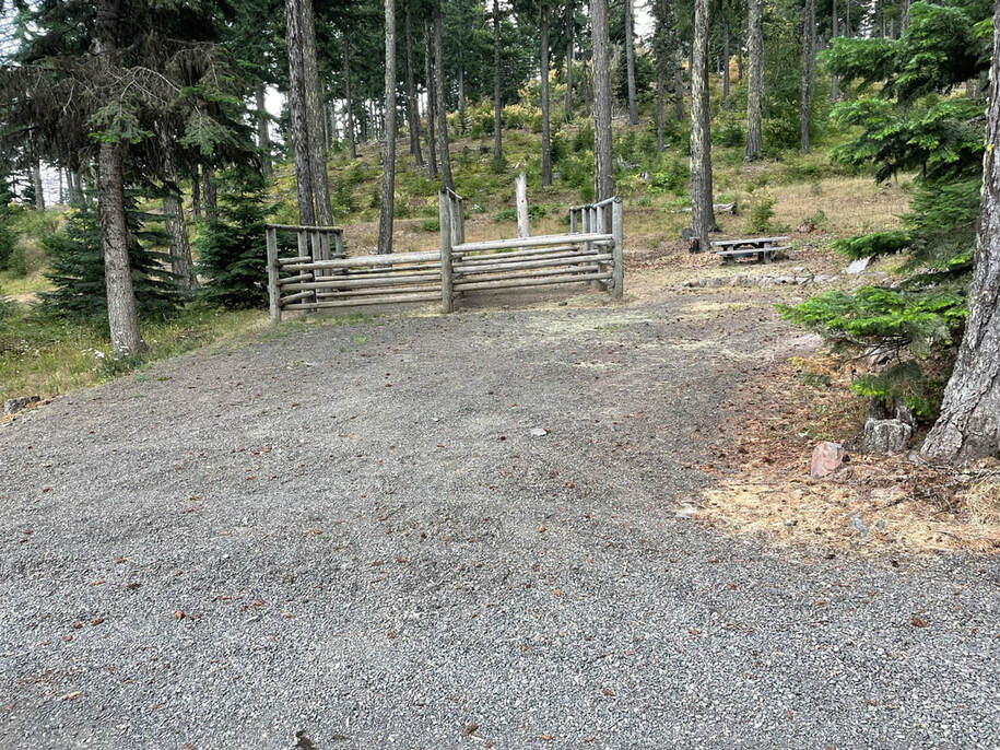
Parking Area 2: Back-in, four horse wooden corral
Parking Area 3: Back-in four horse wooden corral
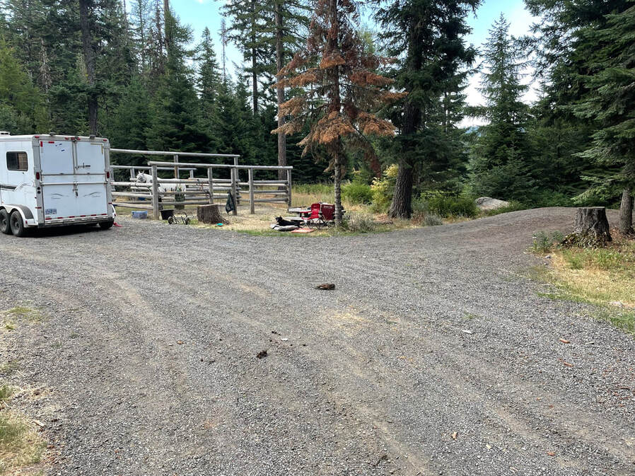
Parking Area 4: Back-in, most level parking area. Could share 4 horse wood corral with parking area 5.
Parking Area 5: Pull-through, wooden 4 horse corral.
Parking Area 6: Pull-through, mowed area of grass, no provided corral, room for a hi-tie or portable corrals.
Parking Area 2: Back-in, four horse wooden corral
Parking Area 3: Back-in four horse wooden corral
Parking Area 4: Back-in, most level parking area. Could share 4 horse wood corral with parking area 5.
Parking Area 5: Pull-through, wooden 4 horse corral.
Parking Area 6: Pull-through, mowed area of grass, no provided corral, room for a hi-tie or portable corrals.
Parking Area 2
Site Video Link
Site Video Link
Parking Area 3
Site Video Link
Site Video Link
Parking Area 5
|
|
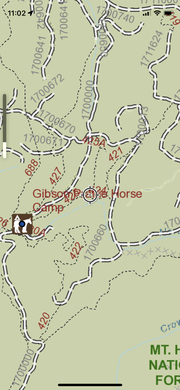
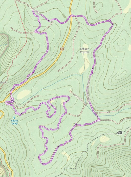
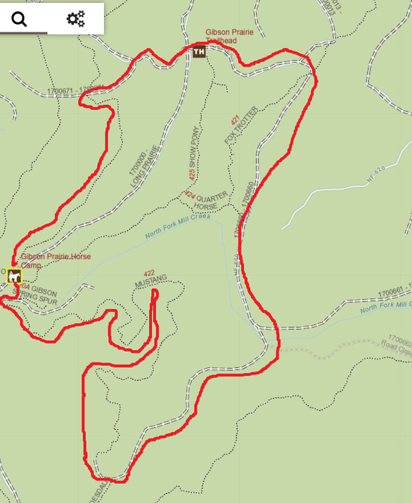
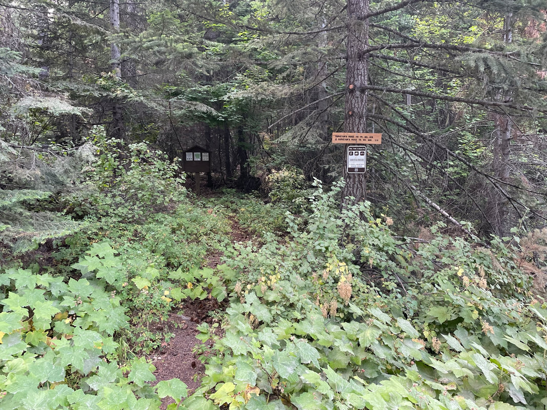
Trail Map
Thank you to the backcountry horsemen for updating the usfs visitor map. The website for this map is Here You can snip it and print it or create a GPS labeled PDF to use in Avenza. I will walk you through the steps to do this. The Usfs map layer in Gaia is not updated so doesn't show all the new trails.
| overview_gp_pdf_trail_map.pdf |
Navigation Options
1) Download PDF of Trail Map
Old school method. Print the pdf map from the link above and take a paper version with you. You may still be confused about where you are on the trail when you are out of cell phone reception. As a back-up you can download the area from google maps to use off-line. The GPS still works, even without a cell signal. This way you can see your position relative to landmarks in google maps without a cell signal.
Old school method. Print the pdf map from the link above and take a paper version with you. You may still be confused about where you are on the trail when you are out of cell phone reception. As a back-up you can download the area from google maps to use off-line. The GPS still works, even without a cell signal. This way you can see your position relative to landmarks in google maps without a cell signal.
2) Navigate with real-time GPS offline
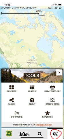
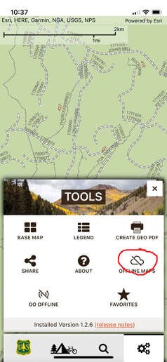
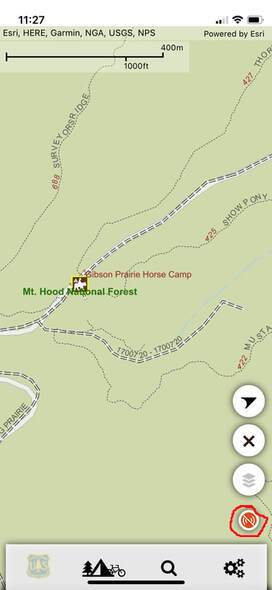
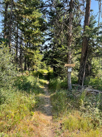
Better navigation options with real-time GPS. From the Apple App Store search for the us forest service. Pick the Visitor Map from the options listed. This app is circled in red in the below picture.
Better navigation options with real-time GPS. From the Apple App Store search for the us forest service. Pick the Visitor Map from the options listed. This app is circled in red in the below picture.
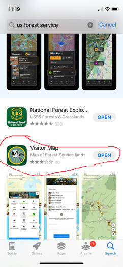
Install and open the app and click on the search option. Type in Gibson and Gibson Prairie Horse Camp should be listed. Click on the horse camp.

You can now see the labeled visitor map on your phone. However, this only works when you have a cell signal.
Use Usfa Visitor Map Offline
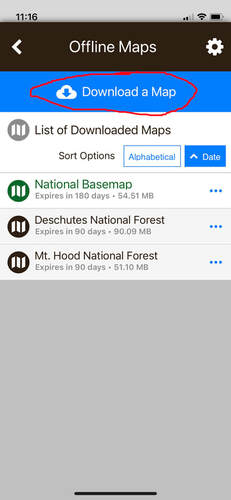
You can access this map offine from the usfs visitor map app. Click on the settings icon in the lower right corner of the app. Click on Download a map in blue almost at the top of the screen.
|
|
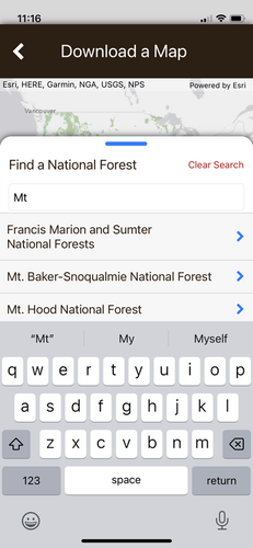
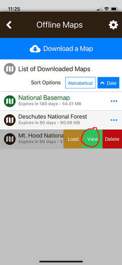
Put in "Mt" to find the option to click on Mt. Hood National Forest.
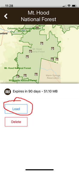
Once you have the map downloaded click on offline maps and pick the three dots to the right of the Mt. Hood map. It will then show options to load, view or delete the map. Click on the view option. Next, click on the load option.
|
|
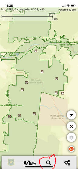
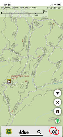
This brings you back to a vague general map. Then use the search bar and type in Gibson Prairie horse camp to zoom in on the horse camp area.
|
|
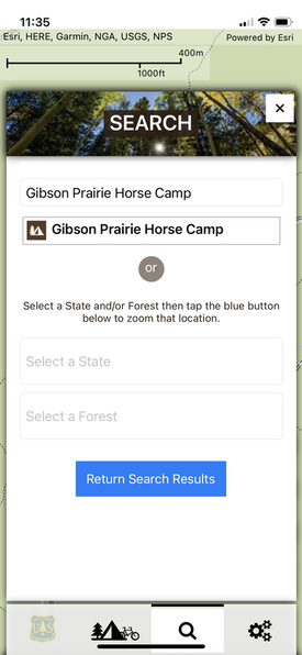
Click on the search bar and type in Gibson to bring up Gibson Prairie Horse Camp. Click on the horse camp and you will be offline but zoomed in on the horse camp. There is a red off-line icon in the lower right corner of the app.
|
|
Use Geo Pdf in Avenza
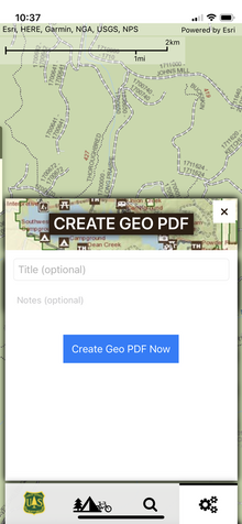
To create an off-line Geo Pdf click on settings in the lower right then create a geo pdf, name it and save it on your phone.
|
|
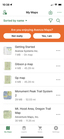
Next, I went to Avenza My maps and opened the Gibson P map. I now can see my location on the Geo PDF without a cell signal. Unfortunately Gaia does not have the ability to import Geo Pdfs which is a shame because it is a much better app than Avenza. The Avenza Geo PDF was a much poorer quality map than the visitor's map. I much preferred using the visitor's map.
|
|
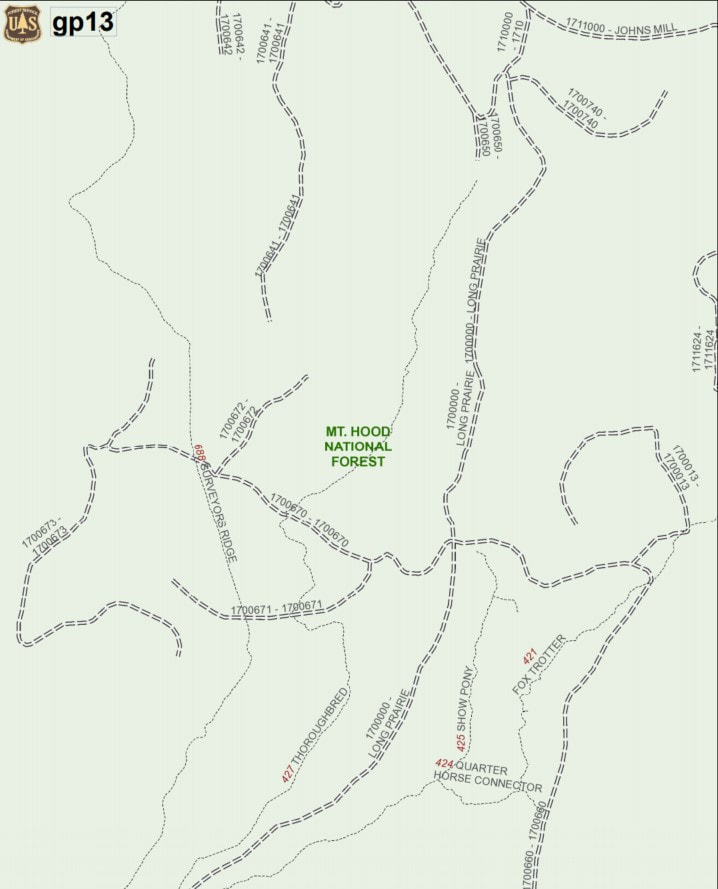
Trail Map
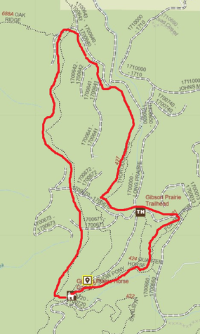
Here is an overview of the trail map. The best way to use the map is to use it off-line on your phone with a real-time GPS. You can also print out a paper map. The trails are very well labeled!! Thank you BCHO, it is so wonderful to have nicely done wooden trail signs at every fork!!
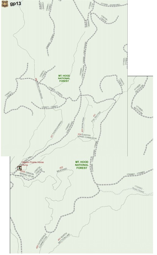
Here is a close up snip of the upper portion of the map.
| gp_upper_good_one.pdf |
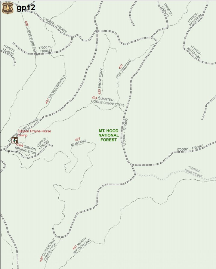
Here is a close-up of the lower portion of the map.
| gp_lower.pdf |
I also saved the pdfs and opened them in Avenza. If I was out on the trail I could open Avenza and see my location on the map in relation to where I was on the trail even if I don't have a cell signal. The quality of the pdf is not great and I can't see the individual names of the trails but you can see generally where you are.
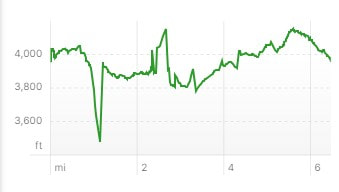
Riding
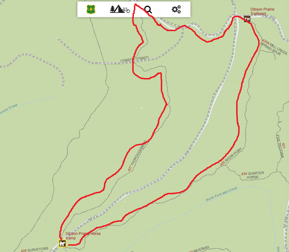
Show Pony to Thoroughbred
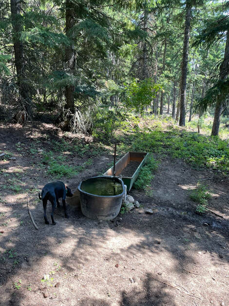
This was a nice orienteering ride for our first day in camp. We rode out of camp close to parking area 6 and started out on Show Pony. We took a brief detour to see the stock tank. I would not let my horse drink out of the tank as it is pretty dirty with lots of algae. There is a spigot with running water that you could fill a bucket up with and have less chance of algae contamination.
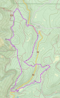
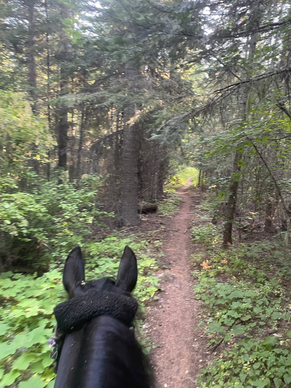
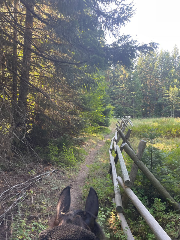
We crossed the main road going around a cattle guard. We rode up a gravel road uphill and found lots of wild raspberries all around the trail! Our dogs have no learned to eat these while we walk! We took the Thoroughbred single-track which led back to camp. The Thoroughbred trail was fun to walk or do a nice long-trot and haul ass back to camp. We started away from camp on Show Pony which is close to parking area 6. The beautiful trail signs made me so happy. The trail was easy, soft and beautiful. On the right is the route we took on the visitor map and I traced our trails in red so you can see the route better.
|
|
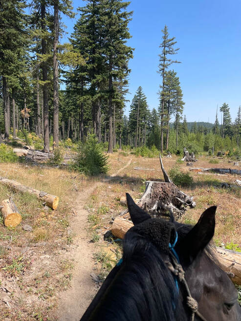
We continued on Show Pony.
|
|
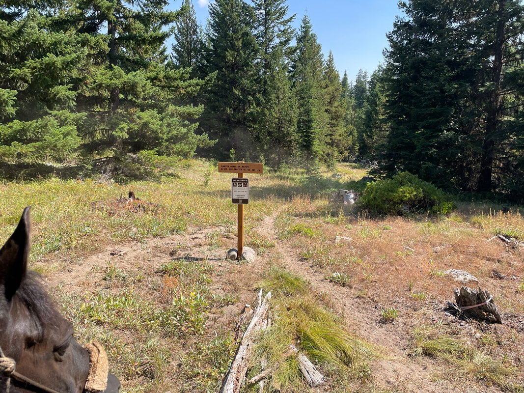
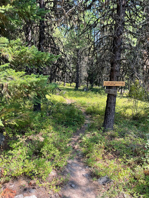
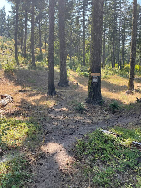
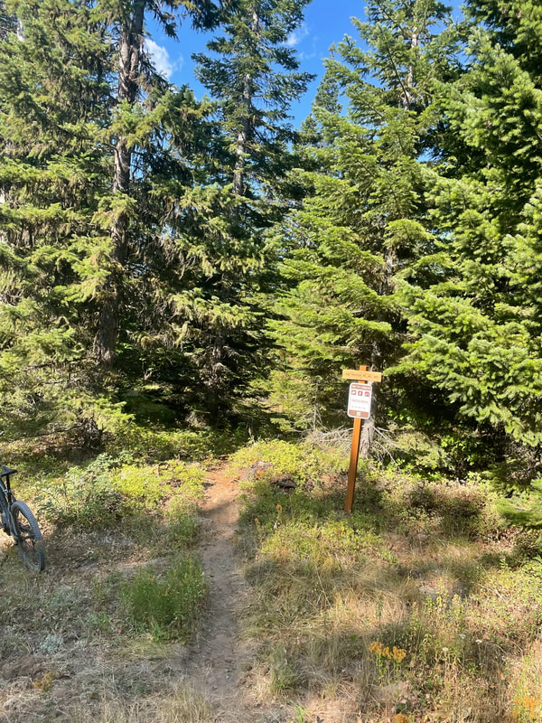
We passed the junction of Show Pony and Quarter Horse which was very well signed!!
|
|
We made a detour to check out the stock water. It was pretty gross. I would not let my horse or dog drink from the trough.
|
|
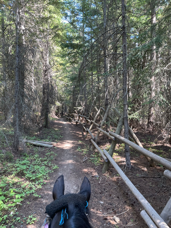
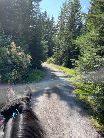
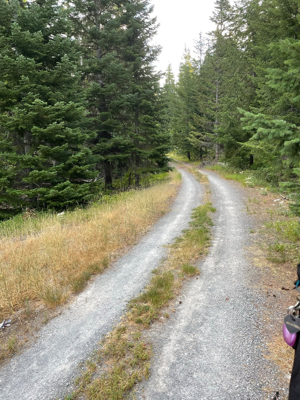
We passed through the trailhead, crossed the main road into camp, went around a cattle guard and up a gravel road. I saw lots of forest service gates that were left open for the season. Along both sides of the gravel road were lots of wild raspberries!
|
|
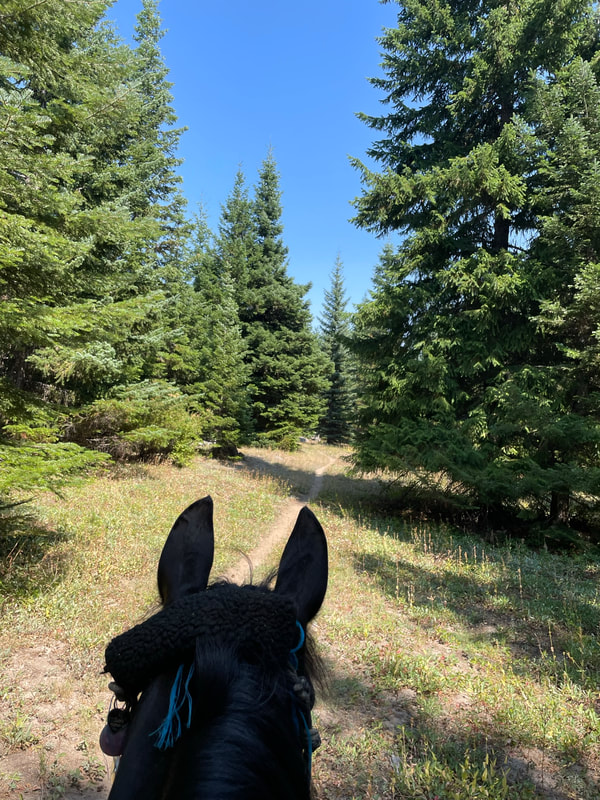
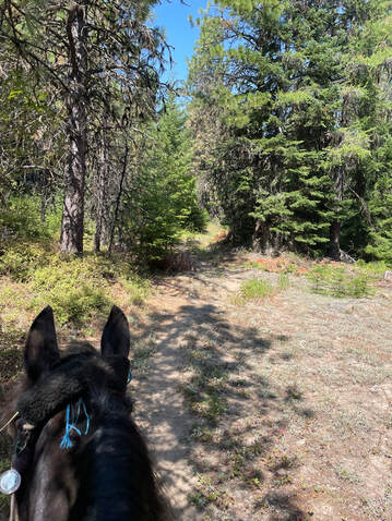
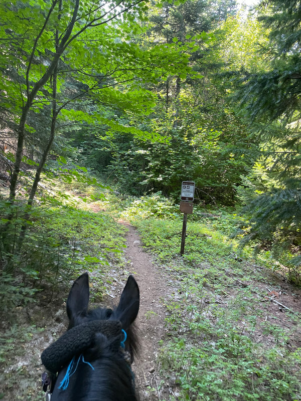
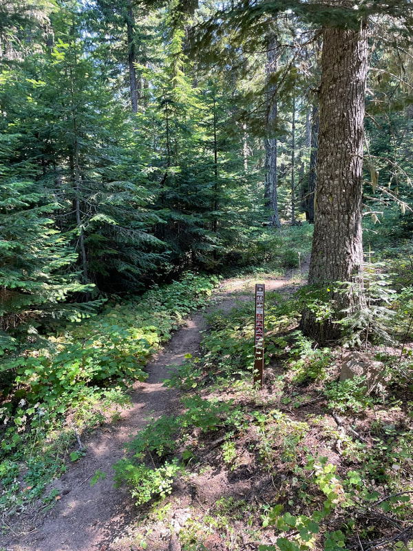
We took a left on the single-track Thoroughbred. I loved all the trail signs!
|
|
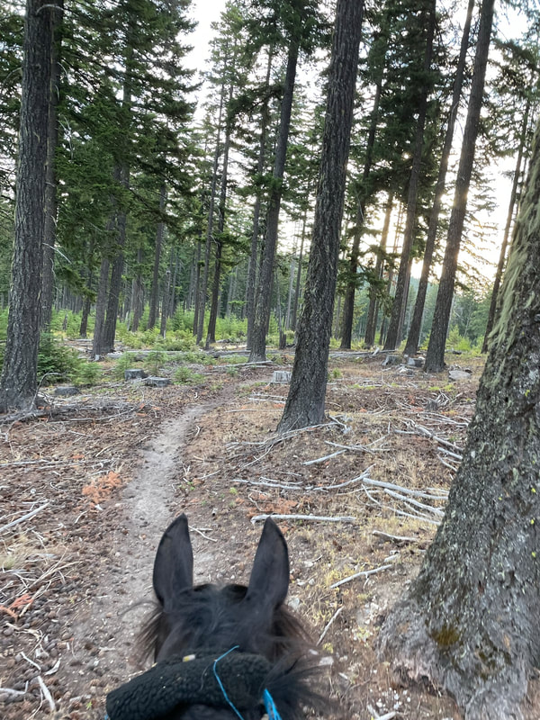
Yea, more trail signs and a magical single-track through the woods.
|
|
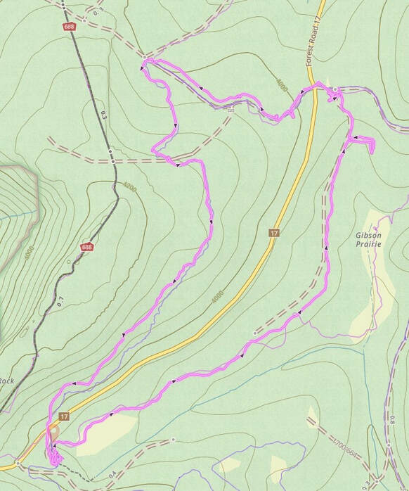
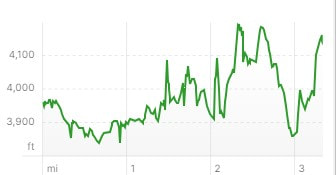
Mustang to Thoroughbred
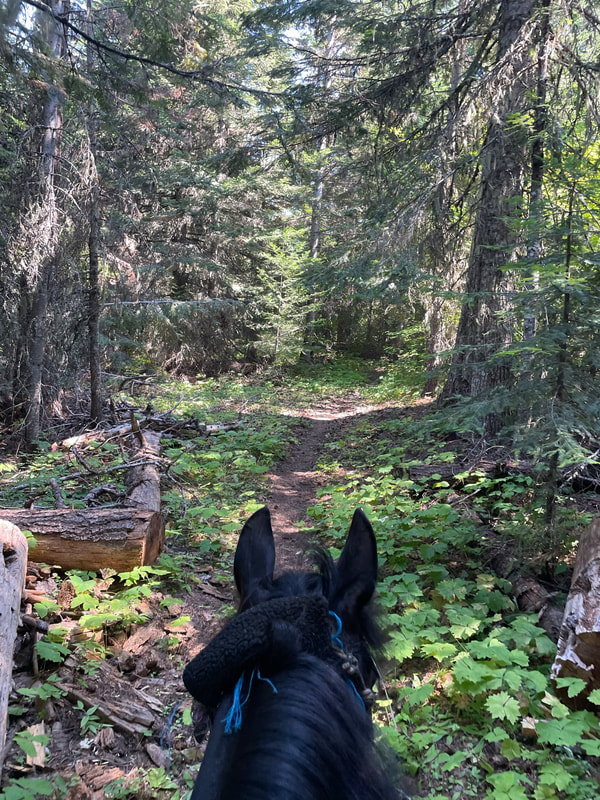
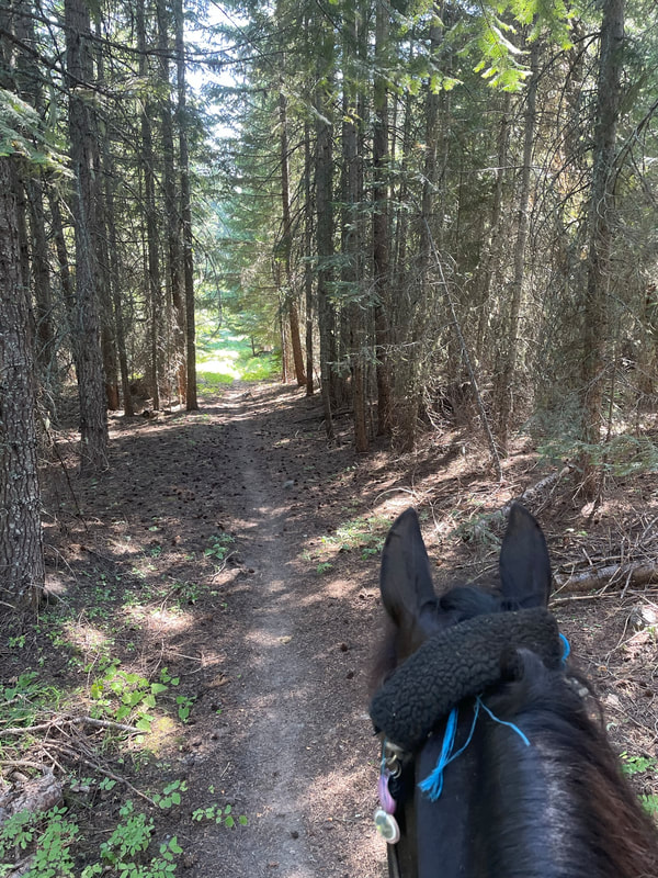
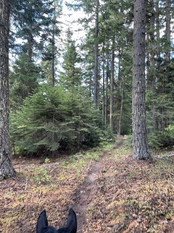
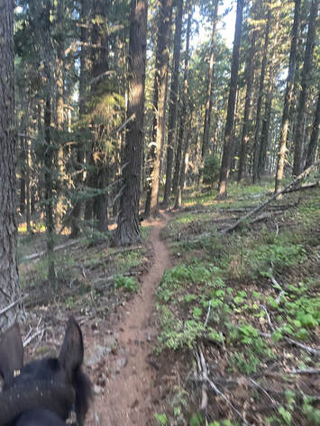
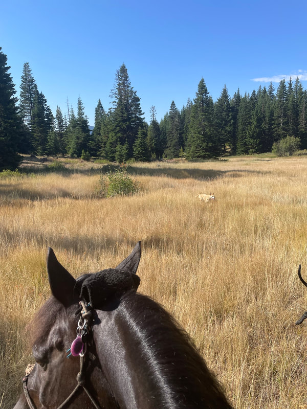
This was my favorite route during our camping trip. The Mustang single-track was scenic without the low branches of Surveyor's Ridge. Long-trotting the Mustang single-track was a heavenly cross country race-track with good sandy footing and a few small down tree branches to jump. Sam hauled butt and we enjoyed ourselves.
Mustang hooked up with some gravel roads. The gravel road brought us to the Gibson Prairie trailhead. We went around the cattle guard, crossed the main road and headed uphill on another gravel road until we took a left oin the Thoroughbred single-track. The mixture of gravel roads and single-track was perfect and it was a combination of footing that led to some amazing long-trotting. One the right is a snip from the visitor map so you can see the different named sections of the trail. The single-tracks are not on Gaia so I used a combination of Gaia and the usfs visitor map to navigate. The visitor map was the best way to see the different sections of trail with the different horse breed names. Lovely trail sign for Mustang to the north of parking area 3.
|
|
The Mustang single-track was the most lovely long-trotting racetrack! No low overhead branches and soft footing!
We hit some gravel roads and had a great trot up to the trailhead. We crossed the main camp road, went around the cattleguard and took the Thoroughbred single-track back to camp.
|
|
Surveyor's Ridge North to Foxtrotter to QH
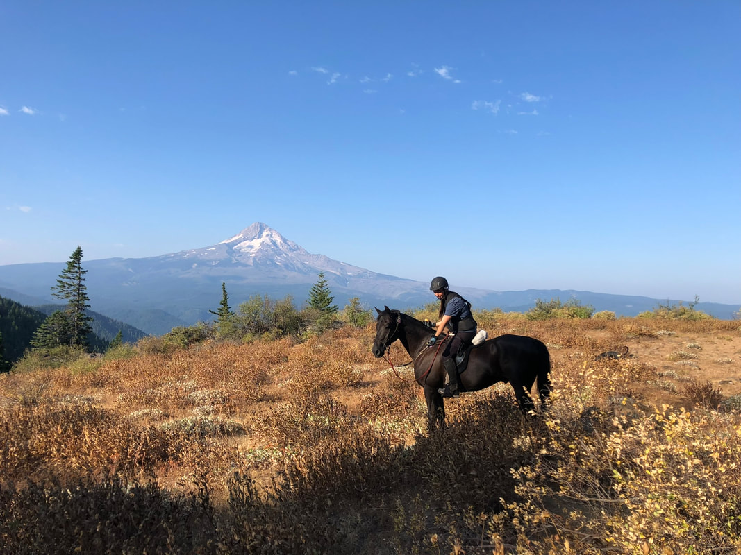
If you want to get the picture of you and your horses against the back-drop of Mt. Hood then this is the trail you want to take. About 2 miles north of camp the trail opens up from a wooded and forested single-track into a butte with an incredible view. There is some width to the trail at the top so you are not against a sharp drop-off and there is plenty of room to stand for a picture.
The Surveyor's Ridge part of the trail was not my favorite. If you have a 14 hand pony, you will love it. However, my 16.1 hand Morgan and I hit every low branch on the trail and we had to play limbo at a long-trot. I need more draft horses to ride this trail before Sam and I go back! We loved the gravel roads. Sam was booted on all four and we liked going a little faster on the gravel road. We did ride on the main road, 17, for a brief section of trail. We did not see any car traffic but stayed alert. We took Foxtrotter to meet up with QH and had a hard time seeing the QH trail as we walked through the meadow. I rode with my phone in one hand with the visitor map open. I could see my location on the map and played hot and cold until I was back on the trail. Sam wanted to trot so it was a little difficult riding while staring at my iphone trying to find the trail while coaxing Sam with one hand on the rein. You are welcome to download my GPS track and load it into "Ride with GPS". Ride with GPS has a "navigate" option and will verbally correct you if you go off trail. |
|
To pick up the Surveyor's Ridge trail we walked out going left on the camp road. The trail was well signed on the right side of the road. Beware if you have a tall horse. For the next 2 miles I got to play limbo at a long-trot. I hit every branch and there was a branch Sam ducked that almost got me! The fun thing was that bikes are allowed on Surveyor's Ridge so Jon rode his bike and we trotted! This is sooo much more fun than walking!
|
|
Finally we got a picture of a mountain, when riding in the mountains. Leave it to us to visit Mt. Adams when it is overcast. This picture spot is about 2 miles north on Surveyor's Ridge. It is a wide section of the trail so no sharp drop offs.
I got to play low branch limbo some more and then was relieved to take a right on the gravel road that led to the Gibson Prairie Trailhead.
|
|
I followed the signs for Foxtrotter to QH and Jon rode the gravel roads back to camp.
|
|
This is where to trail disappeared. I rode with my visitor map app open on my iphone while I tried to ride in the right direction so my GPS arrow took me to the trail. We curved to the left and found a sign for QH ahead of us. From there we met up with Show Pony to ride back into camp.
Rating
I love this place! I thought about not writing about it....however, more people should enjoy this beautiful horse camp. This horse camp is the best horse camp in the Mt. Hood region. It is much better than Riley, Lost Lake, Joe Graham or Clackamas. There are lots of riding options and the footing is safe and the trails are only moderately difficult. The elevation change is not severe and there are good horse containment options. The trail forks are all labeled and the visitor map works beautifully offline.
