Santiam Horse Camp
Location: Santiam horse camp, Gates, OR 97346, no address available
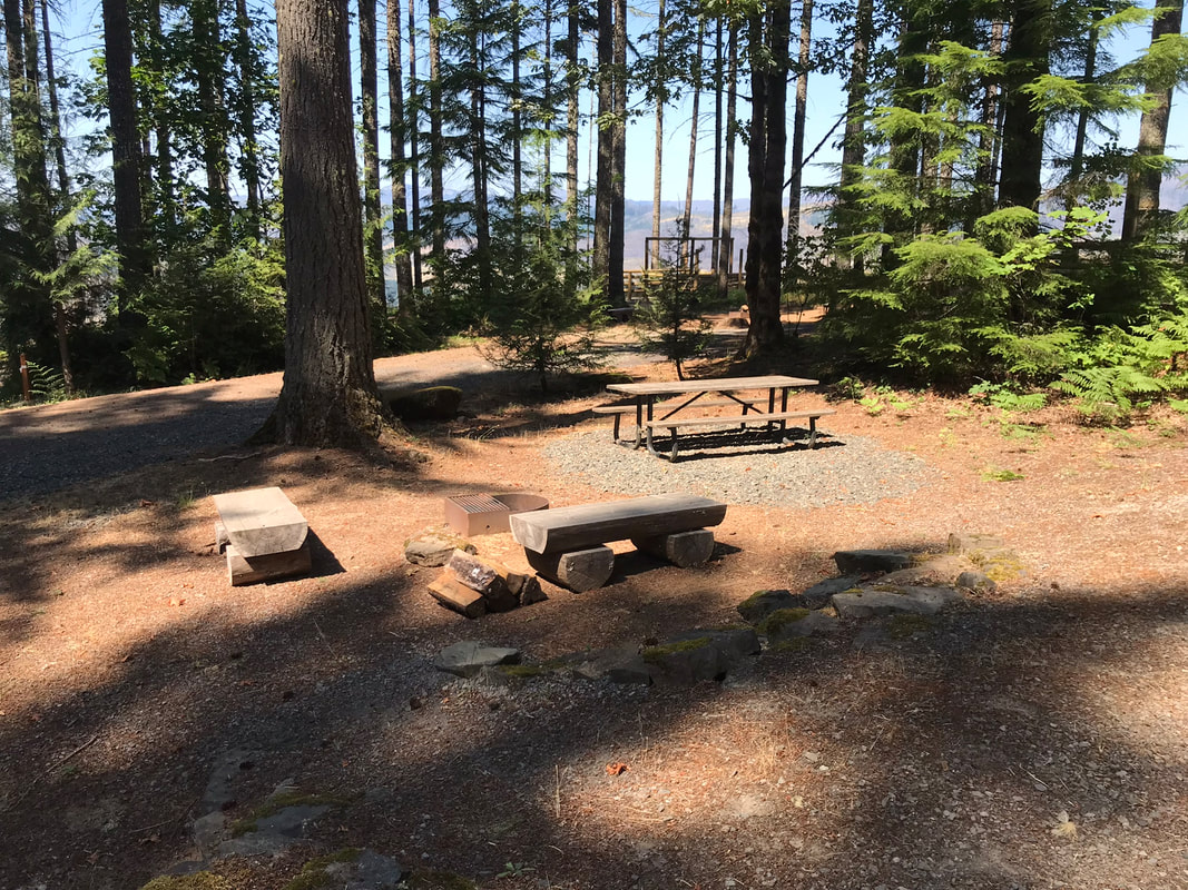
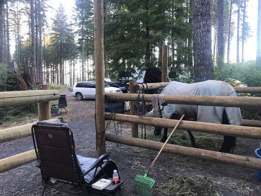
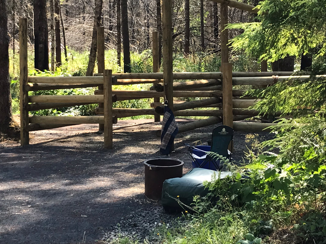
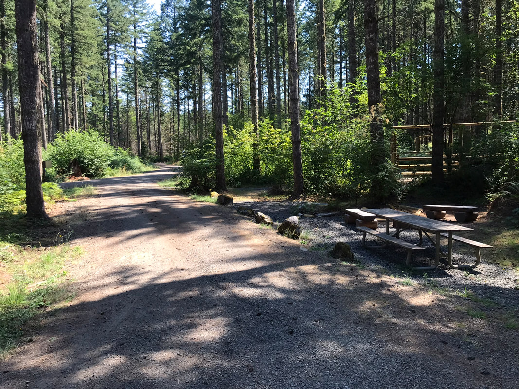
Facilities: Vault toilets and trash can, The bathrooms are ADA but there is no wheelchair ramp, picnic pavilion, manure bins and wheelbarrow, fire pits and picnic tables at each site
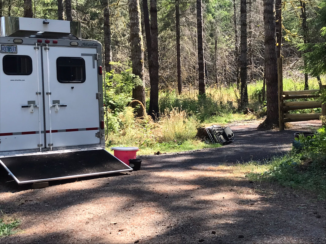
Camp Site Amenities: picnic table, fire pit,
Site Type: back-ins all except #10 which is pull-through
Water: Hand pump, difficult to use. There is a hose hook-up provided for the hand-pump, but no spigot. Other riders report that the water tastes funny and horses will not drink it. The water pump has a filter system. If you attach a hose to the pump and pump it through the filter it will taste better. It is harder to pump the hand pump when the water goes thru the water filter. Many riders say it is easier to bring your own water.
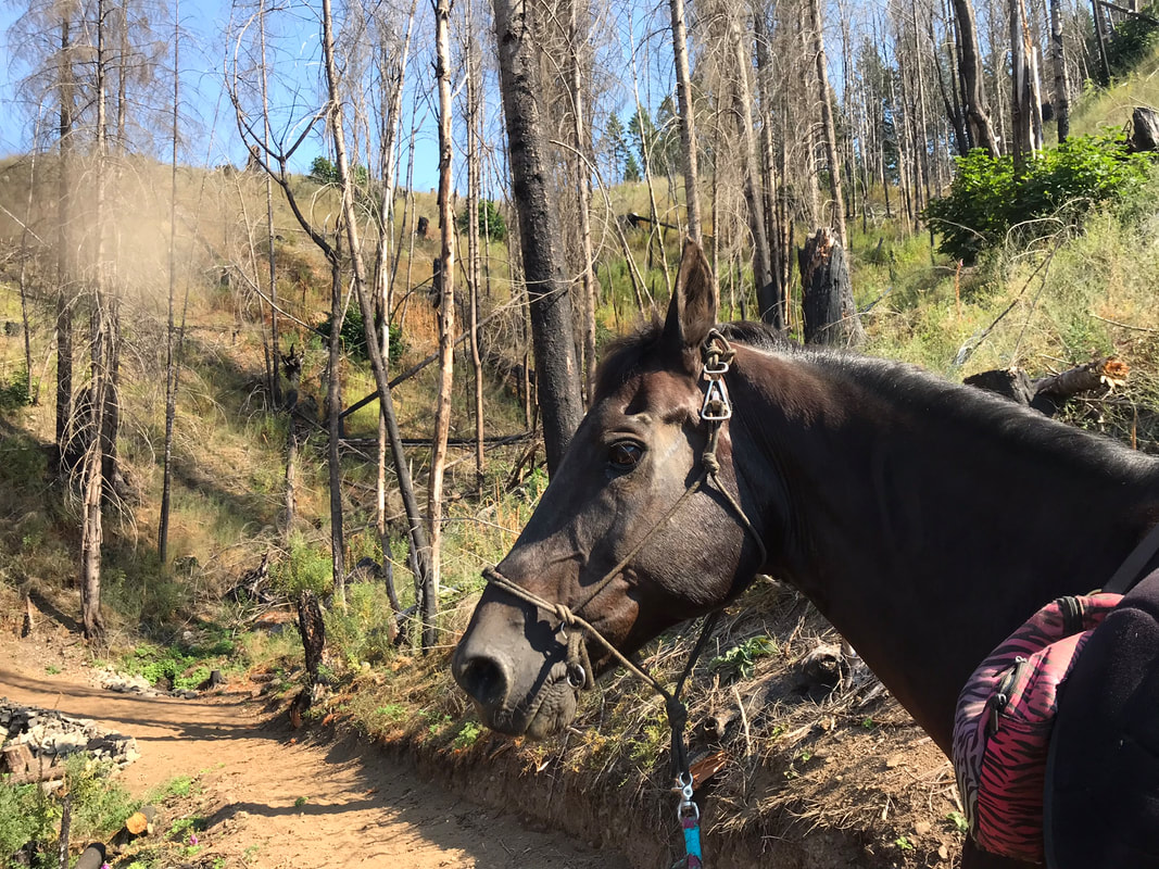
Footing: Rocky, hoof boots recommended
Cell Signal: ATT 2 bars!!
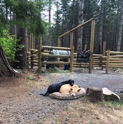
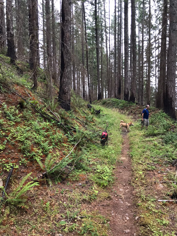
Dogs: Dogs allowed
Other: Weed-free hay required
Cautions: Bees, ride early in general to avoid bugs. Yellow Jackets are common if you are pot-lucking or are eating meat in the summer.
Website/Reservations: https://www.reserveamerica.com/explore/santiam-horse-camp/OR/411802/overview
Date Visited: August 19-21/2022
Facilities: Vault toilets and trash can, The bathrooms are ADA but there is no wheelchair ramp, picnic pavilion, manure bins and wheelbarrow, fire pits and picnic tables at each site
Camp Site Amenities: picnic table, fire pit,
Site Type: back-ins all except #10 which is pull-through
Water: Hand pump, difficult to use. There is a hose hook-up provided for the hand-pump, but no spigot. Other riders report that the water tastes funny and horses will not drink it. The water pump has a filter system. If you attach a hose to the pump and pump it through the filter it will taste better. It is harder to pump the hand pump when the water goes thru the water filter. Many riders say it is easier to bring your own water.
Footing: Rocky, hoof boots recommended
Cell Signal: ATT 2 bars!!
Dogs: Dogs allowed
Other: Weed-free hay required
Cautions: Bees, ride early in general to avoid bugs. Yellow Jackets are common if you are pot-lucking or are eating meat in the summer.
Website/Reservations: https://www.reserveamerica.com/explore/santiam-horse-camp/OR/411802/overview
Date Visited: August 19-21/2022
Must Brings
1) Gaia!! I always think Gaia is a must bring but it is super easy to get turned around on all the logging roads. During my stay at this camp I showed several campers aged over 50 how to download and use this app, so it can be done, no matter your age!
2) Trail map PDF and Avenza app! Pay attention to this section in the "Riding" section. So, the camp host emailed me this PDF and I saved it to my files on my Iphone. I then opened Avenza and added this pdf to my maps to open in Avenza! Tada, I could see where I was on the PDF as we rode. I liked Gaia overall better but the Avenza map showed the names of the different sections of trails so I could make sense of where I was on the loop faster. I had a paper map too but Jon dropped it somewhere before we started riding and I wadded up my copy and stuffed it under Sam's granola bars, where it soon became a gooey mess.
3) Power!! So, we usually overkill this must-have. We had two Ryobi batteries and inverters from our lawnmower, another laptop sized battery for iPhones, Ipads and air mattress, small portable iPhone chargers to carry when hiking, a mega CPAP battery that lasted easily for 2 nights and back-up car-jumping batteries that could jump my F350 and any other unlucky soul we need to save at camp.
4) Drugs, the good kind. We are talking about hydroxyzine, prednisone and epinephrine. This is in case of BEES. You could also follow my advice and avoid the trail section where others have encountered bees. Every trip usually has a good story from someone who has or has not survived the sting of the ground-nesting bees.
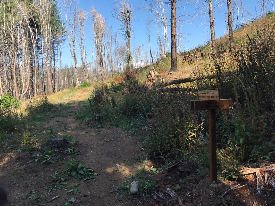
Getting There
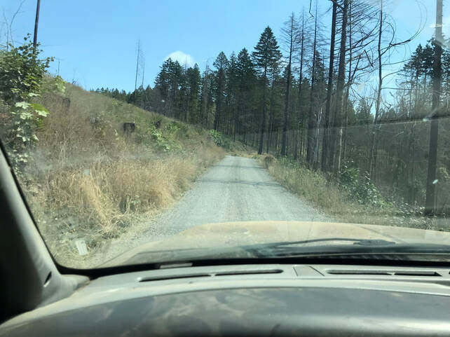
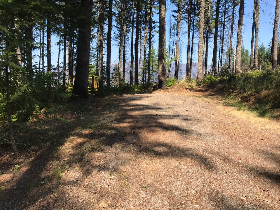
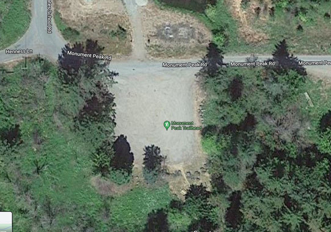
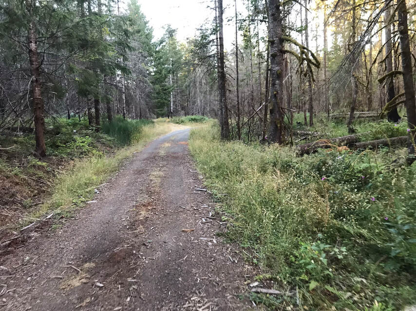
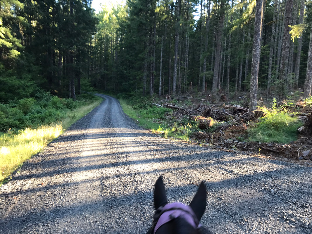
To get to Santiam Horse Camp, as you go past the Monument Peak Trail-head the road goes from paved to gravel. You drive about 1.6 miles on the gravel road. This feels like forever when you arrive, but is short when you leave. There are parts that are wash-boardy so I ended up doing 10mph or less. Ever since installing my trailer camera I go so much slower and I feel every bump in the road. I did worry about what I would do if I met another horse trailer on this road. I would be more cautious if you are arriving around noon which is the check out time.
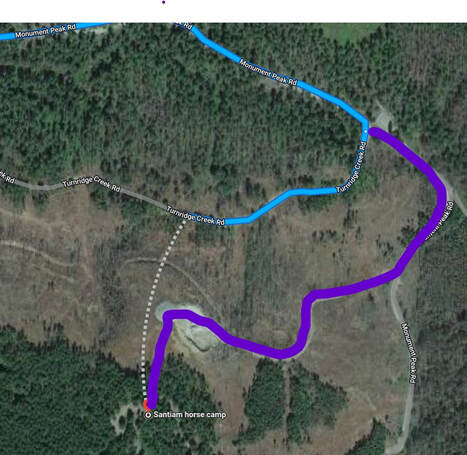
If you are coming from anywhere that is not Gates or Mill City the GPS on google maps may throw you off. Most people would assume that they are not hiking cross-country to get to the horse camp.
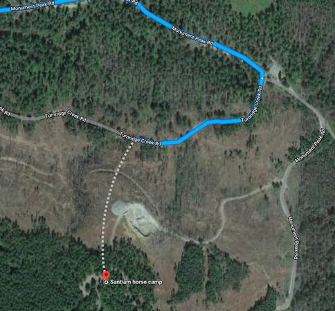
Instead take the unlabeled road (purple) that is Christmas Tree road or x-mass tree road off Monument Peak Road. As of 8/2022 this junction and the proceeding junctions are actually well signed. I get lost in Costco consistently, but I was able to figure this one out. If you are arriving late at night or pulling a large rig, missing the turn could cause a bout of panic. There are many dead-end roads that you may be able to pull into and then turn around but it would be fairly traumatic.
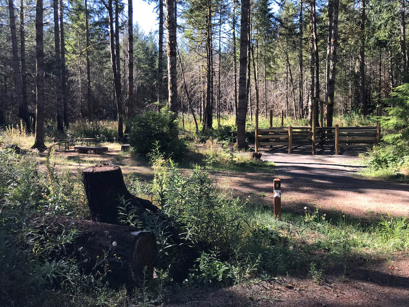
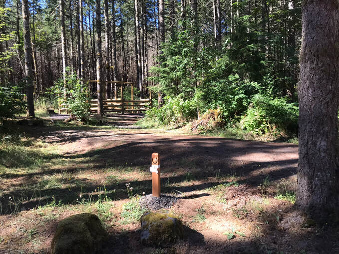
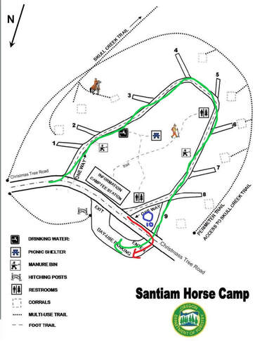
Horse Campsites
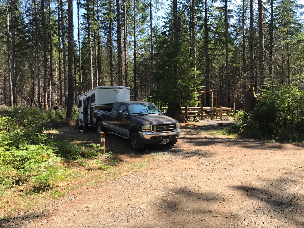
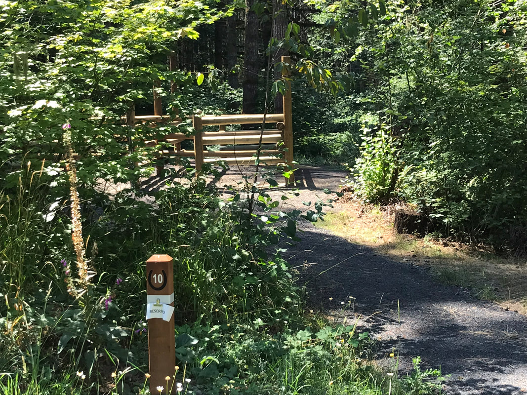
All of the horse sites at Santiam Horse Camp are back-in except for #10 which is a pull-through. You must have a horse to reserve a site. This statement is actually true here as the ranger and camp host keep close tabs on this campsite. Site 10 is not on the original map. The parking place is a Y off the main 1-way road and looked like a nice place to park with a bigger rig.
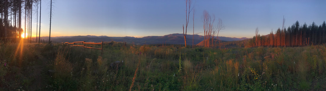
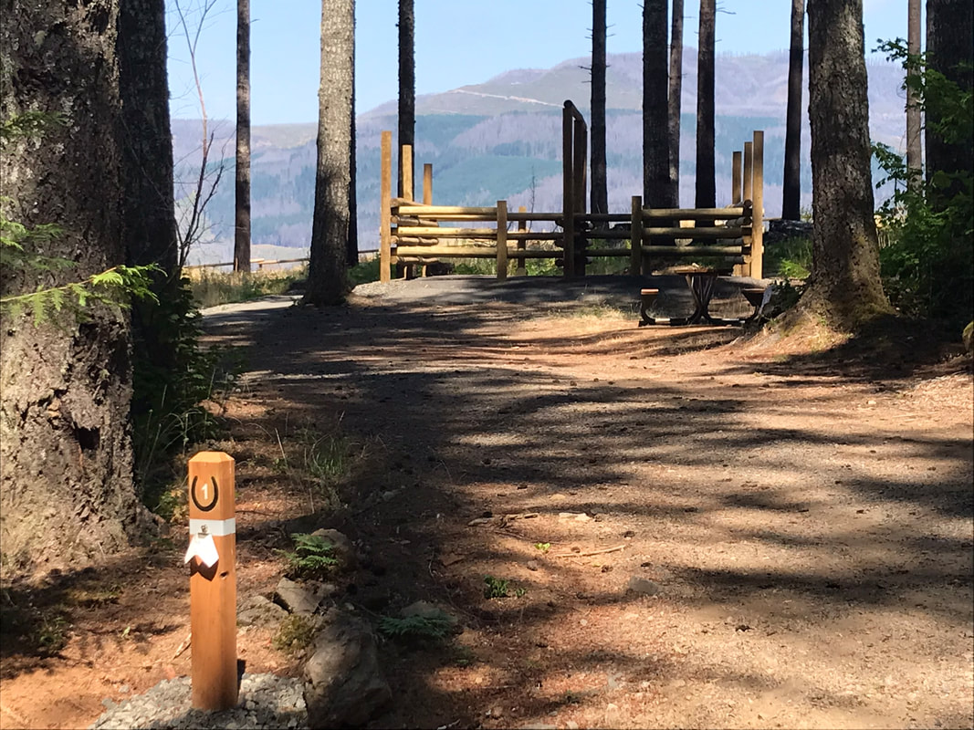
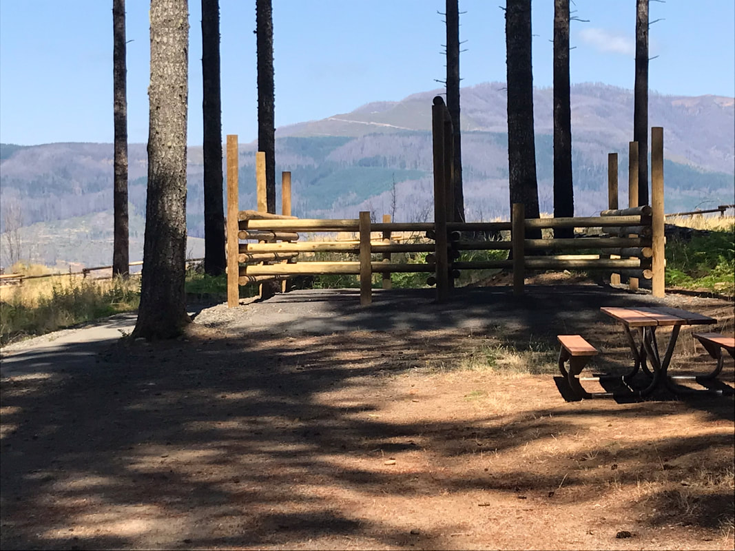
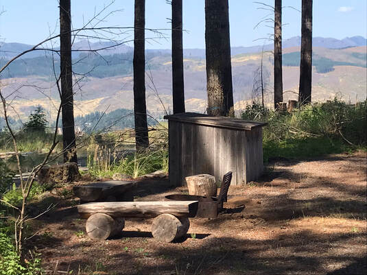
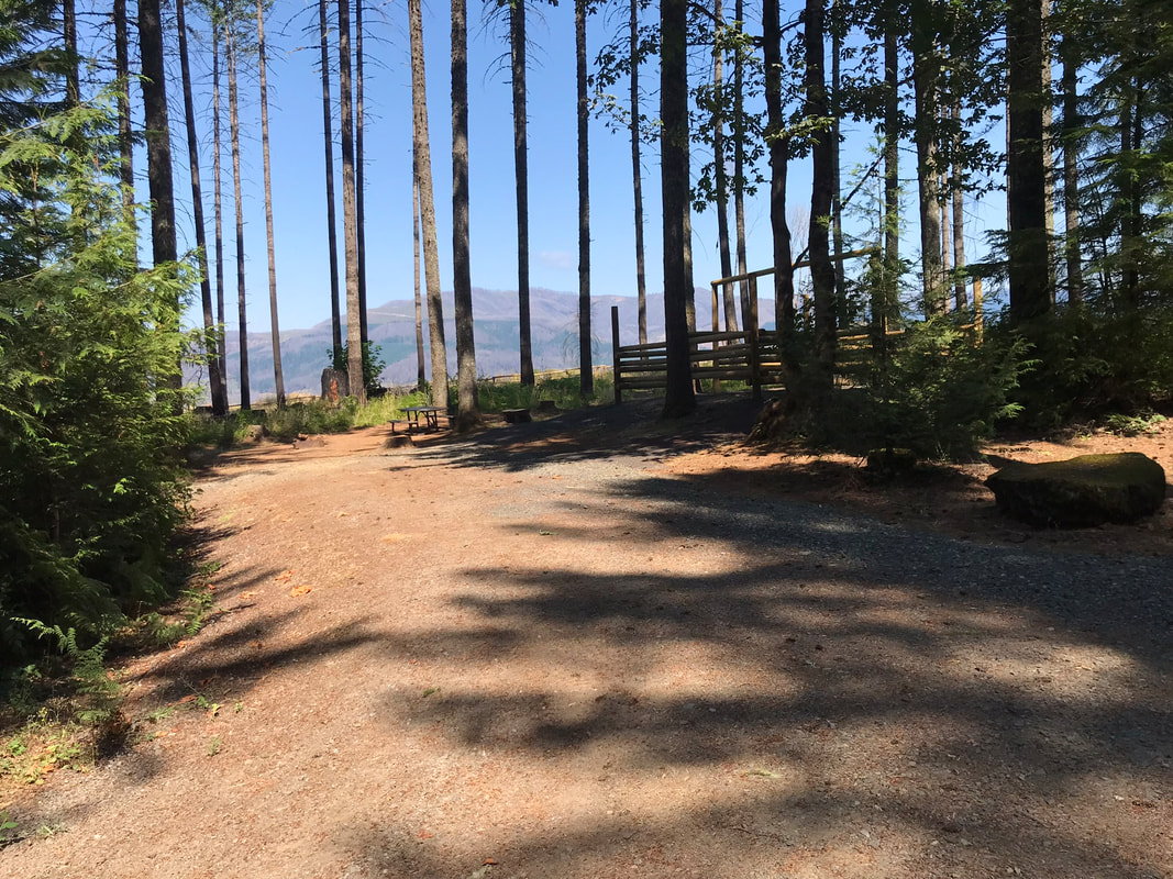
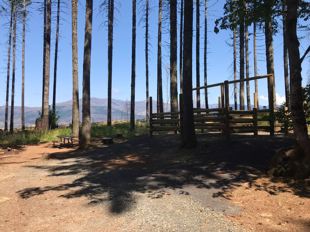
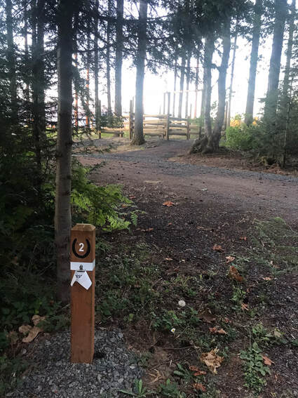
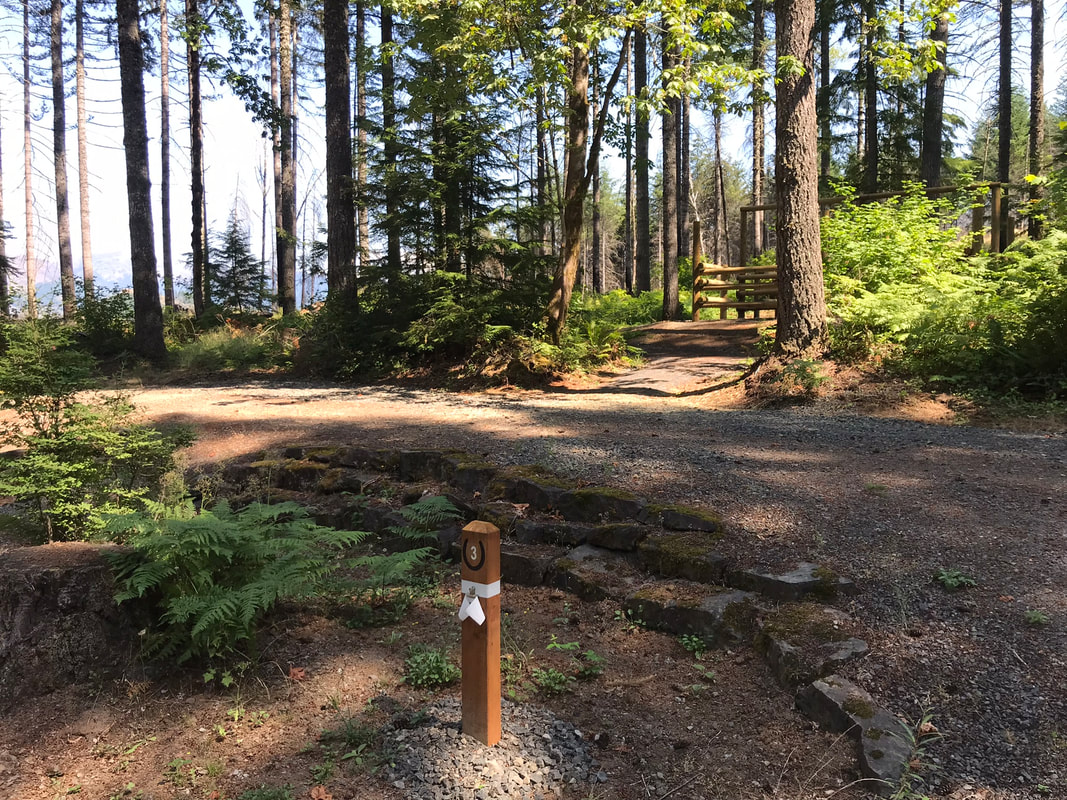
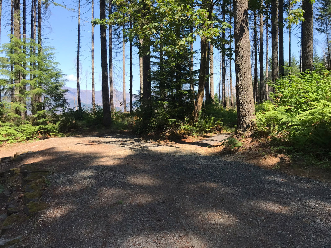
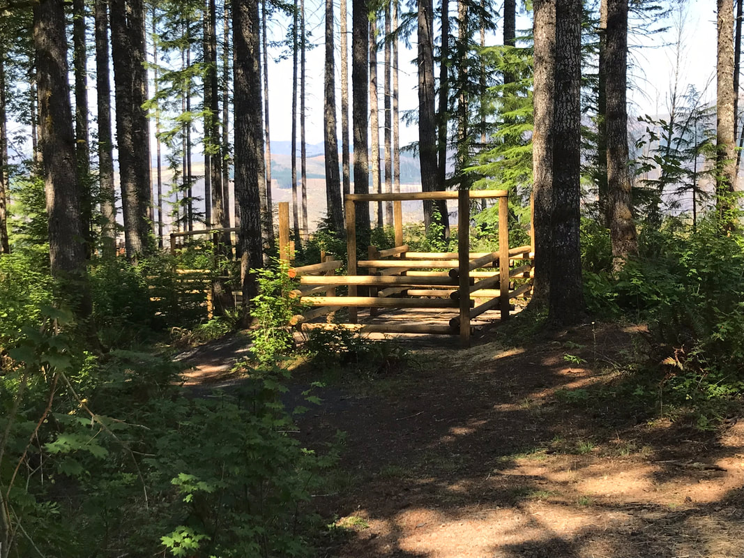
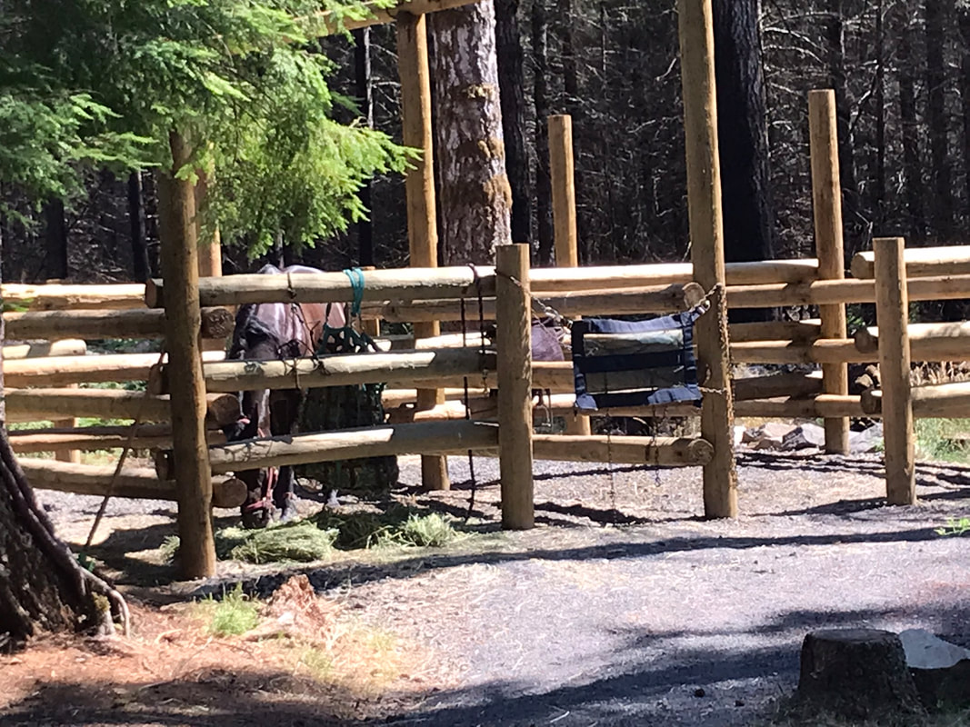
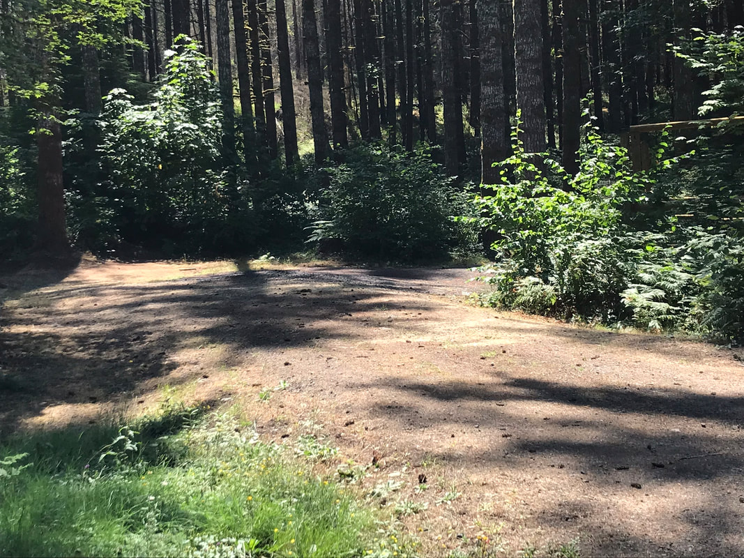
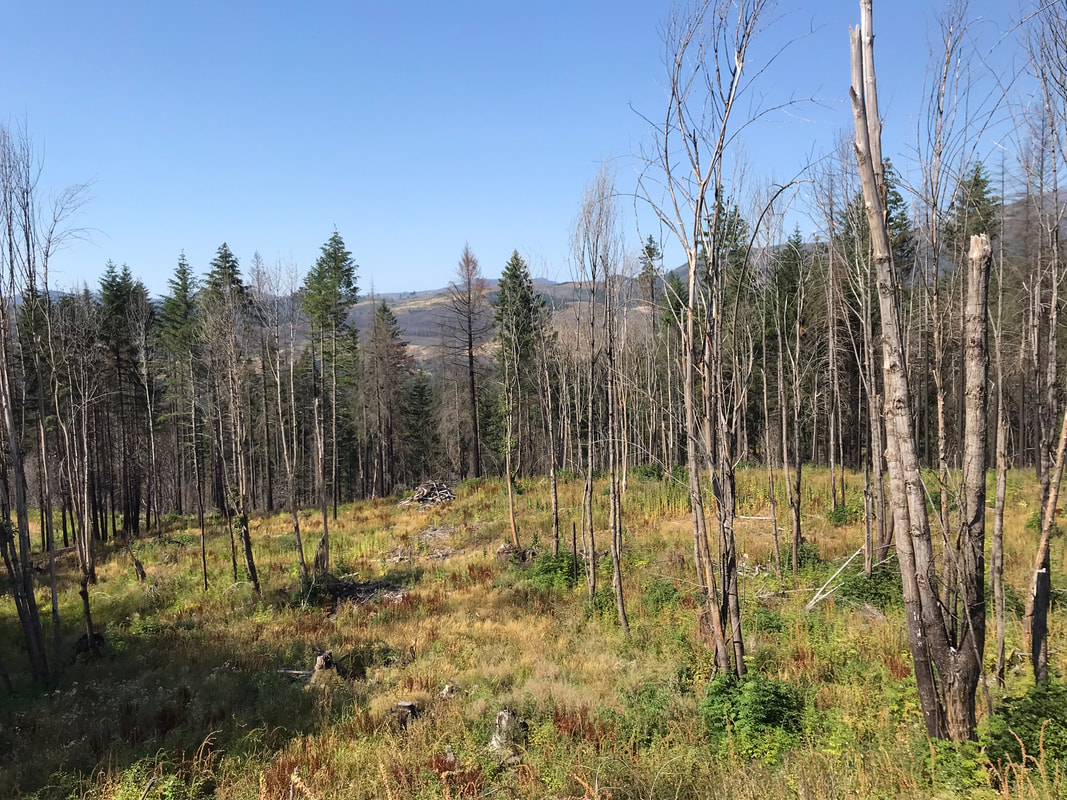
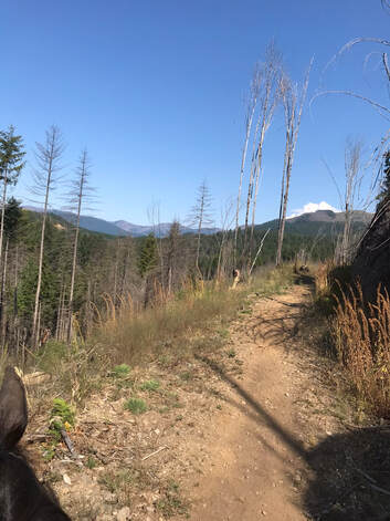
Each site has an access path to the outer trail around the campground and each site also has signs and numbers on the outside of the site facing the campground loop trail. This is a very nice touch! This campground used to be very shaded and treed before the 2020 fire. As a consequence of the fire the trees are thinner and there is an amazing view of the surrounding hills from sites 1, 2 and 3. These sites are also more sunny. There are 2 manure bins on opposite sides of the loop but only 1 wheelbarrow. I ended up walking around the whole loop to locate the wheelbarrow. It was also hard to use when multiple groups were checking out and cleaning at the same time.
Each site has an access path to the outer trail around the campground and each site also has signs and numbers on the outside of the site facing the campground loop trail. This is a very nice touch! This campground used to be very shaded and treed before the 2020 fire. As a consequence of the fire the trees are thinner and there is an amazing view of the surrounding hills from sites 1, 2 and 3. These sites are also more sunny. There are 2 manure bins on opposite sides of the loop but only 1 wheelbarrow. I ended up walking around the whole loop to locate the wheelbarrow. It was also hard to use when multiple groups were checking out and cleaning at the same time.
Campsite Details
|
|
Campsite Pictures
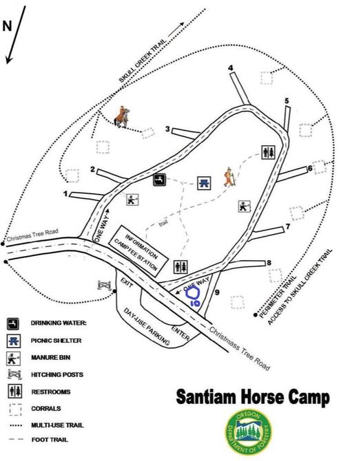
Site 1 - really nice view, this site is usually reserved for the camp host or emergencies according the to ranger on duty during my stay
|
|
Most sites also had this cute benches around the fire pit. This is a nice touch.
Site 2 - This site was my favorite, the view was beautiful.
|
|
Site 3
|
|
|
|
Site 4 - close to manure pile, hand-pump and trash, the corrals were off to the left, down a slight hill, the corral to picnic table matters to me and this may be too far. I fuss over Sam constantly so going up and down a hill would be difficult.
|
|
|
Site 5 - I nearly took out the brand new site sign when I backed in, which would have been very sad. Please put the signs farther from the driveway, please for all the novice trailer drivers out there.
|
|
This is pure happiness at camp.
|
|
Site 6 -
|
|
Site 6 unoccupied
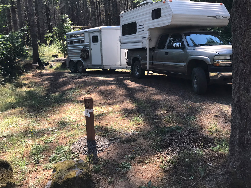
Site 7
|
|
|
Site 7 unoccupied
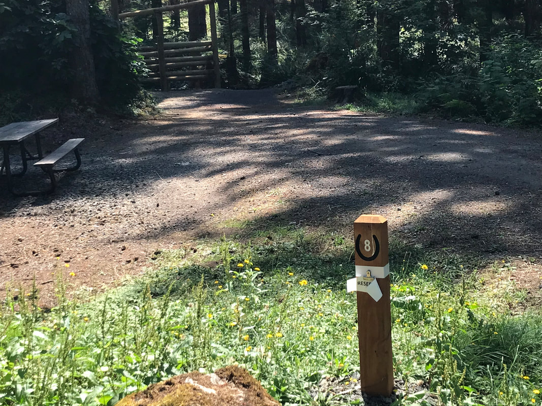
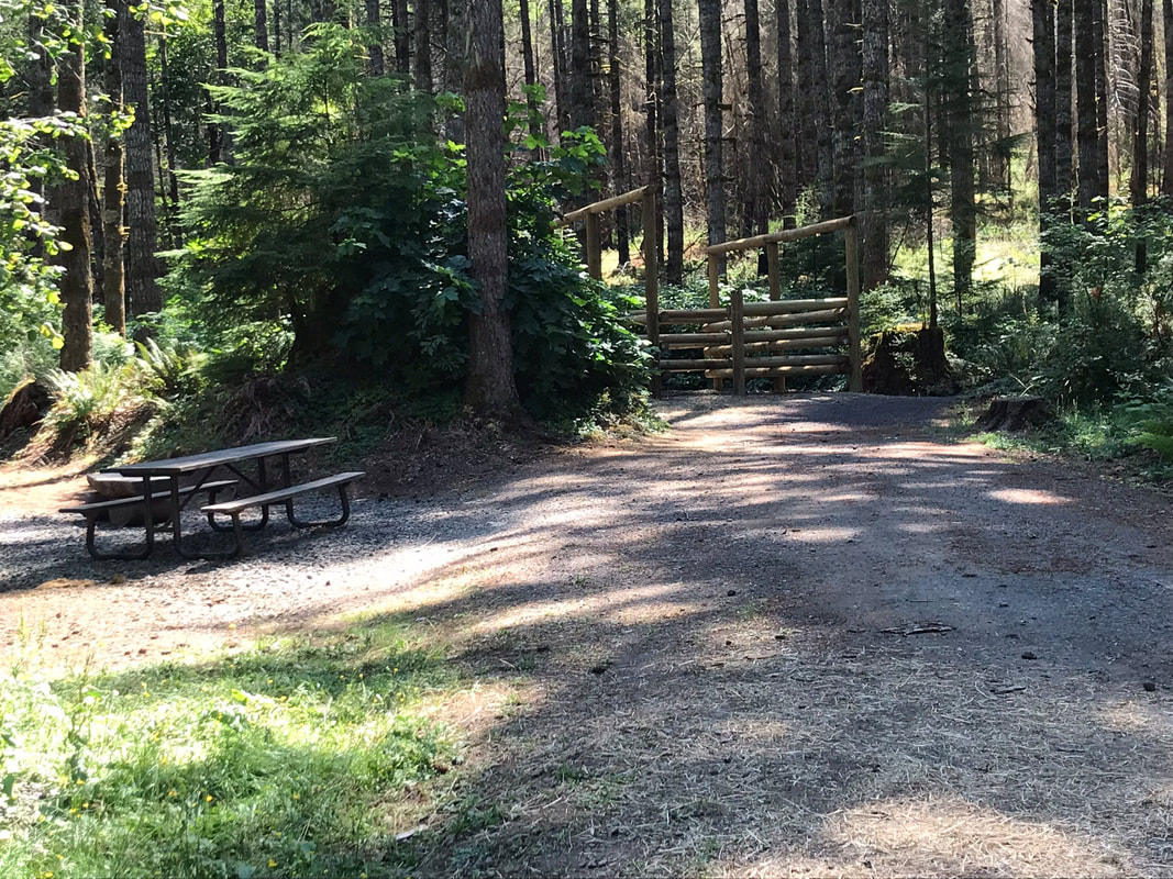
Site 8
|
|
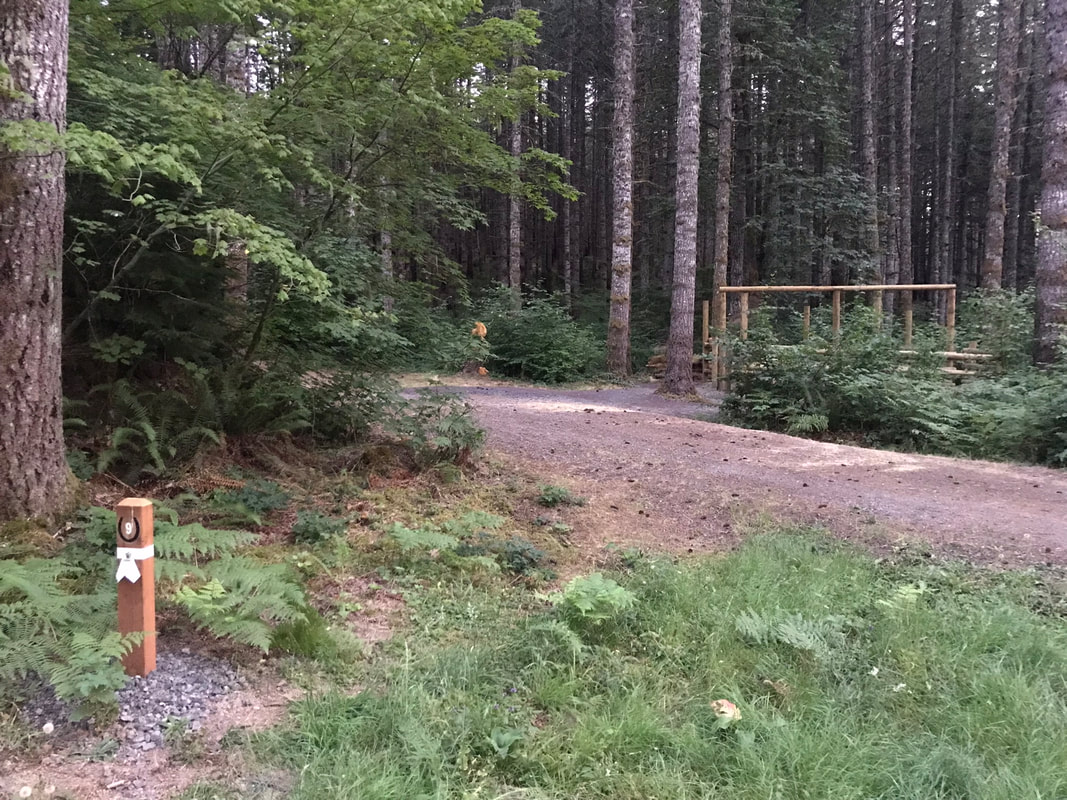
Site 9 - the corrals are set back a little in the trees
|
|
Oh, yes, a panorama shot of site 9 below
Site 10 - the only pull-through site, possibly a little more buggy according to a Silver Falls OET member
|
|
I figured out how to use panorama on my iPhone. Here is another perspective on site 10. The picnic table seemed a little far from the horse corral for me.
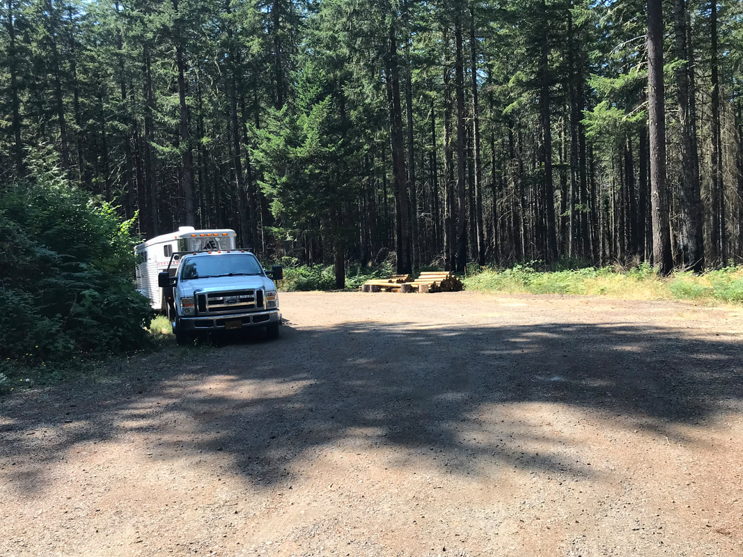
Day Use Area
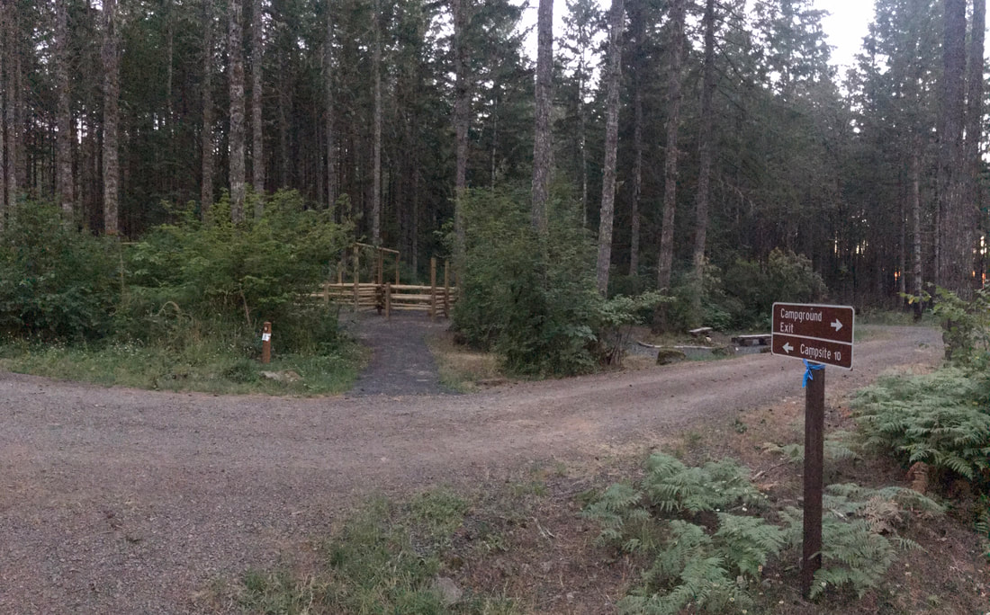
The turning arc looked a little tight to me. It was ok if there is no rig in site 10 because you can drive around the whole camp loop and then into the day use area as shown by the green arrow. If there is a rig in site 10 then you have to make a tighter turn into the day use area as shown by the red arrow. Clearly this can be done as people ride here for the day all the time. I however get stressed out about tight turns in my trailer so this is the kind of thing I would think about. This also shows how site 10 is an after-thought addition but a nice pull-through site.
|
|
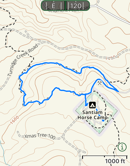
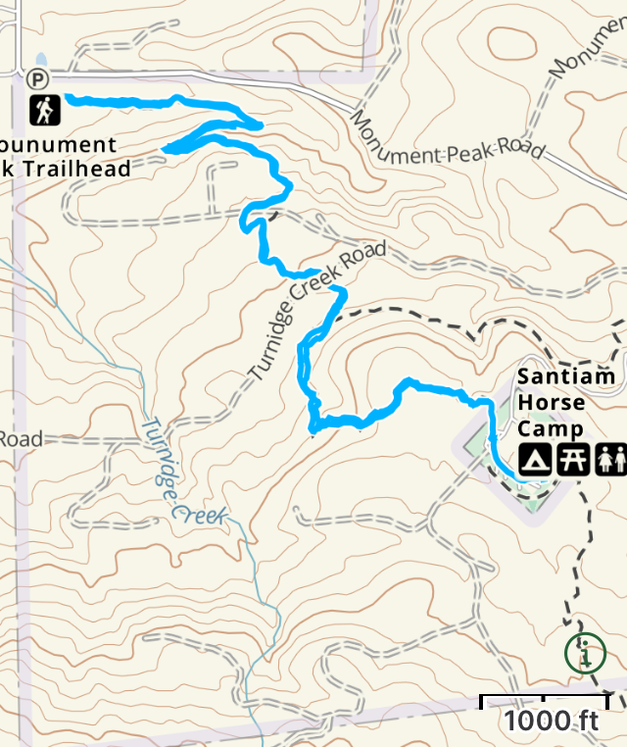
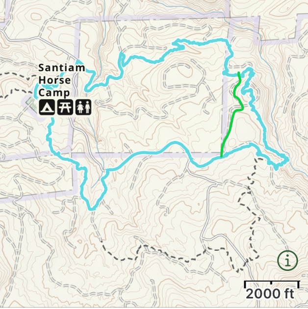
Riding Overview
Below is a link to download the map the camp host emailed me.
| monument_peak_trail_system_pdf_official_map.pdf |
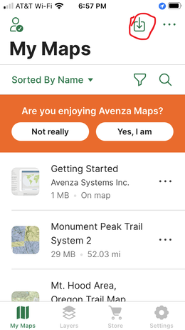
You can open this website on your phone or email yourself this file. Open it in Avenza and you can see all the different trail segments and see your relationship to them. From the main screen in Avenza click on the arrow going down in the box in the upper right as circled in red in the picture below.
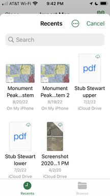
Click on Import File. Click on from storage location. I usually save from my email to "files" on my iPhone.

Click on the Monument peak system map that you saved to your IPhone.
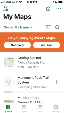
It will add the map to your Avenza.
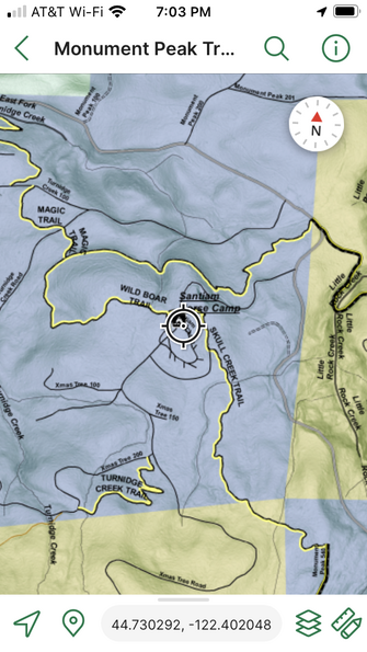
Then click on the Monument peak map to open it. You can see your position on the PDF map!
I don't love Avenza or this PDF map. I used Gaia and was really happy with it. When you zoomed in you could see the different names of the segments of all of the loop trail and the names of the main forest/logging roads. I had two paper maps but it was hard to dig it out of my bag and Jon promptly lost his.
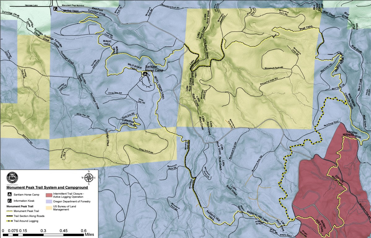
Trail Map PDF
Here is another version of the map without the new Bobcat trail marked. This version is easier to see the different parts of the loop and all the logging roads and forest roads that connect them.
Here is another version of the map without the new Bobcat trail marked. This version is easier to see the different parts of the loop and all the logging roads and forest roads that connect them.
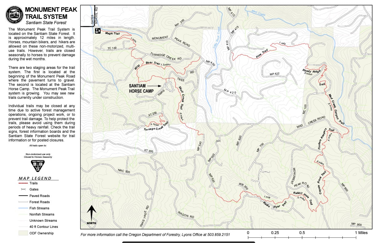
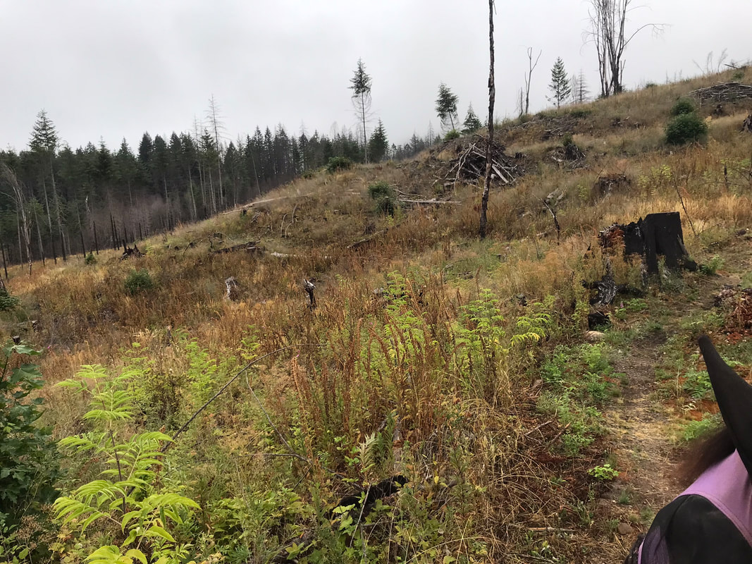
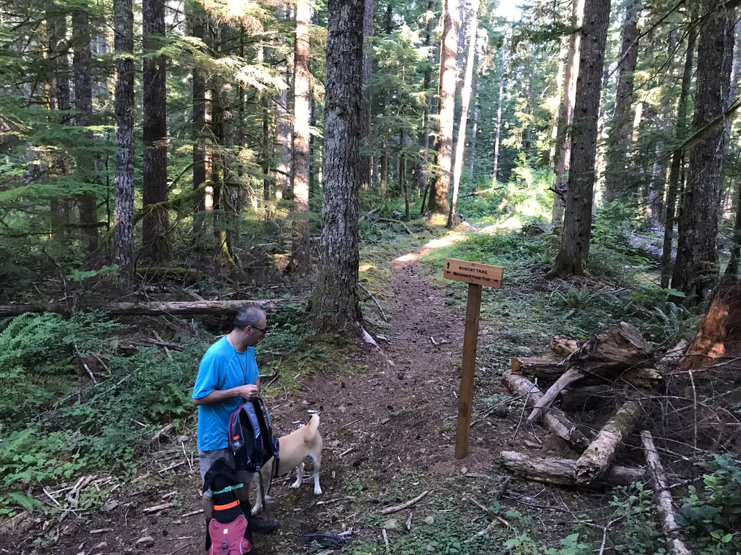
New Trail - Bobcat Trail
The yellow and black striped line is the newer Bobcat trail created by ZoeAnne Farman's boyfriend and maintained mostly by ZoeAnne. Below this is a snip of the file just to show you what it looks like. The newer yellow and black bobcat trail cuts out some of the harder sections of the whole Monument Peak Loop. ZoeAnne is still working on fixing some "Boomer holes" and places where the blackberry bushes need to be trimmed back (August 2022). However, if you ride this trail maybe take some shears and help trim the blackberries a bit without injuring yourself. Sam and I did not ride this trail, we will wait for ZoeAnne and other OET member to sort out the Boomer holes and blackberry bushes.
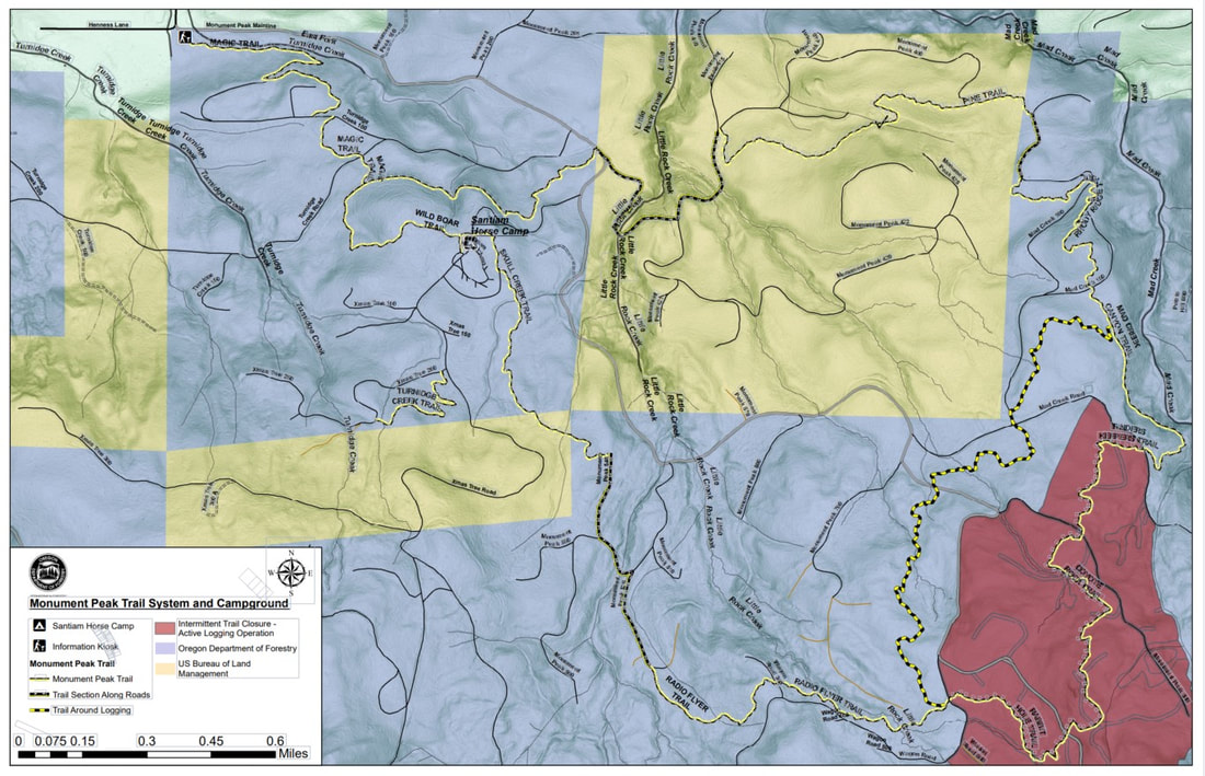
Pine Trail to Mad Creek to Bobcat Trail
|
ZoeAnne shared with me her Gaia Track for the new Bobcat trail!!
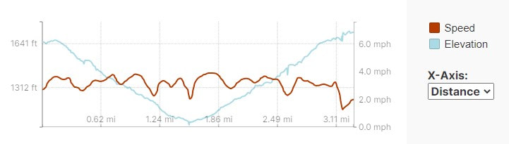
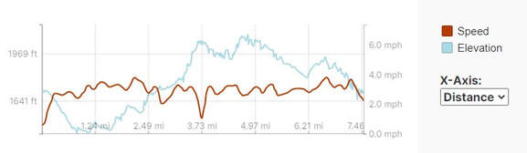
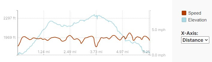
Mileage: 7.6 miles Time Taken: 3 hours Ascent: 1065 feet GPS Track Link and Elevation Profile The fact that she knew how to do this made me super excited! You can download this track and open it on your phone then follow the track to retrace ZoeAnne's route. This route cuts out some of the steeper parts of the entire loop. It also gives you options to just ride the south-east or north-west sections of the loop. All entrances to this trail are very well marked. |
|
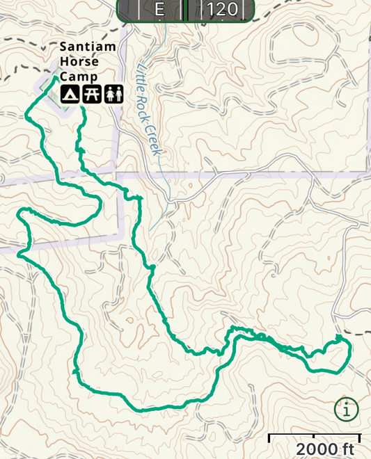
Riding Options
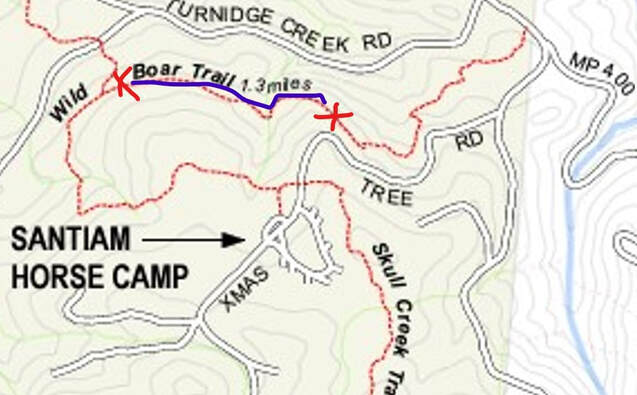
When I was preparing to ride here I was a little disappointed thinking that there was only 1 route to ride, and it was the whole loop. This is totally incorrect! There are many options for shorter loops combining single-tracks and forest roads. One thing to take note is where NOT to ride. Do not ride where the bees are nesting. Below see the two red x's and the blue line between them. I would not ride this section of trail, especially in August! So Sam and I cluelessly walked this section without a problem but we were by ourselves and walking. I saw bees but somehow did not connect the dots that they were dangerous. We got lucky. Sam thought the overhanging cliff to our right was very scary and I dismounted and led him on this section anyways. I got home and ordered Epinepherine and Hydroxyzine for our next trip.
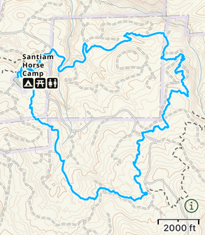
Wild Boar Trail Loop
Mileage: 1.33 miles
Time Taken: 46 minutes
Ascent: 112 feet
GPS Track Link and Elevation Profile
So I was pretty clueless about the bees on this route. This route may be better in the early spring if it is not too wet or slippery. The bees were bad after the junction with the magic trail which you can see on my Gaia map as it crosses the Turnridge Creek Road.
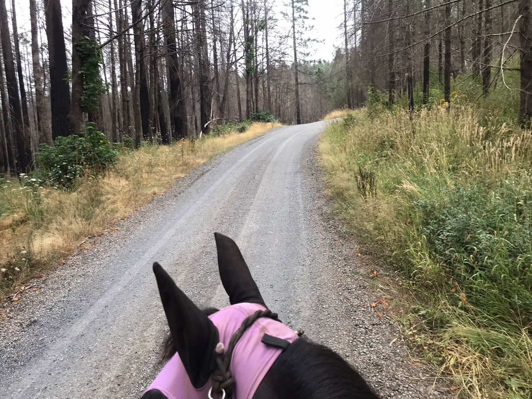
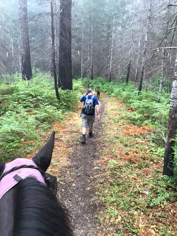
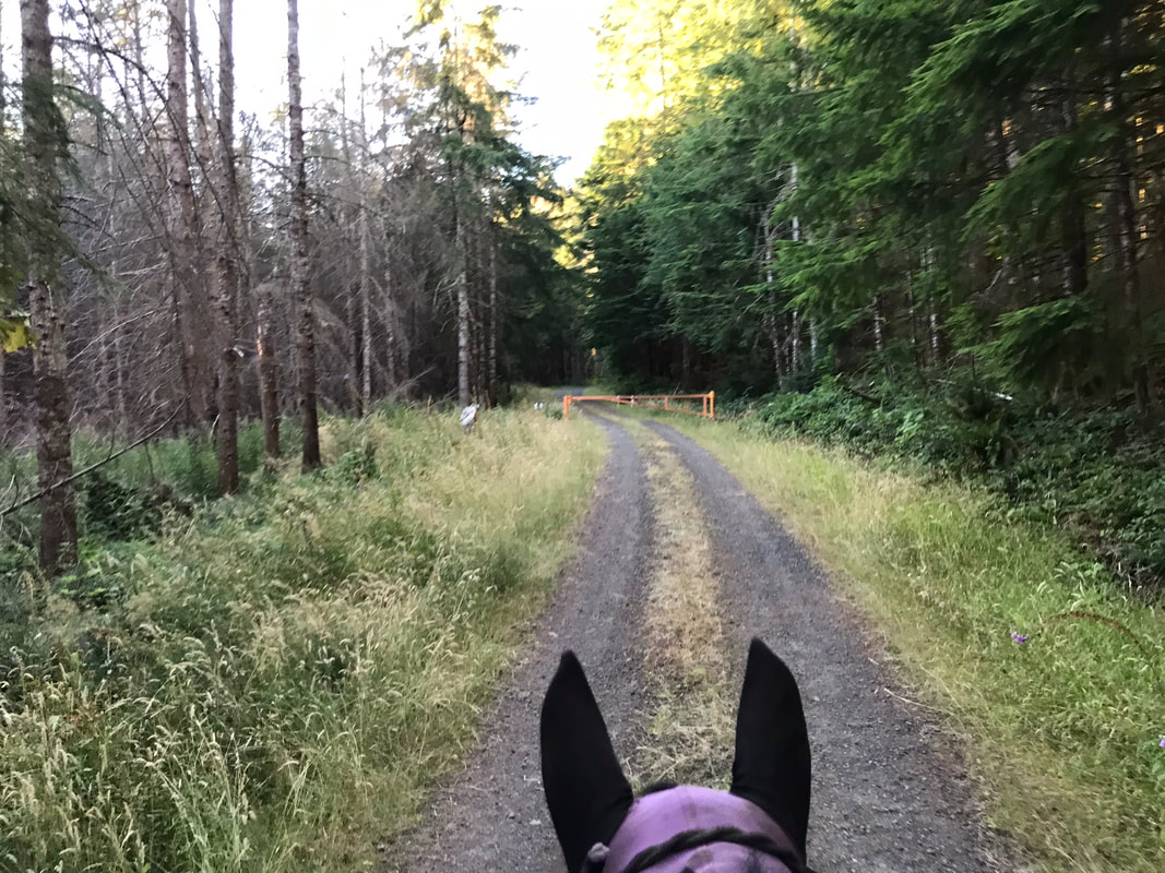
Riding away from camp was pretty gorgeous. We rode around 4pm in late August and the bugs weren't bad until we got back to camp.
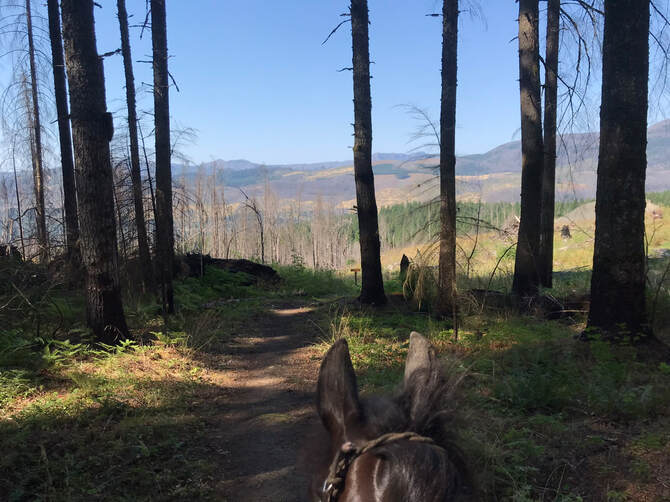
The initial trail going away from camp is pretty steep. I would not want to do this if it was muddy or slick. It was really pretty with switchbacks going down the hillside.
|
|
Just past the fork to the magic trail is where the bees were seen. It was a pretty view. I was looking at the view and not worrying about the bees around our feet. Sam was nervous about the steep cliff to our right and some bark hanging from the trees that was flapping in the wind. I dismounted.
|
|
This area also had bees. Again, I thought that if we didn't disturb them directly that we would be fine. Next we faced a steeper uphill along a cliff so I found a place to get back on.
|
|
I had dismounted to calm Sam and convince him that he was ok with some apples and granola bars. Luckily there was a good incline to stand on to get back on.
|
|
We walked up the main road back to camp.
Horse Camp to Monument Peak Trailhead via Magic Trail
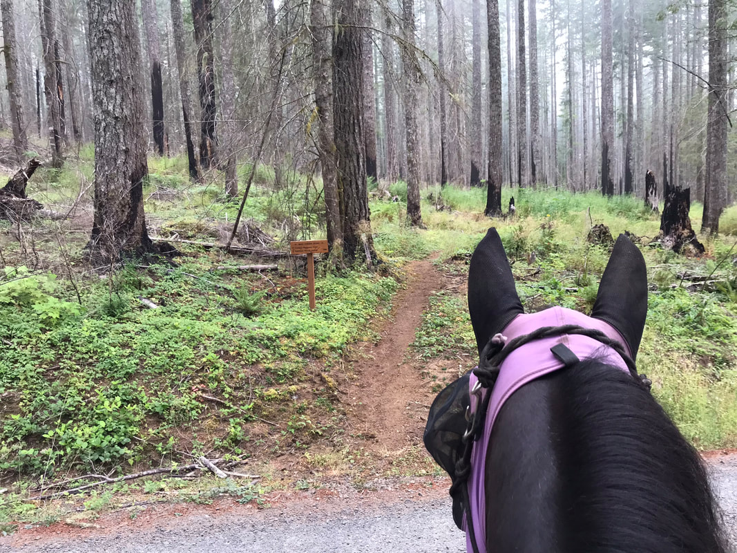
I rode the first short loop described above then started back out again from camp to give Sam some more miles before dark. I thought this route would be short and easy. It was short, but it wasn't easy. The trail had a pretty steep grade downhill from camp and then uphill from Monument Peak Trailhead. I would not want to ride this if it was wet or slick. Sam is a rock-star and we didn't think twice about the grade of the trail. We didn't slide as it was well designed with switchbacks. We crossed gravel roads twice in each direction. We did hear and see motorcycles that were very loud and fast on the gravel roads. These are the only motorized recreational vehicles we saw all weekend but a few apples were called for to convince Sam they were no big deal and associated with yummy goodness. We avoided the bee section of trail by turning left on the Magic Trail before the Bee corner. |
|
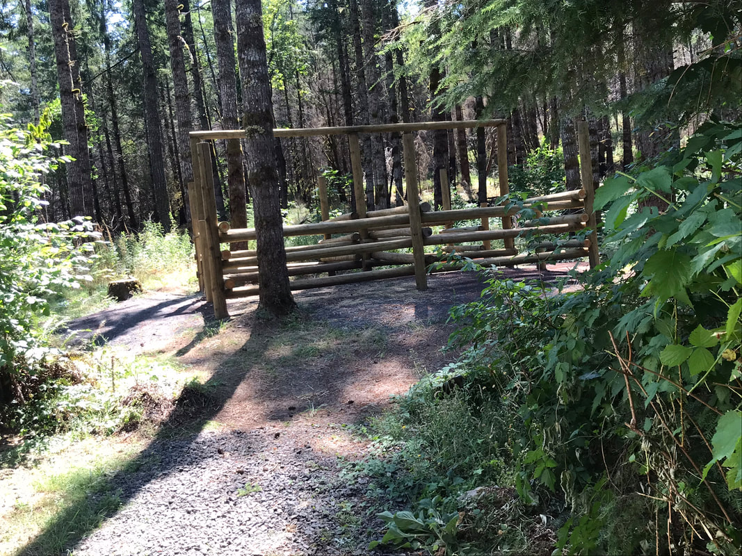
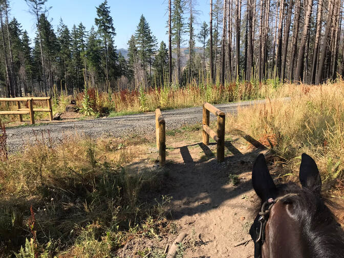
There were partitions to keep motorized vehicles off the trails. Sam and I fit through them but it would have been rough if he was afraid of them. You could go around them as well.
We crossed the gravel roads but listened first for the motorcycles before crossing.
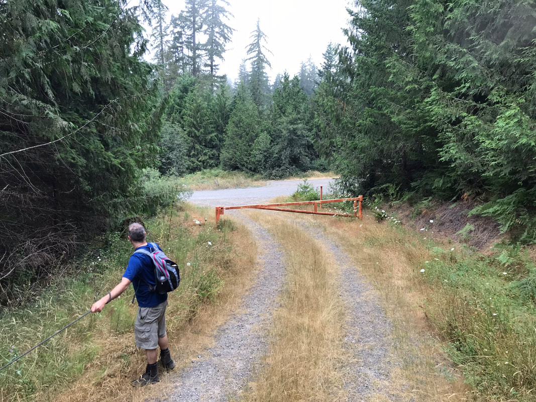
There was a nice picnic table at the trailhead to stand on but no restrooms. Sam and I shared some apples and granola bars and then headed back up to camp, retracing our steps. There was a truck loaded with motorcycles in the trailhead parking lot so we did not linger. You could park a horse trailer here but it would be hard to position for a quick exit if any other cars are in the parking lot. This was not my favorite route due to the motorcycles that we heard on the gravel road. We rode this on a Friday afternoon around 4pm. You might have a better time if you go early in the morning.
|
|
North Loop, Pine Trail to Rhody Ridge to Mad Creek Road
So I wanted to do a loop but not get Sam exhausted. We were able to cut the big loop in half and go back towards camp on Mad Creek Road which was more level than the steep up and downs of the south-east part of the loop.
We rode clock-wise and enjoyed the easier Pine trail but then got some steep switch-backs on Rhody Ridge. We started our ride by walking down the camp road back toward town. This way we avoided "Bee corner" and cut out some mileage which I had already ridden the day before. |

|
The full loop is 10 miles but it is a very up and down 10 miles and should only be attempted if you routinely ride 20 miles without breaking a sweat. This is not us, so we did not want to do this. Underestimate the mileage your horse can do. A shorter happy ride is better than a longer panic or anxiety stricken ride.
You can cut out some of the steep parts of Rhody Ridge by taking the gravel road highlighted in green to the right of the trail instead. We rode early, by 7am and were back by 11am. The flies started to get worse as the day warmed up.
You can cut out some of the steep parts of Rhody Ridge by taking the gravel road highlighted in green to the right of the trail instead. We rode early, by 7am and were back by 11am. The flies started to get worse as the day warmed up.
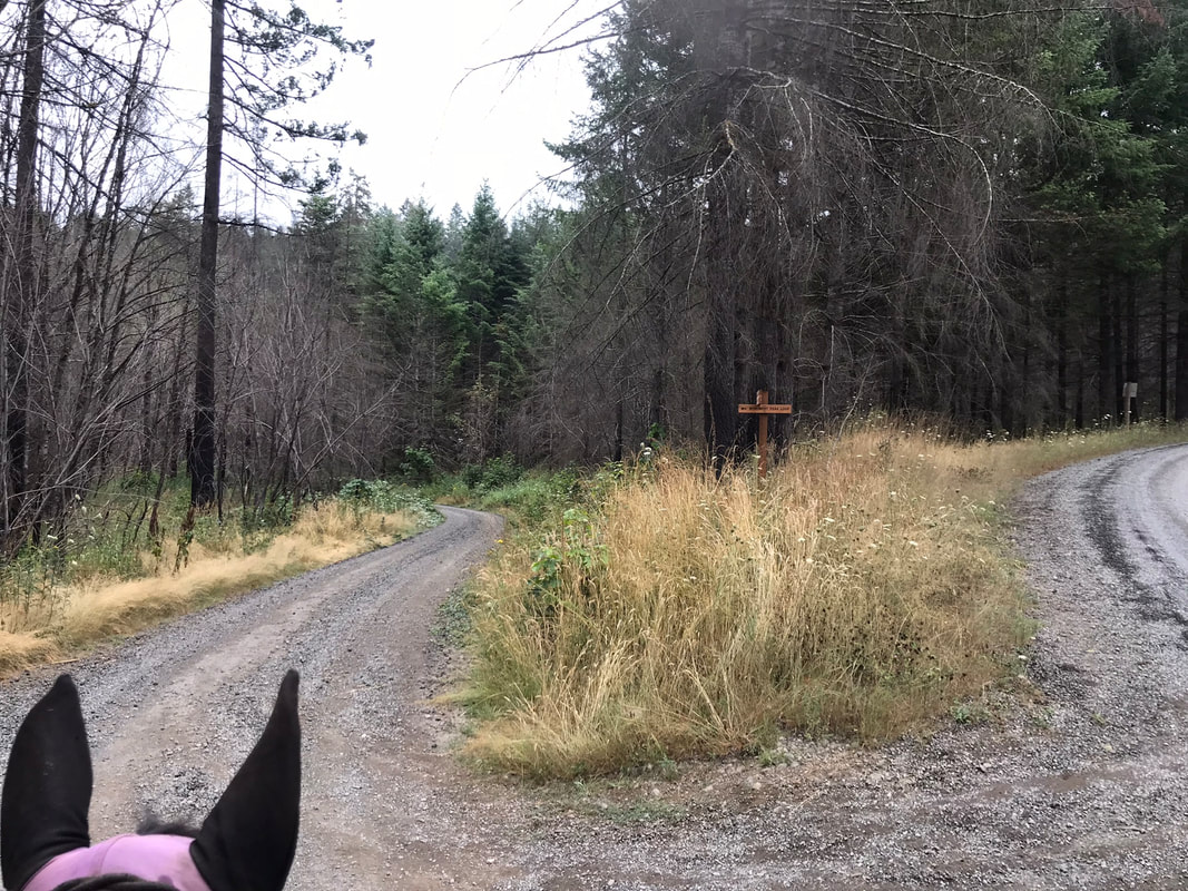
After walking part way down the main camp road we veered off to the left to pick up the trail. We turned right to start downhill at the first fork to avoid the bee area.
|
|
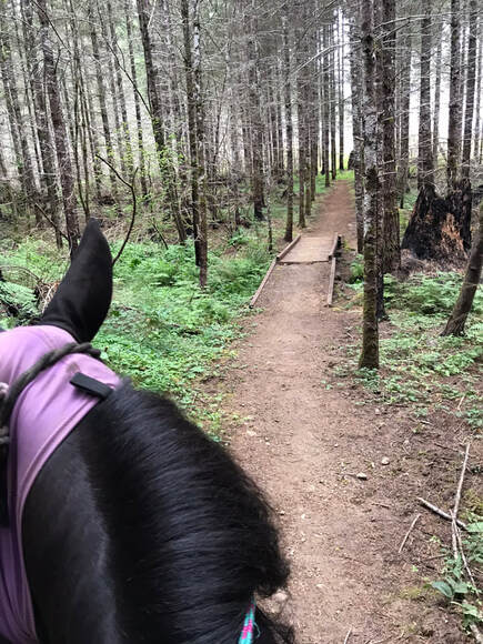
The trail did incorporate some gravel roads. The trail was marked as "Monument Peak Loop" and was well signed.
|
|
|
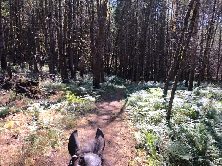
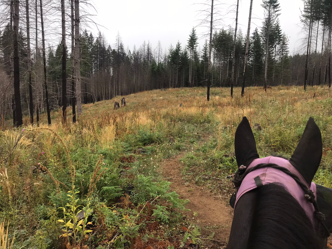
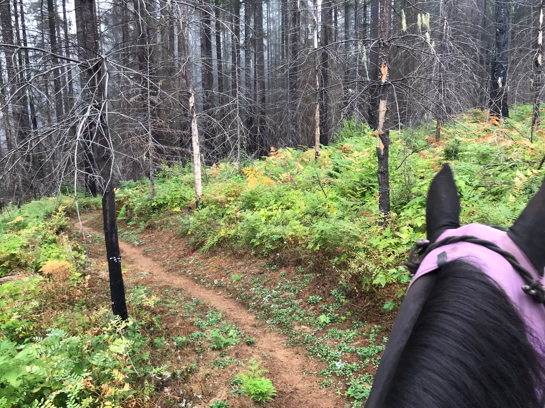
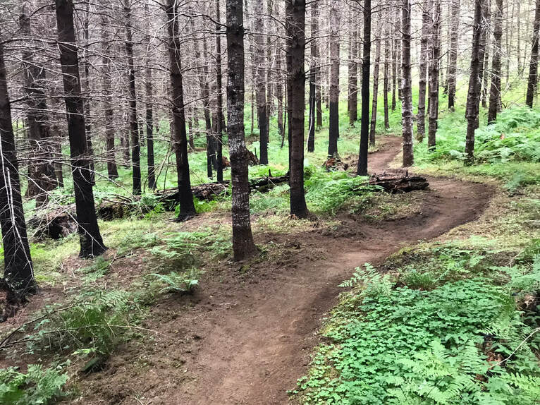
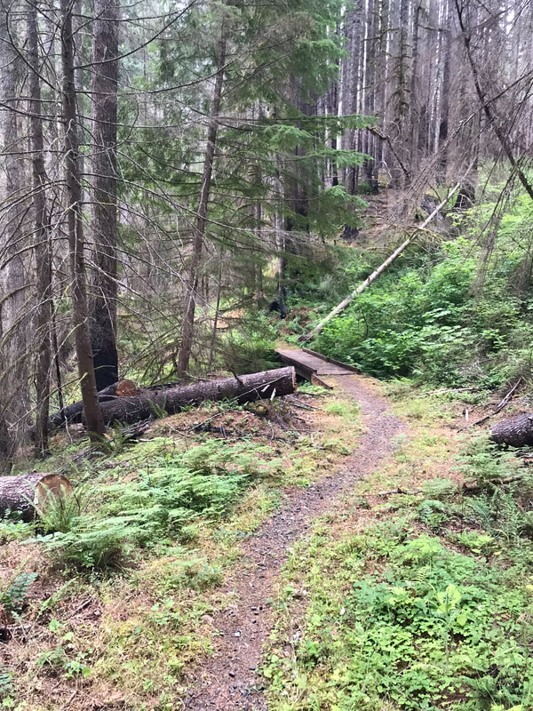
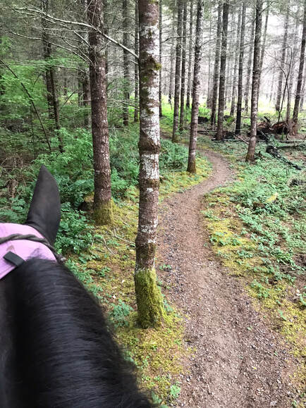
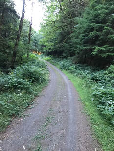
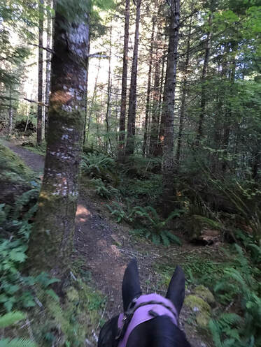
The Pine trail segment was the easiest and had a really pretty windy path through the forest.
|
|
Super lovely trail. We just walked.
The Rhody ridge trail section had some steep switchbacks. These pictures are just before the switchbacks started. On the right you will see a fork for the Bobcat trail. If you take this new trail you will avoid some of the steeper parts of the loop.
|
|
|
If you don't want to do the steeper switchbacks and are ok with riding on a gravel road you can veer off to the right. In the map below it is marked in green. This route will decrease the mileage and the difficulty of this route. It is nice to have options if you or your horse are more tired than expected.
We walked the gravel road back to Skull Creek Trail. The gate is marked on Gaia as a box with a z in it so it was easy to tell where we were. We followed the road to reach the single-track of Skull Creek Trail.
|
|
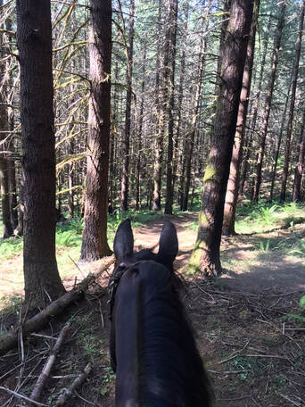
Skull Creek Trail was some nice rolling up and downhills. There was a bridge with no rails to cross right before we hit camp. Sam normally is not a fan of bridges like this but smelling camp he was ready to go home and had no problem crossing it.
|
|
Wagon Road to Radio Flyer
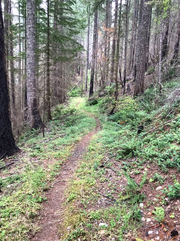
This was the easiest trail of the trails we rode. We rode x-mass tree road from camp and stayed left to get onto Wagon Road. Looking at the GPS track we rode counter-clockwise. The trail junctions were not well marked and the Wagon road sign was knocked over. I was fine because I could see where I was with Gaia. The gravel road was uphill from camp for a nice long 2-3 miles then leveled out as it got closer to Radio Flyer. This would be good if you have a horse that needs to burn off some angst as you start riding. The gravel on the road got rockier a few hundred feet right before Radio Flyer. Sam was wearing boots on all 4 with pads. 5-6 miles is our sweet spot and we got a combination of gravel road and single-track riding
|
|
I was happy to see a gate on x-mas tree road. It is nice knowing you will not see motorcycles or atvs on your ride. We did see 1 local residential car that was going slow.
|
|
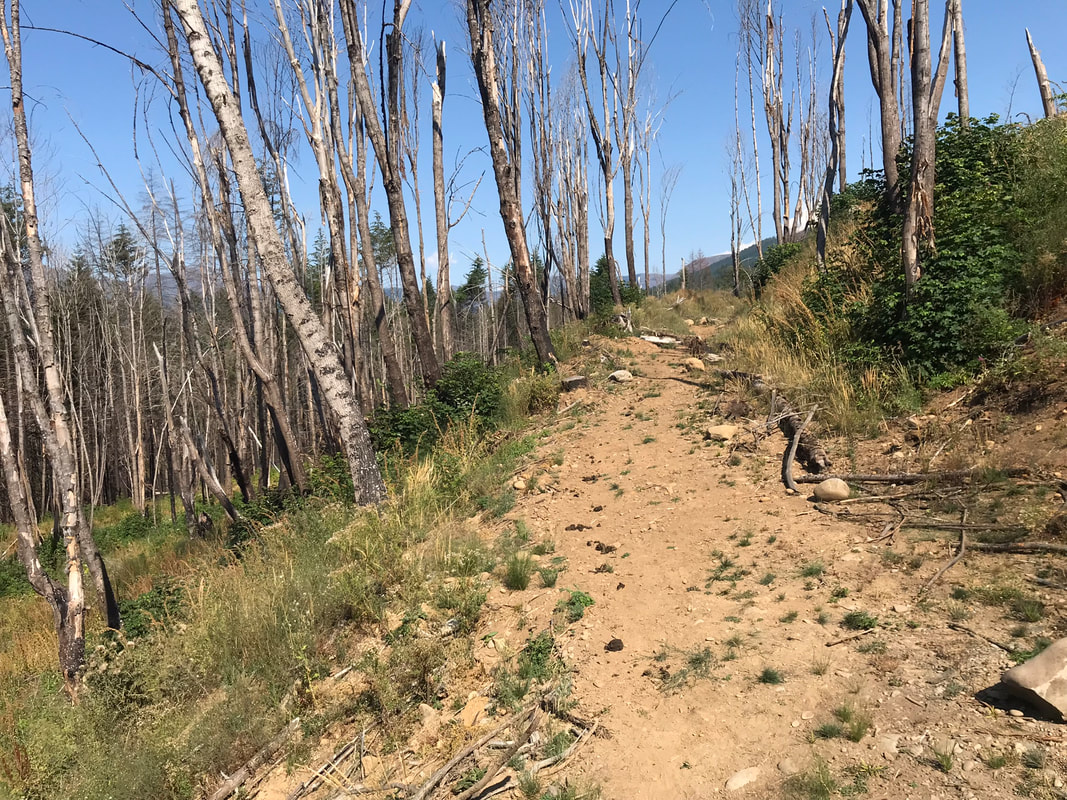
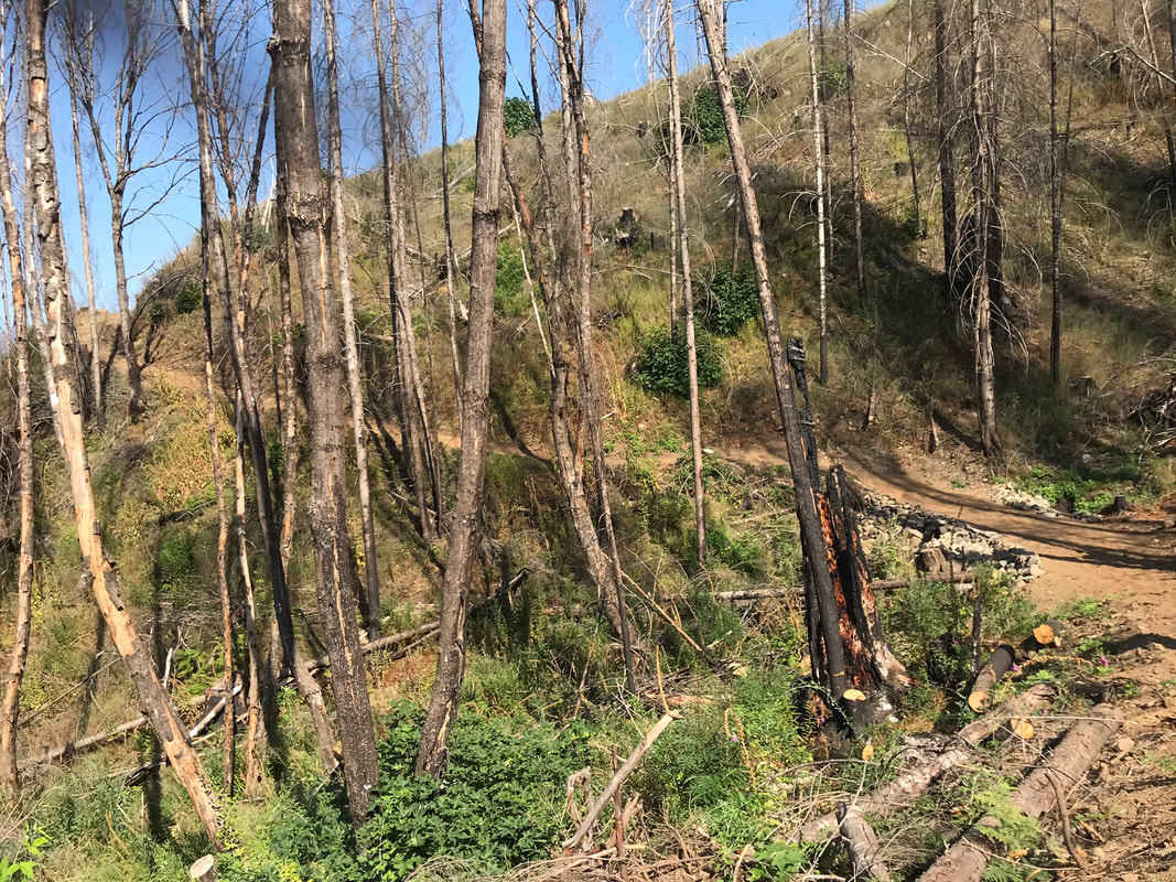
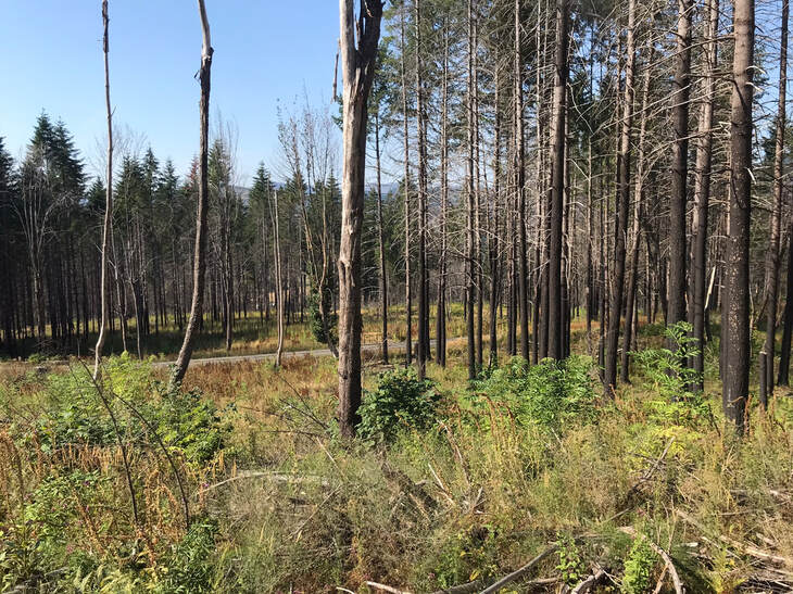
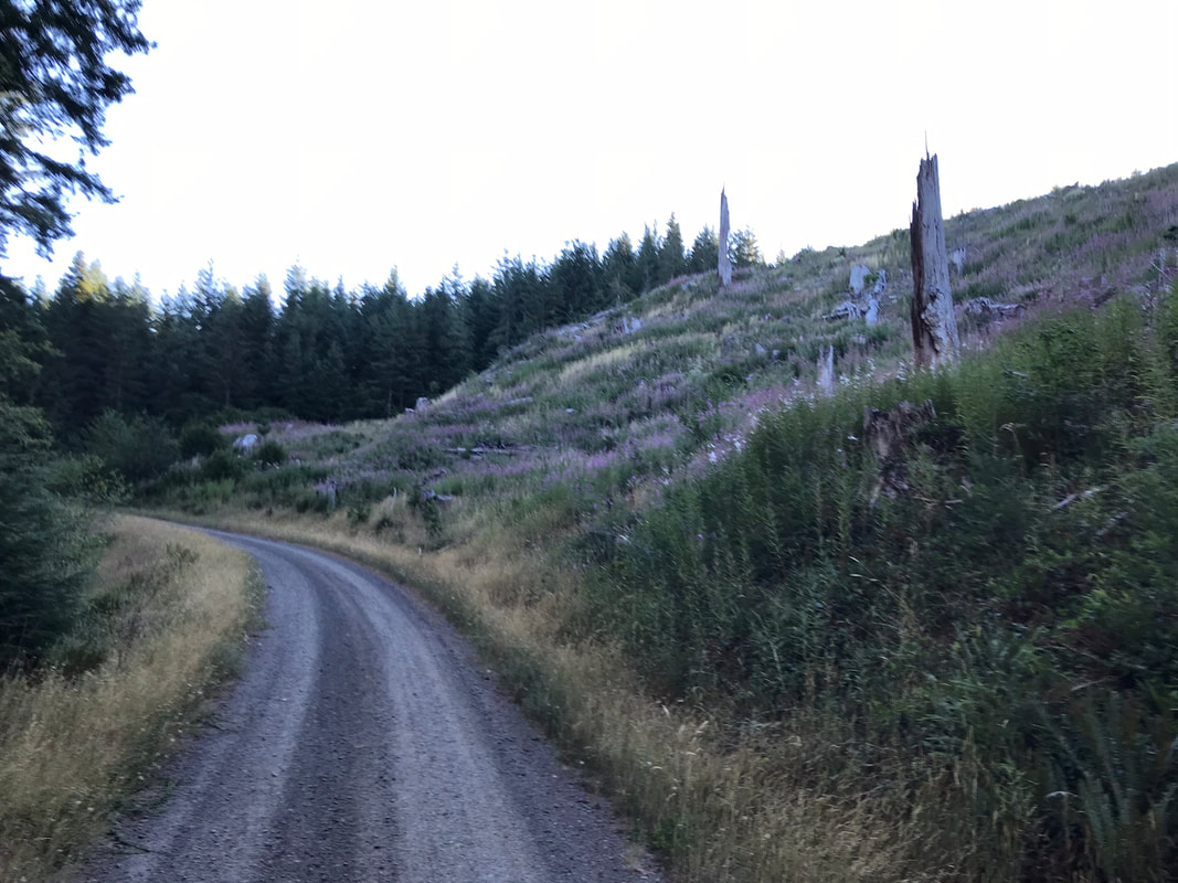
Nice trail to long trot. You can see the effects of the 2020 fire. On the far right is where we are almost to the single-tract trail fork and the gravel was newer and rockier.
|
|
|
Below left is the junction for Radio Flyer Trail. We passed the southern trail marker for the Bobcat Trail.
|
|
Radio flyer to Skull Creek was a nice combination of rolling up and downhills. From there we hooked up with Skull Creek which we had ridden the day before.
Rating
I loved this horse camp! I love having cell phone service! The views were beautiful and the corrals were new and functional. I would not enjoy it if I was towing along children, a green horse or rider, or was responsible for someone else's riding enjoyment. The horse trainer with a free weekend or seasoned trail rider that can handle inclines and rocky footing will have a great time! It is easier riding than Kalama but that is a low bar. All the trails are steep in at least most sections and require a fit horse. Some OET members rode the whole loop during my stay and one rider told me it was the hardest ride her horse has ever done. I heard this remark and I did not want to ride the whole loop with Sam even if he is a freight train. I prefer not to have an exhausted horse in the middle of nowhere. I try to always put my relationship with my horse above any kind of riding goal. There are shorter loops to ride but they are all still steep. This camp is great for endurance riders with fit horses. The forest has changed since the 2020 fire. It is sad to see for the people that loved it the most. I am excited to see what the next decade brings for regrowth.
