Silver Falls Horse Camp
|
Location: 20024 Silver Falls Hwy SE, Sublimity, OR 97385
Facilities: Chemical toilets or porta potty, hot shower in people campsite which is a drive away, bathrooms too far to reach in middle of the night. Camp Site Amenities: Each campsite has a water spigot, picnic table, fire pit and 4 horse corrals. Site Type: Back-ins. Can you see your horse from your gooseneck?: Maybe sites D and E, A and B. Phone Reception: Weak reception with ATT Manure Dump-site: Wheelbarrow available, Water: Spigot available at each site, bring at least a 100 foot hose or longer, the distance from spigot to corral really varied. Footing: Rocky on most trails, boots best, Must Bring: A portable loo or bucket, a very long hose to reach from the spigots to the corrals, at least 100 feet! Website: https://stateparks.oregon.gov/index.cfm?do=park.profile&parkId=151 |
|
Horse Campsites
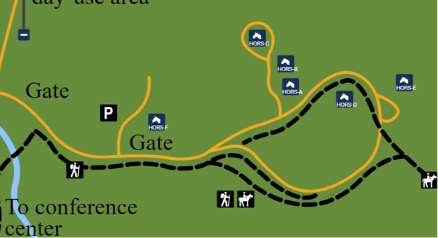
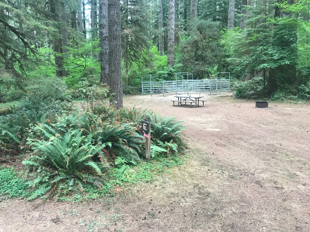
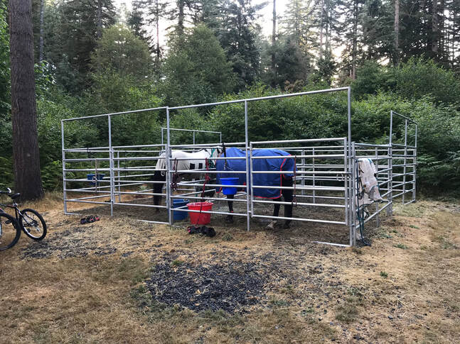
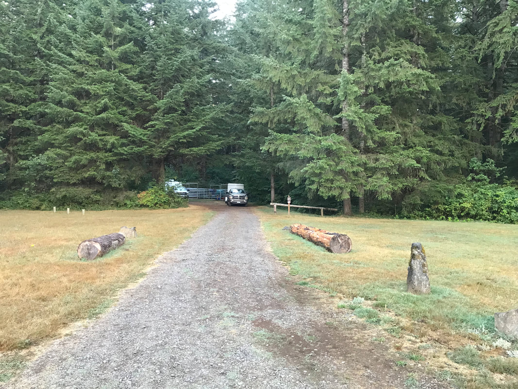
The horse campsites are laid out a little strangely. First, site F is very isolated and is by the day-use area and far from the other sites. I drove the D-E loop and was confused trying to find the group site C. Going from site D around the corner to site A was a tight turn. Sites E and D are across from each other and sites A and B and very close to each other. To reserve site C you can have up to 8 people and at max 3 vehicles. For our trip we had special permission from the rangers to fit more trailers and people in site C. The corrals are wonderful metal corrals with actual gates. These newer corrals are much bigger than the old wooden corrals and are about 12x12 feet per horse.
|
|
Campsite Details
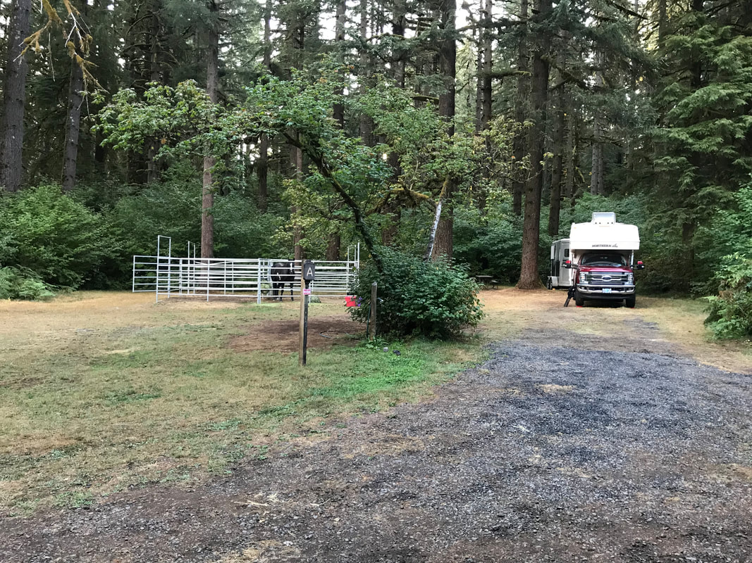
Site A: Back-in, 60 foot driveway, close to B
Site B: Back-in, 60 foot driveway, close to A
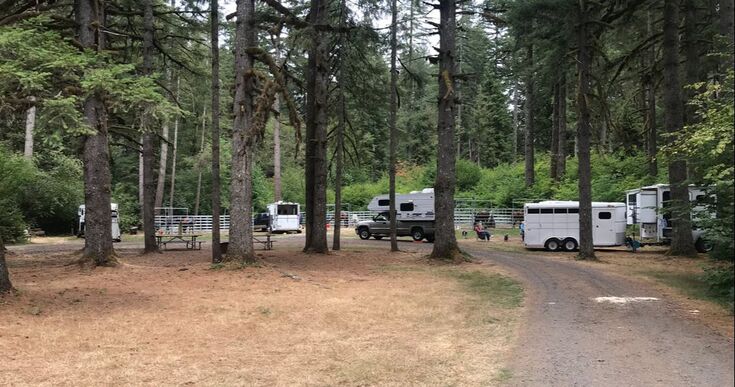
Site C: Group site, 60 foot driveway, we fit 4-5 rigs fairly easily, 3 groups of 4 horse corrals for 12 horses total
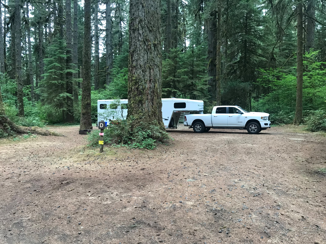
Site D: Back-in, 60 foot driveway, across from E
Site E: Back-in, 60 foot driveway, across from D
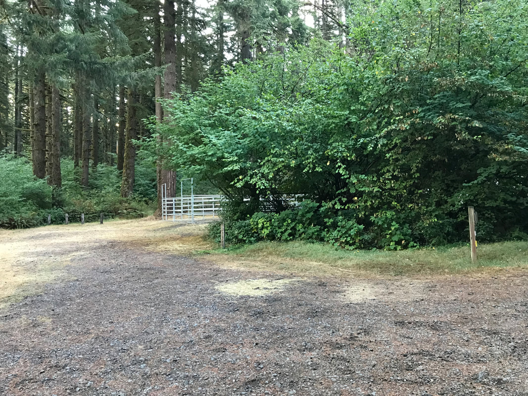
Site F: Back-in, 60 foot driveway, isolated from other horse campsites, access site through day-use area
Site A: Back-in, 60 foot driveway, close to B
Site B: Back-in, 60 foot driveway, close to A
Site C: Group site, 60 foot driveway, we fit 4-5 rigs fairly easily, 3 groups of 4 horse corrals for 12 horses total
Site D: Back-in, 60 foot driveway, across from E
Site E: Back-in, 60 foot driveway, across from D
Site F: Back-in, 60 foot driveway, isolated from other horse campsites, access site through day-use area
Below sites D and E.
|
|
Sites A and B were very nice and close to each other. There was lots of room to back in and all of the corrals were the bigger and newer metal corrals. On the left is site A, right site B.
|
|
Site C was the group site. It consists of 3 groups of 4 horse corrals. They were all the new styled metal corral. There was a loop to drive in and out on.
|
The metal corrals put in by the OET are really nice. There is gravel footing and very little mud.
|
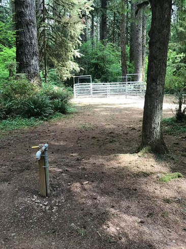
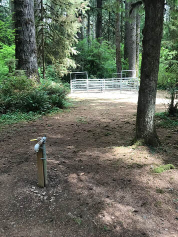
Below is an example of the distance from the spigot to the horse corral. This is why I would bring a hose at least 100 feet long, maybe 150 would be even better. You don't want to go camping just to haul buckets of water to your horse all day long.
|
|
|
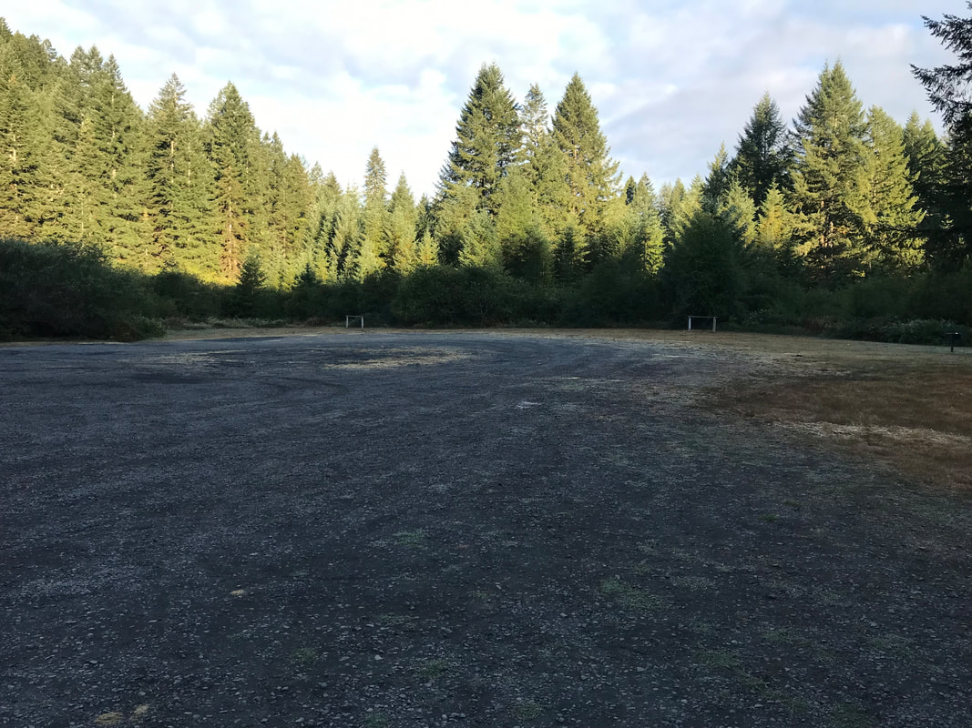
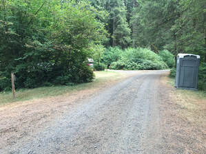
Below is the day use area. You have to drive through the day use area to find the isolated horse site F. Site F is pictured on the right.
|
|
|
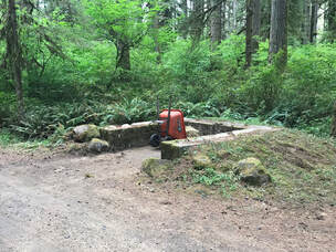
Below an example of the "chemical" toilet and the manure bins. There was a wheelbarrow supplied but bring your own manure fork.
|
|
Riding
Trail conditions update: 3/23/2023, there is work being done on the Buck Mountain Loop and it is closed until May 1st 2023
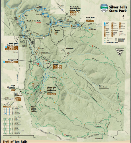
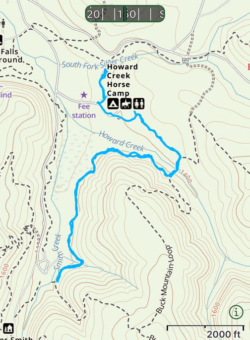
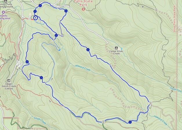
Trail Map Link
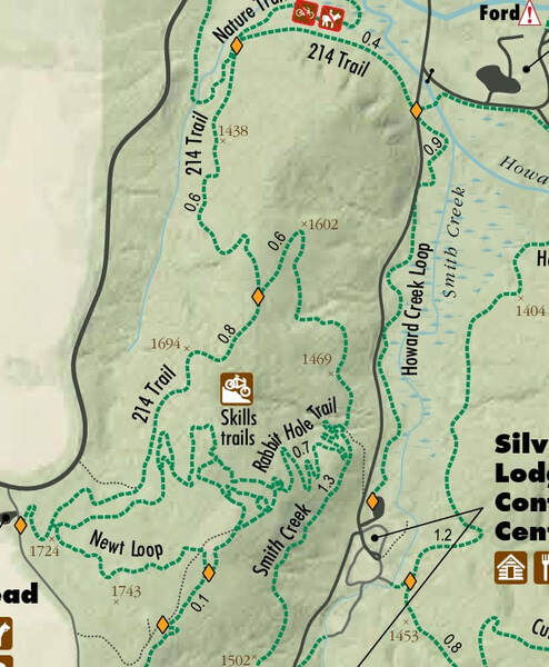
This trail map is really hard to read if you print it to scale. For my eyes I needed to blow it up into two parts and snip them to make a magnified map that I could read and print to take on the trail. Gaia is my go-to but sometimes the official trail map helps you see potential riding loops on a larger scale.
This trail map is really hard to read if you print it to scale. For my eyes I needed to blow it up into two parts and snip them to make a magnified map that I could read and print to take on the trail. Gaia is my go-to but sometimes the official trail map helps you see potential riding loops on a larger scale.

|
|
Horses, bikes and dogs are not allowed on the Trail of Ten Falls so I spend most of my time on the lower half of this map. Horses are not allowed on the Perimeter Trail, the Nature Trail or the Rackett Ridge Connector Trail.
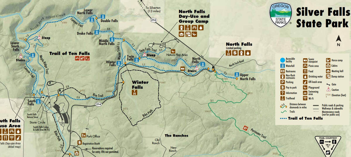
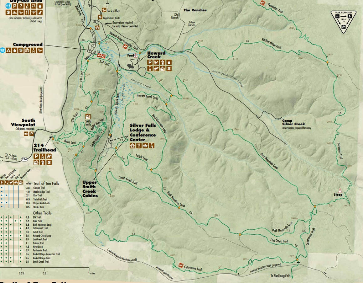
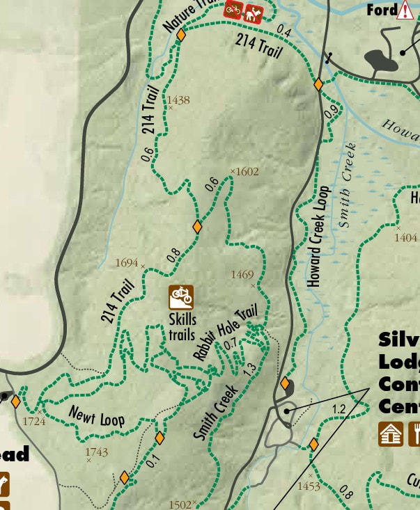
This map is so large it is hard to see the west more complicated loops. Here is a close-up.
Short Rides < 5 miles
Short Arrival Day Loop
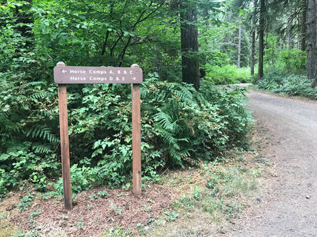
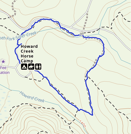
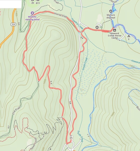
When I arrived I just wanted a short, easy loop I could ride Sam on and pony Bailey. There is a great loop you can take out of group site C or by campsites D and E. Gaia is my go-to map on the trail. I would study the official trail map briefly as some trails do not allow horses.
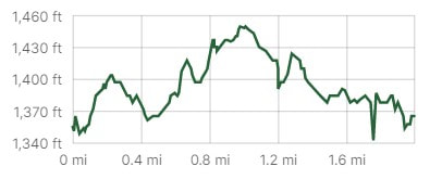
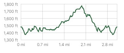
We rode the gps track clock-wise. First we crossed the creek. Next we took the Rackett Ridge Trail. We followed the first right along a service road over a bridge. We connected to the Buck Mountain Loop which led us back to camp. If you start from group site C take all the right forks. If you start from camp sites D and E take all the left forks. It was a total of 2.02 miles, 109 feet ascent and took me 40 minutes on my fast-walking Sam, ponying my old gelding Bailey. |
|
|
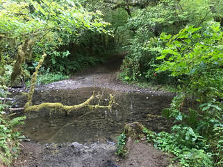
If you ride out of the trail entrance by group horse site C you get to test your horsemanship with a water crossing about 30 feet into the trail. It will test your hoof boots too! I highly recommend all 4 boots or shoes. The service road is pretty rocky, the rest of the trail is soft dirt.
|
|
Howard Creek East Arm Out and Back
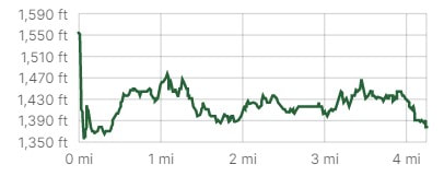
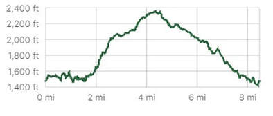
Our last day I also wanted a shorter, less steep ride. My husband rides his bike while I ride Sam so I wanted a flatter route so he could keep up and not work so hard. We rode 4.26 miles in 1.5 hours with Sam walking as fast as he wanted but with me ponying my old horse Bailey behind us as a small handicap to our speed. We picked up the trail across from site E and took all right forks.
It was pretty narrow and overgrown and there were some logs to step over. I ponied Bailey behind us and both horses did great. We reached the Silver Falls Lodge and Conference Center. To make a loop we would have to walk through the conference center trail to pick Howard Creek Loop back up but there was a sign that said no horses were allowed on the connector trail! Apparently there is a bridge that may not be safe for horses to cross. I was happy turning around and retracing our steps because it was such a nice rolling hills trail. It was perfect for my husband with just enough uphill to enjoy the ride downhill on his bike. |
|
Howard Creek Loop Option
|
You can ride the west arm of the Howard Creek Loop and hook up to the 214 trail to ride a loop. If you open the Gaia track you can see the elevation ascents and descents on the 214 loop can be steep. Ride this trail in dry weather!
|
|
During late summer of 2021 there was a tree set up for tree climbing lessons on the west Howard Creek Loop just before a bridge! That would really test your bomb-proof horse to come upon tree-climbers! We didn't see any but I had a heads-up to go slow around this area.
Near the conference center you can cross the road and take a fire road to connect to the 214 trail.
Near the conference center you can cross the road and take a fire road to connect to the 214 trail.
|
|
Rides > 5 miles
Buck Mountain Loop
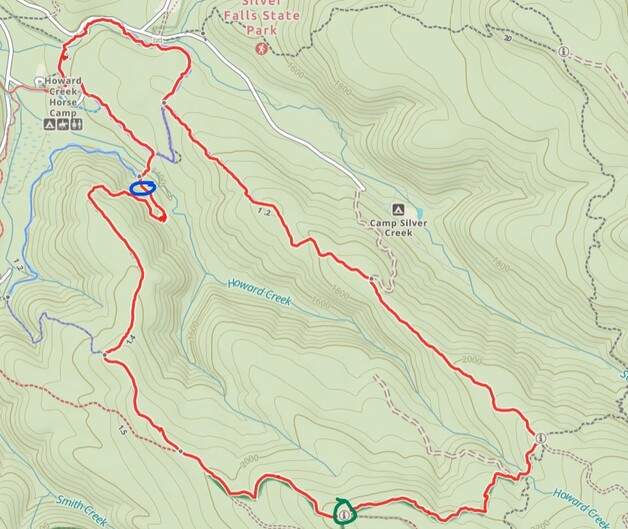
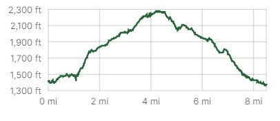
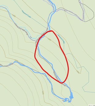
This trail is 8.5 miles and ascends 930 feet. We rode it in 3 hours and 20 minutes but I was really holding Sam back as we were riding with slower horses. This trail starts out the same way as our little loop then you take a left fork to go up the Buck Mountain Trail. We rode this trail starting from D and E then going right then left onto the Buck Mountain Trail. The blue circle on the map is the bog before a steep climb and the green circle is the location of a very nice large log that is easy to use for mounting after lunch.
|
|
|
To the right, in the red circle is a year-round bog. As we crossed Howard Creek we went through a bog and I lost all 4 hoof boots! So of course I ended up dismounting twice on a hill in a bog and then trying to remount my 16 hand Morgan on a slant! You can see the squiggles of my GPS track in blue as I struggled to pick up boots and remount. I was very glad I was not using my usual treeless saddle or else I would not have been able to get back on!
|
|
Howard Creek to Cutoff Trail to Buck Mountain
Zoanne Farmen reports that if you ride a larger loop and take the Howard Creek Loop to the Cutoff Trail that you can avoid the bog. The Cutoff Trail has some really rocky parts but may be preferable to getting stuck in the mud. There is a lot of hill climbing and the footing was rocky in places. At the junction of Lost Creek Trail there is a log to stand on to mount if you give your horse a break. It is steep in places so be careful if it is wet or muddy!
|
|
Perimeter Trail
During my visit in 2021 the Perimeter loop was off-limits to horses. As of today in 2/2023 I was told it is rideable by horse. I would only consider riding this trail if your horse is extremely fit, and you are not afraid of rocky trails or steep drop-offs. I do not recommend riding this trail and the trails I described above are lovely and challenging enough for most riders.
Dogs
Dogs are allowed and our dogs did well at camp. We get them tired in the morning then kennel them in my horse trailer while we bike or horse-back ride. We biked our dogs along the paved entrance road to help burn energy. It was a lot harder biking them along the gravel road to and from the horse camp and I was worried they would hurt or cut their paws.
Rating
The trails were moderately challenging for the average rider. Howard Creek was the easiest route. There are no showers in the horse camp so you would have to drive to another camp site if you want to shower. I dislike having back-in sites because I am such a novice trailer driver. The trails are beautiful if you don't have to play in the bog fishing for hoof boots! For a longer stay I would much rather go to Stub Stewart.
