Sisters Cow Camp Horse Camp
|
Location: Forest Service Rd 15, Sisters, OR 97759
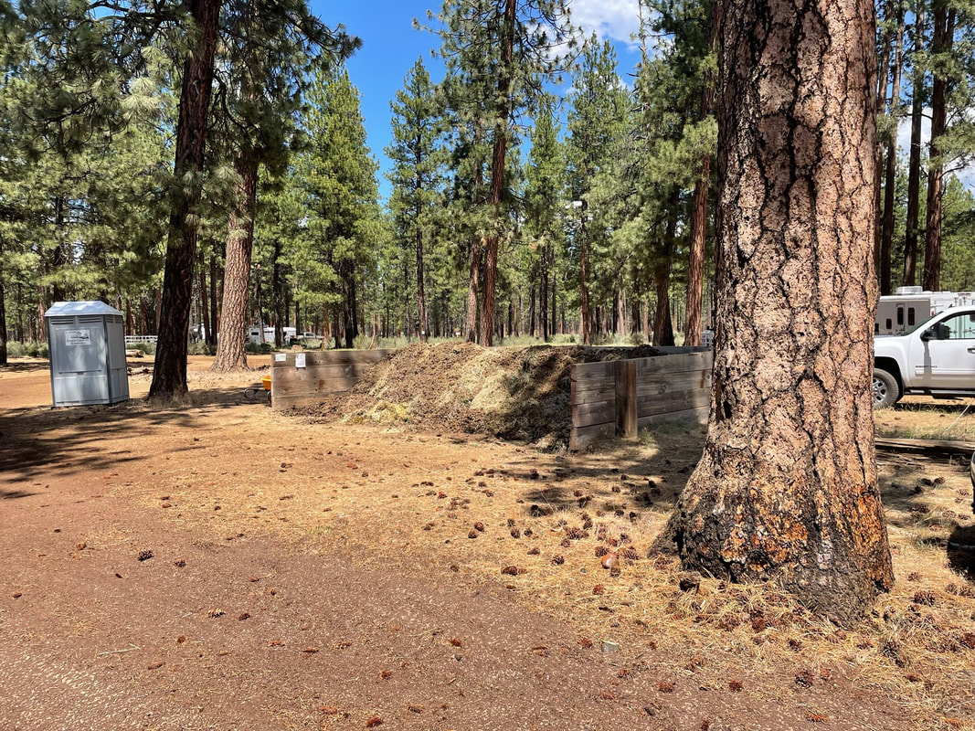
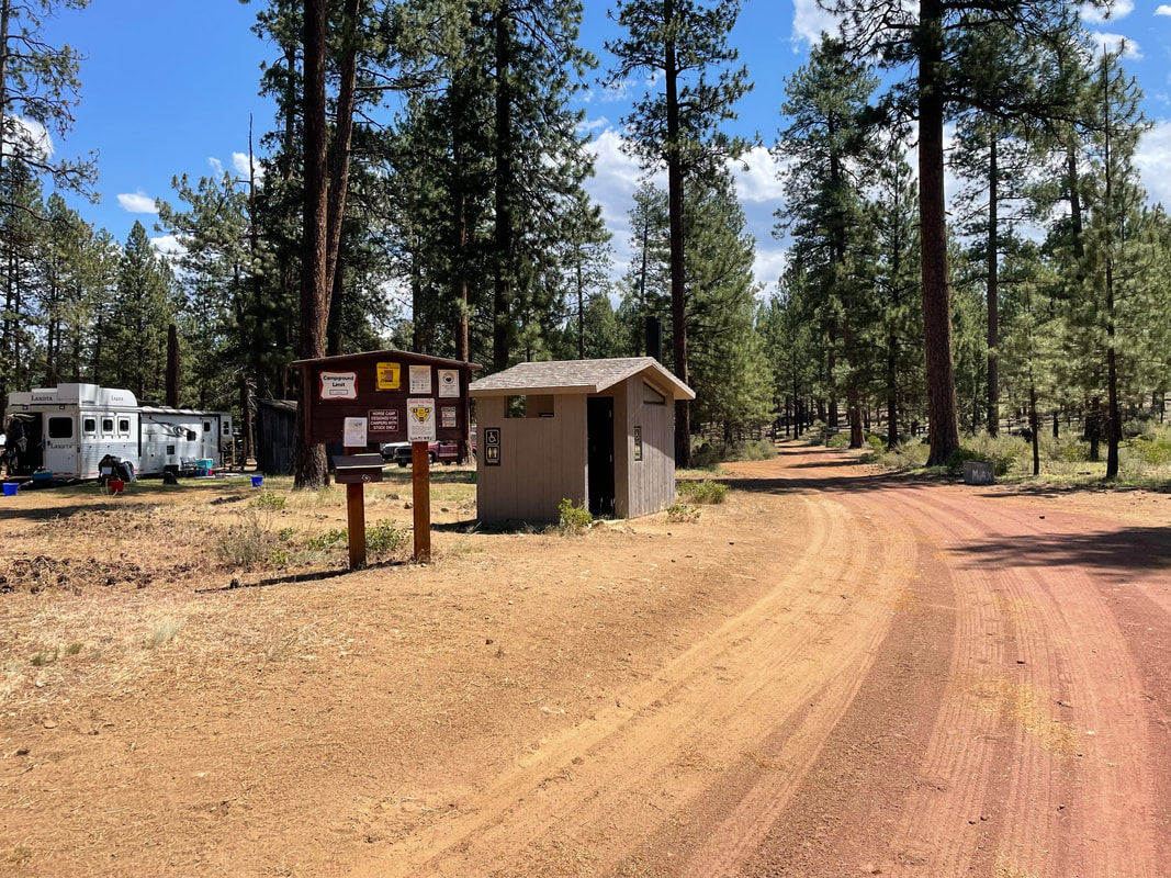
Facilities: Vault toilets, manure pits, fire pits and picnic tables dispersed around camp Camp Site Amenities: 12 central corrals Site Type: No specified campsites, park as you see fit Water: Stock tank in corrals but really dirty water Footing: Rocky, hoof boots recommended Cell Signal: 2 bars ATT Dogs: Dogs allowed Other: Weed-free hay required Website: https://www.fs.usda.gov/recarea/deschutes/recarea/?recid=39240 Reservations: First Come First Serve, No reservations available |

|
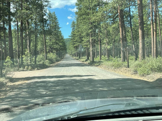
Getting There
There was a gravel road but it was 0.9 miles of gravel road that was in good shape. This was dreamy compared to Whispering Pine or Graham Corral. The drive from Portland was beautiful and easy.
Must Brings
1) Water, horse and human - Or go during an endurance ride where they spoil you by having huge tanks of horse water!
2) Gaia and GPS Tracks downloaded - My ride was marked with flags which also was heavenly. Benefit #2 of endurance rides and eliminates much "getting lost" anxiety.
3) Hoof Protection - The trails here are rocky and technical.
4) Shade - In June it was hot with highs of 80 degrees. You can park so your horse has afternoon shade from your trailer.
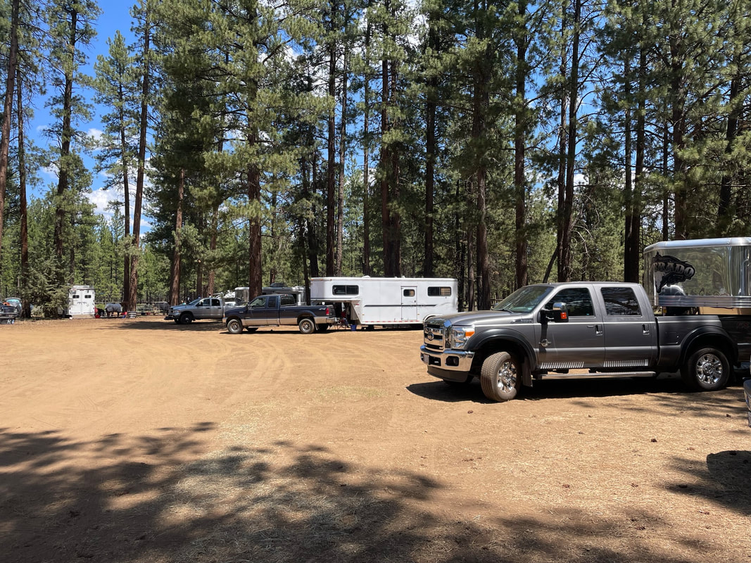
5) Highline or Hie-tie - I would not count on the middle corrals to be unoccupied. Bring your own horse containment. It is not possible to make reservations at this horse camp. At our endurance ride we fit 50 riders in the camp with lots of space between trailers. You will have plenty of room if you bring horse containment.
2) Gaia and GPS Tracks downloaded - My ride was marked with flags which also was heavenly. Benefit #2 of endurance rides and eliminates much "getting lost" anxiety.
3) Hoof Protection - The trails here are rocky and technical.
4) Shade - In June it was hot with highs of 80 degrees. You can park so your horse has afternoon shade from your trailer.
5) Highline or Hie-tie - I would not count on the middle corrals to be unoccupied. Bring your own horse containment. It is not possible to make reservations at this horse camp. At our endurance ride we fit 50 riders in the camp with lots of space between trailers. You will have plenty of room if you bring horse containment.
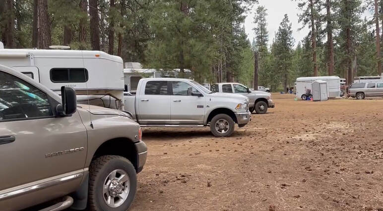
Horse Campsites
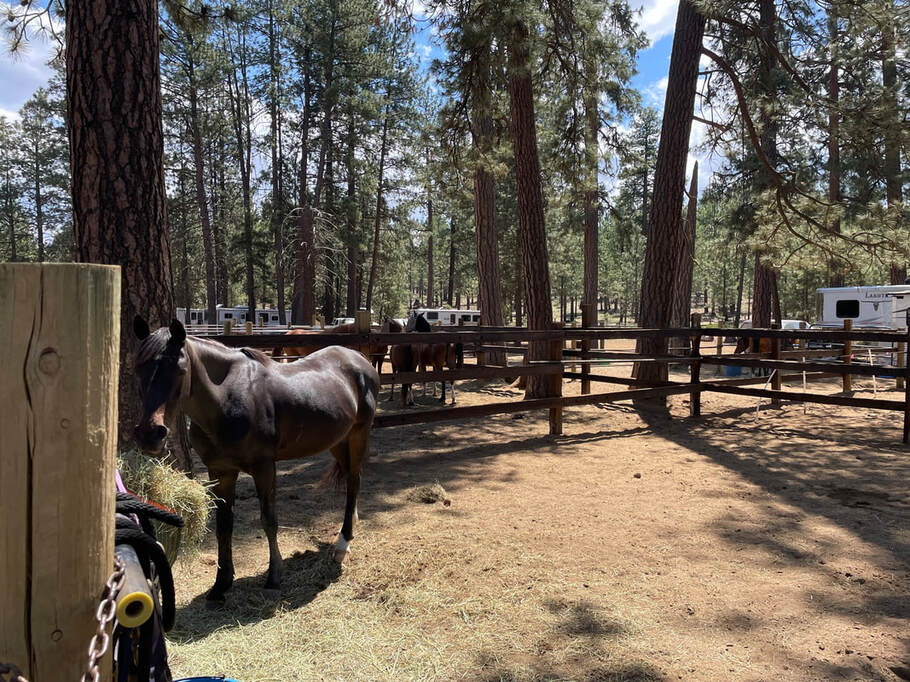
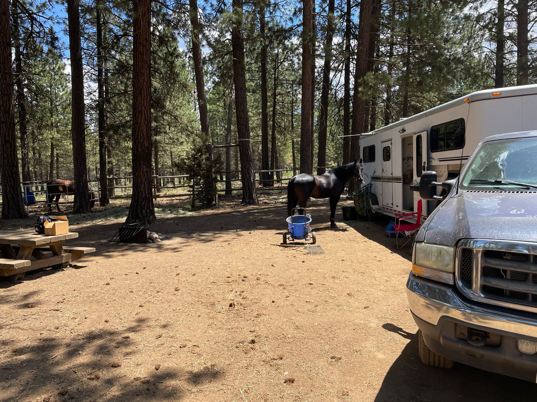
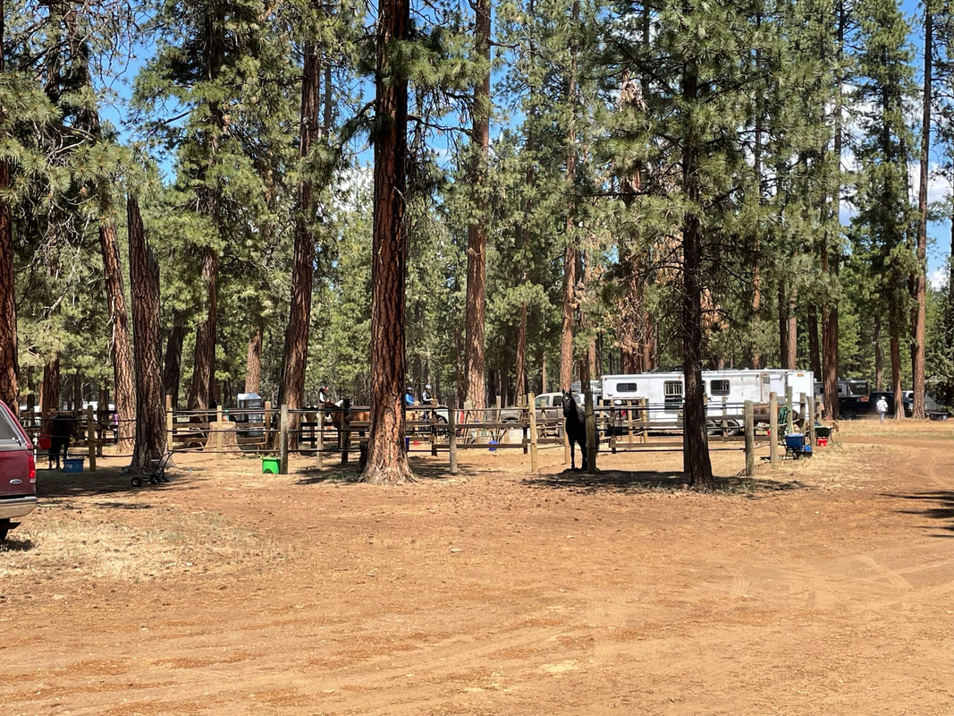
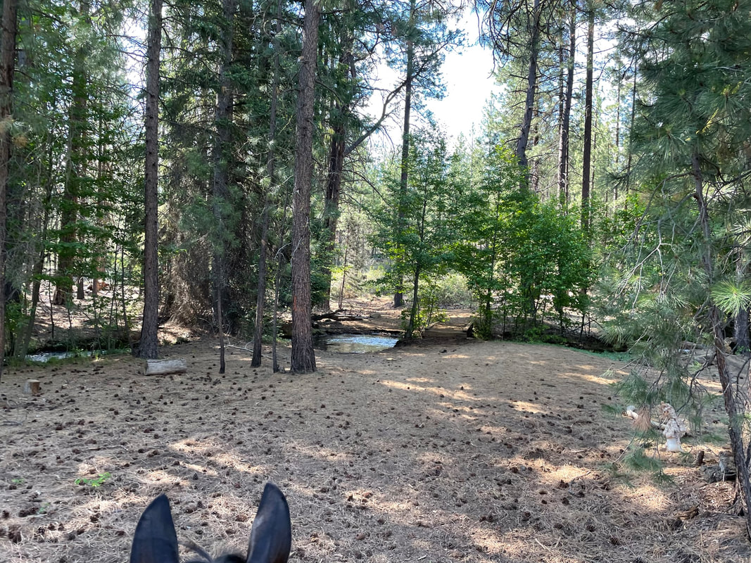
I would use the word camp-site pretty loosely. I visited Sisters Cow Camp during an endurance ride. There are 6 picnic tables that may be associated with good places to park. However, if you bring your own horse containment you can park anywhere. There is one large horse corral in the middle of camp that has been divided up into 12 corrals. The corrals are probably close to 24 x 24 feet and were much larger than the typical 12 x 12 foot corrals. They had wood posts and metal rails.
Middle Corrals Video Link
Middle Corrals Video Link
I would bring your own water, horse and human. There was a stock tank in the corrals but that water was nasty. I would not let my horse drink it.
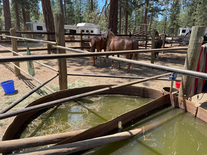
There was a manure bin and a vault toilet.
|
|
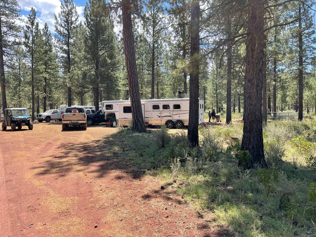
Instead of Campsites there are picnic table areas. I have a hie-tie but I still love having a picnic table to cook and a place to put down gear. If you don't need a picnic table then I am happy for you because you can park wherever you would like! I made up the numbers for the picnic tables and Sam and I were parked at picnic table area one.
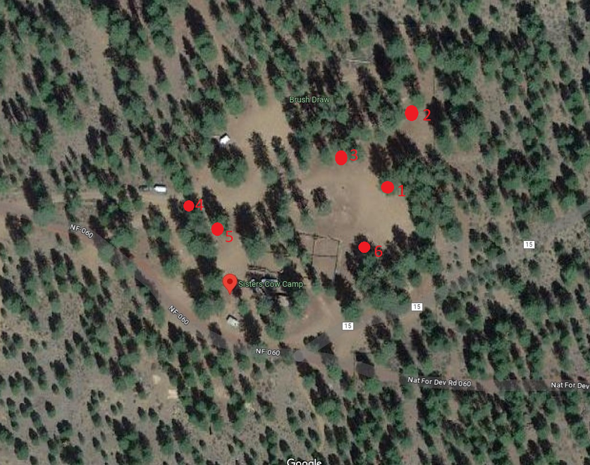
Picnic Table 1 - Lots of room for bigger rigs and to hie-tie
Picnic Table 2 - Nice and shady area
Picnic Table 3 - Could park in sun or shade
Picnic Table 4 - Close to camp road
Picnic Table Area 5 - Close to restroom and middle corral
Picnic Table Area 6 - Close to restroom and middle corral.
Picnic Table 2 - Nice and shady area
Picnic Table 3 - Could park in sun or shade
Picnic Table 4 - Close to camp road
Picnic Table Area 5 - Close to restroom and middle corral
Picnic Table Area 6 - Close to restroom and middle corral.
|
|
Picnic Table Areas 4/5
|
|
Picnic Table Area 6

Riding
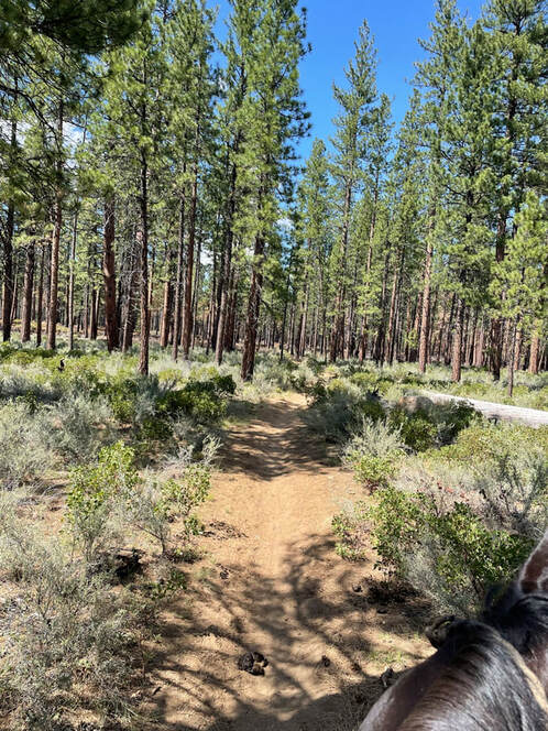
The riding here is difficult. The Met-win trail sounds delightful in theory but it is rocky, dry, dusty and hoof-abrading. If you are prepared for mountain riding you will love it here. Sam and I used to ride in Colorado so we felt right at home with the dry climate and rocky footing. I visited during an endurance ride so I had a lovely trail cleared and flagged for me! The best time to ride the trails is in the early morning before the afternoon heat after an endurance ride to guarantee cleared trails.
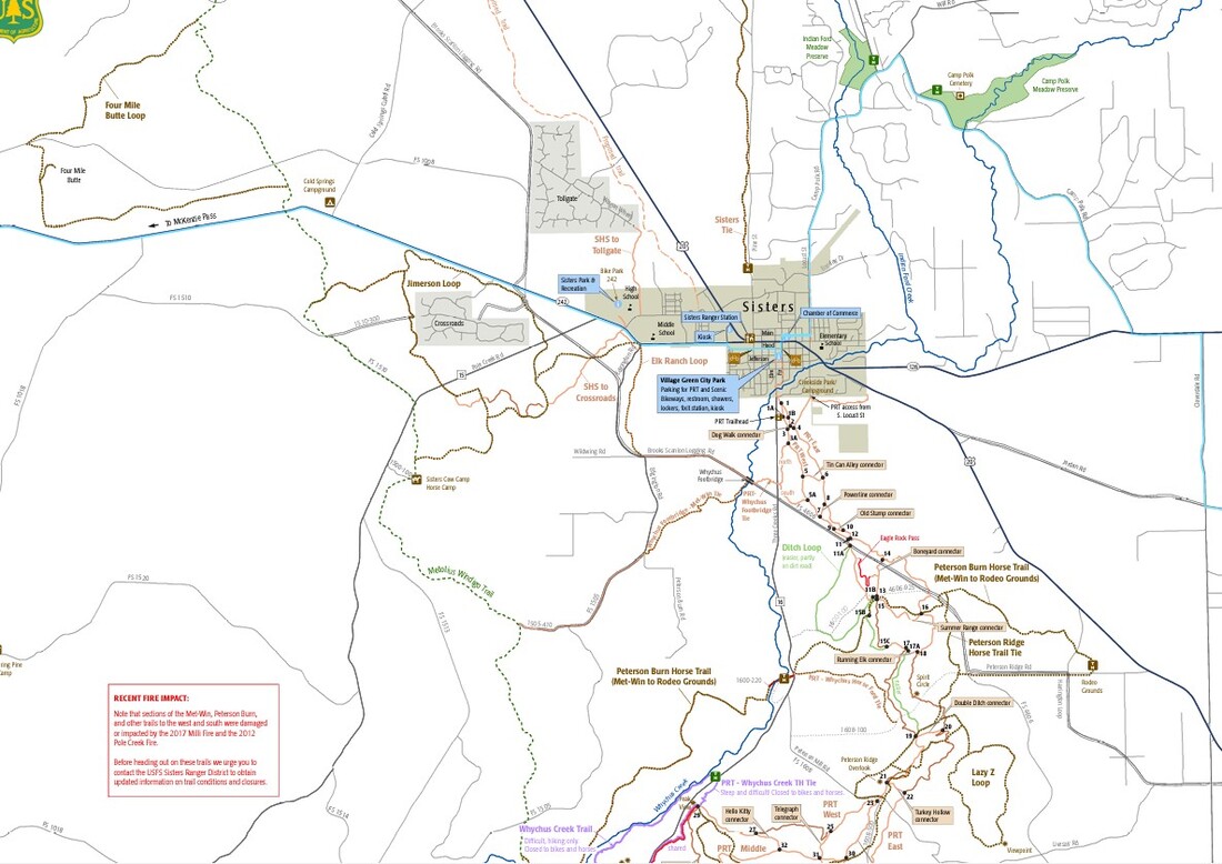
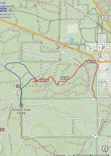
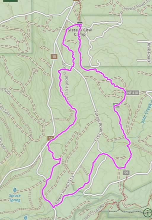
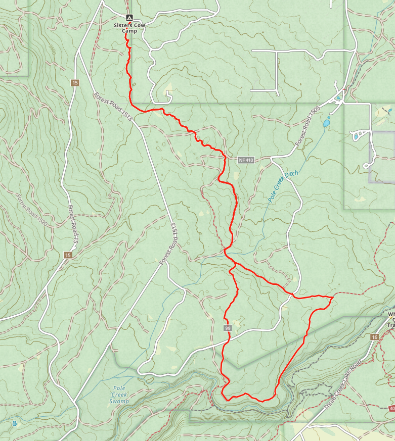
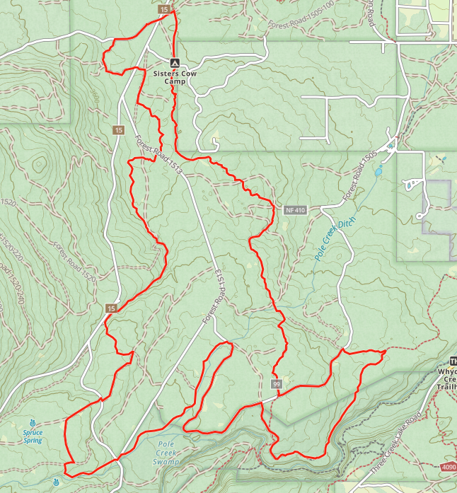
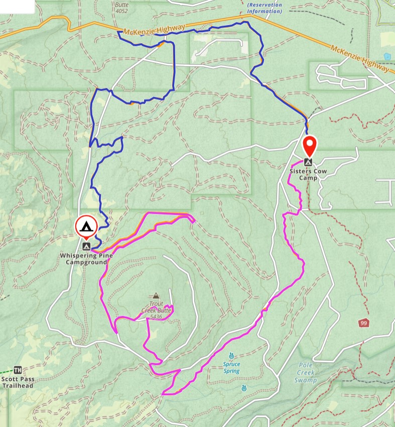
Trail Map
The best way to navigate is by using Gaia or Avenza and following a know GPS route. I have not found any great maps that have all the forest roads. Here is a trail overview map from the town of Sisters.
You have 5 basic trail options.
1) Ride North on Met-Win trail. Easy.
2) Ride South on Met-Win Trail. Difficult.
3) Ride Jimerson Loop. Easy.
4) Ride an Endurance Route to Whispering Pines. Difficult
5) Ride Forest Roads to Whispering Pines. Moderate.
During our visit we rode North and South on the Met-Win and I drove West to Whispering Pines in my Volvo. I do not recommend driving this route!
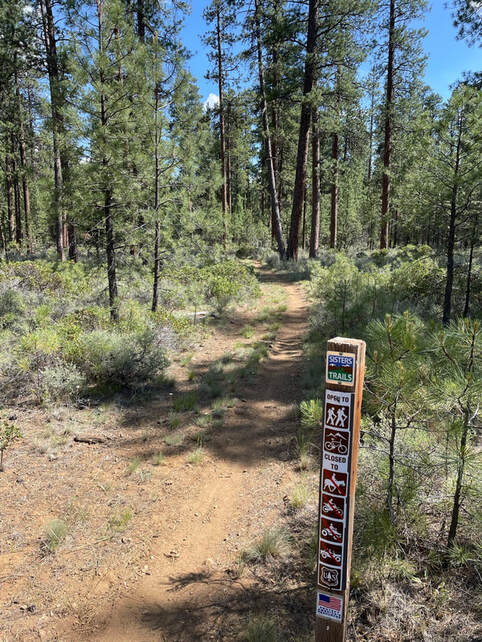
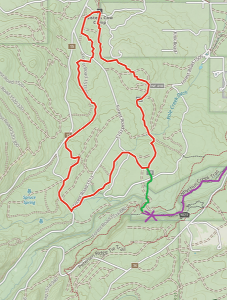
Horse Trail to Sisters
I started out north from camp and did a shorter loop following the Met-Win and some forest roads. The "Horse Trail to Sisters" turn-off is marked by the big x. There was a very official forest service sign very bluntly saying that horses were not allowed on this trail. This was pretty confusing. I may have to go back and investigate this further on foot. Personally, I would not want to ride my horse across 242 but I would ride my bike down to get ice-cream!
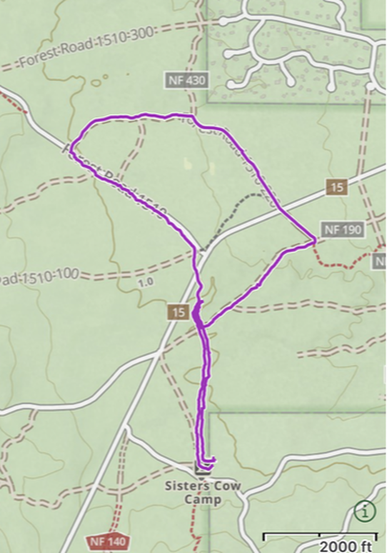
Short Met-Win and Forest Road Loop
Arriving in the afternoon for an event the next day I wanted a short and easy loop to stretch Sam's legs and see the area around the horse camp. I wasn't sure I wanted to do the whole Jimerson loop of 8 miles so we made up our own loop using the met-win and the forest roads.
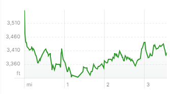
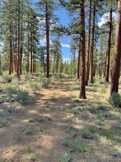
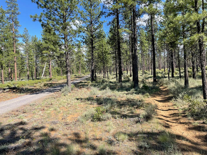
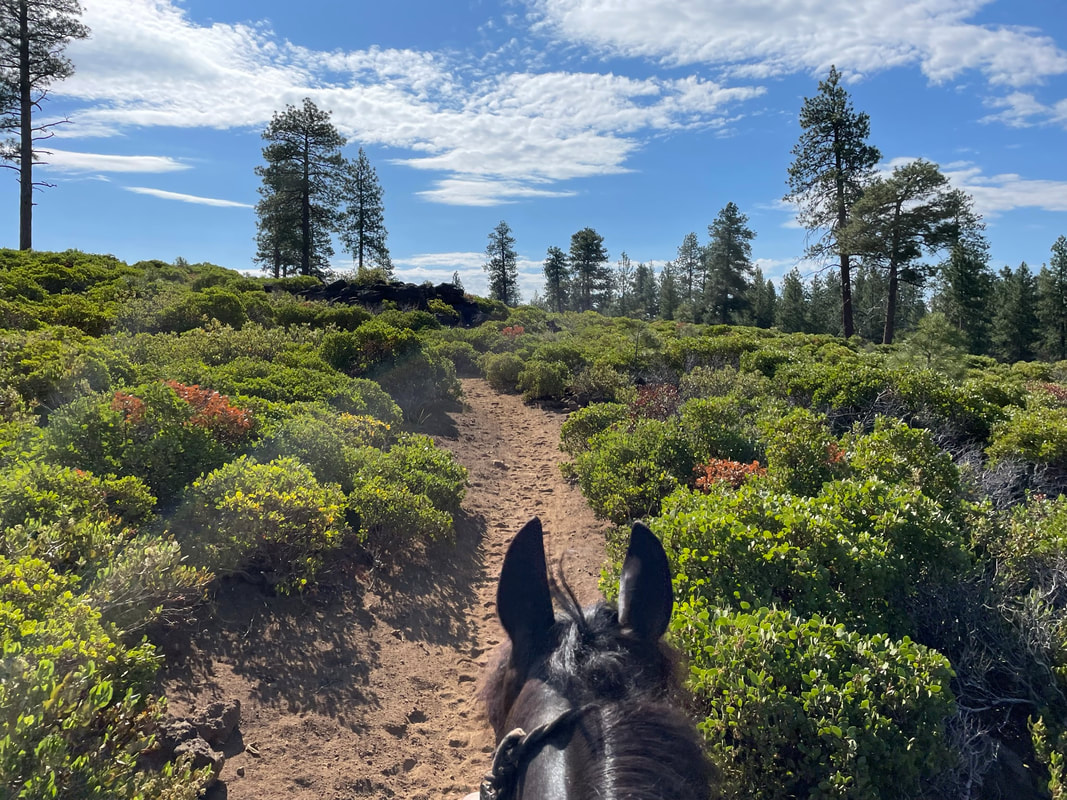
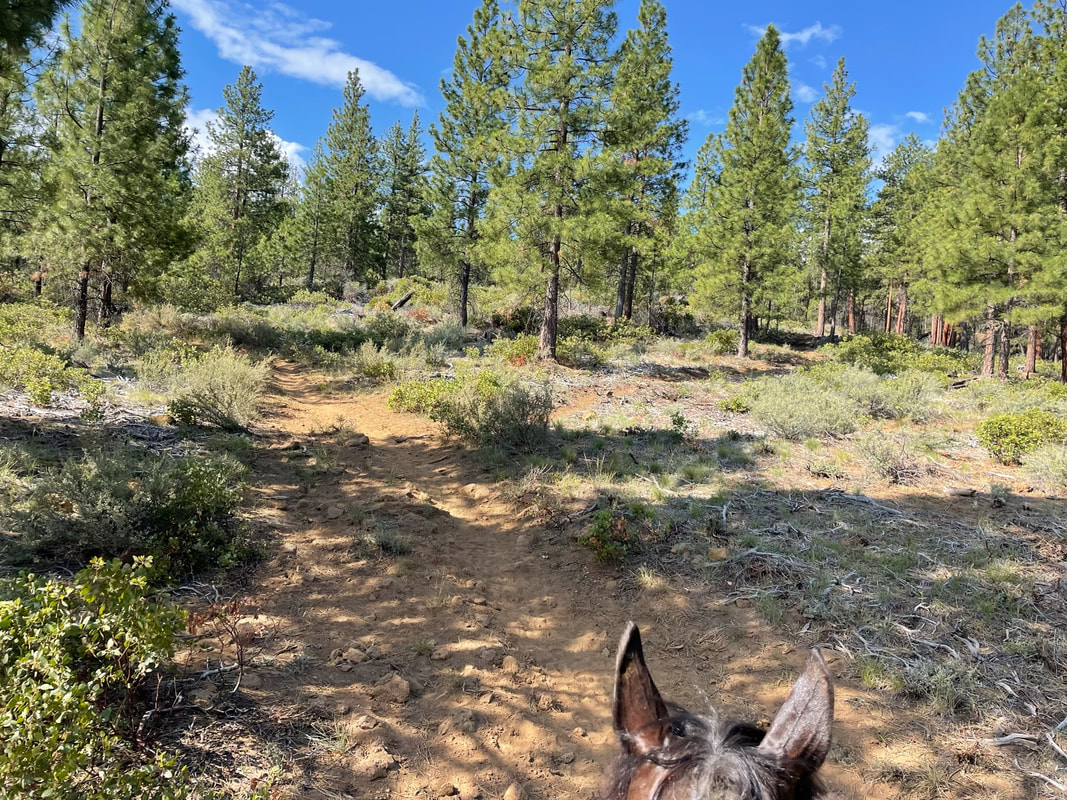
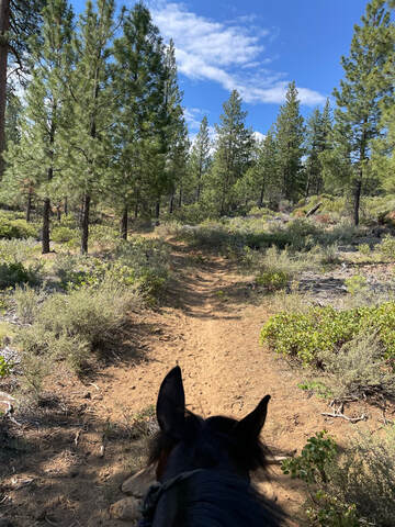
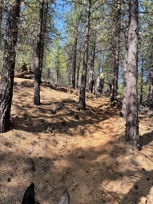
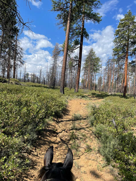
The single-track footing was mostly smooth and the forest roads were mostly dirt and were fine with Sam wearing all 4 boots. We found the "Trail to Sisters" but saw a very plain horse image with an x through it. We took a left instead and looped back to the met win which parallels the forest road 1510. The Met-Win going north from cow camp was a lovely trail with mostly smooth footing and no elevation change. The Met-Win going south from cow camp is a lot more technical. Sam did not want to trot the single-track and you can see a slight rut in the middle of the track that made it harder for him to place his huge hooves in a small line. The endurance riders theoretically trotted these trails but I found them to be just rocky and uneven enough that we needed to stay at a walk. There were trail signs but they were not at every fork so I mostly just wandered around. I would love to have every fork signed but there are a lot of forks with random forest roads! |
|
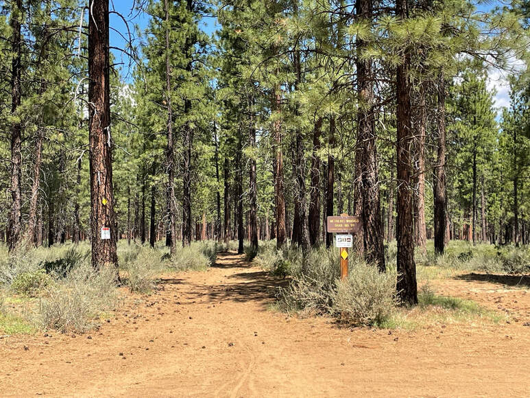
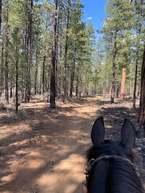
We headed out on the signed trail for the met-win at the north border of cow camp.
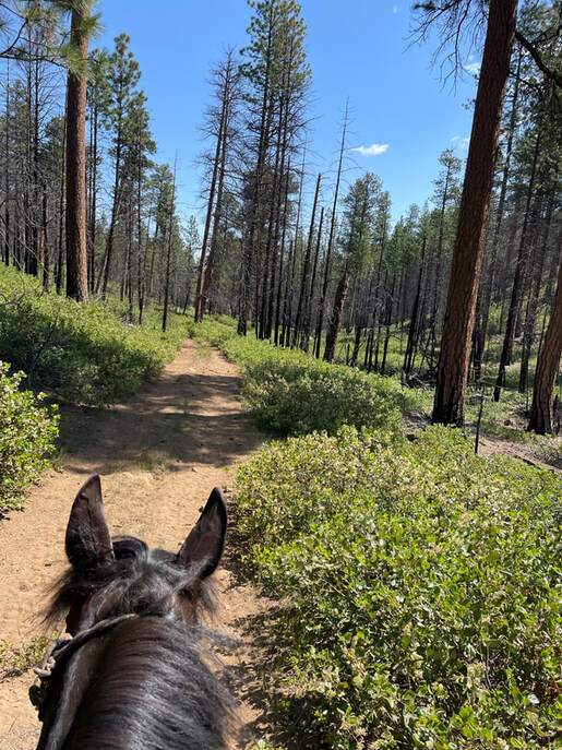
The footing was mostly smooth without a lot of rocks but Sam needed hoof boots.
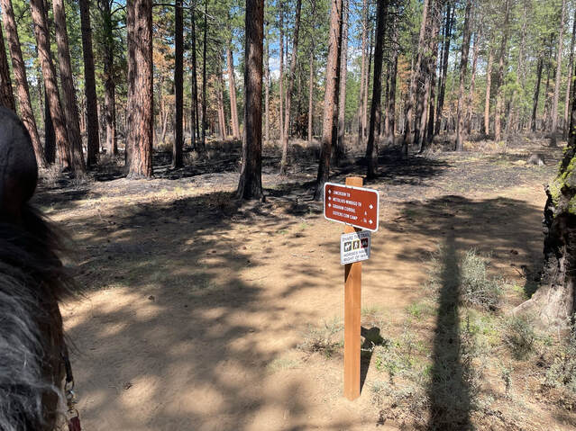
Below is an example of a sign marking the Jimerson trail and the met-win. We tried to follow the Jimerson but not every fork was signed so we got off track and ended up wandering around making our own loop.
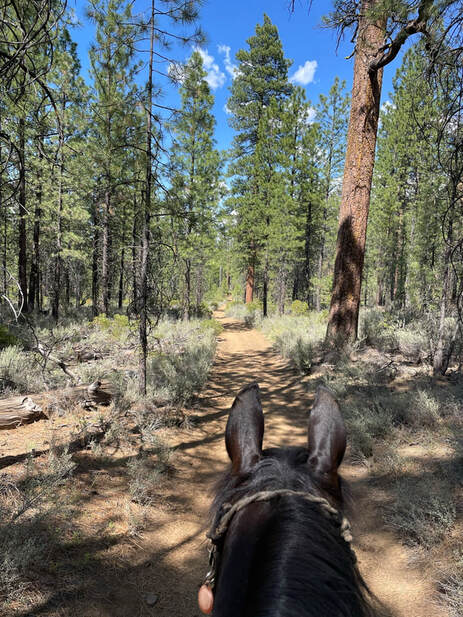
Just a pretty afternoon with temps in the 70s wandering the woods with my horse. We took it easy as Sam gets pretty hot in the warmer temps. Our ideal would be low 50s and early in the morning.
|
|
I was a little surprised to see that horses were not allowed on the Sisters Trail. I had no intention of riding into town and just wanted to check out the single-track. We took a sharp left instead on an unmarked forest road.
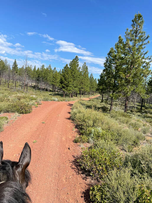
I was very glad we did not have to ride on the gravel 1510 forest road as the met-win ran parallel to the road.
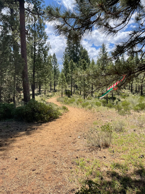
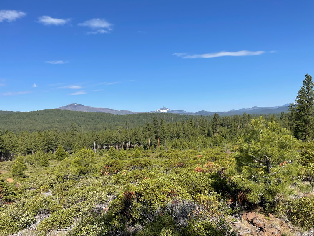
Marquis Loop on Met-Win and Forest roads
At my ride this route was flagged with red and white flags and was known as the Candy Cane Loop. It starts South on the Met-Win trail and follows Pole Creek West then loops North on forest roads. I would call it moderate to difficult because of the elevation change and the rocky trail. I had to walk Sam along most of the trail with brief stretches of trot on smoother single-track. We needed all 4 hoof boots and I could still tell that Sam would have appreciated a pad in his boots due to the stretches of gravel roads and pumice trails. We crossed Pole creek. There was a horse-friendly bridge but it had no sides and we were hot enough to want to stand in the water for a time.
It was a beautiful trail and cleared for the endurance ride. It was well marked with flags, with scant trail signs. I was following a GPS route that I checked if I didn't see a flag for a while. I am glad that we chose to trail ride instead of a competitive longer distance. The scenery was breath-taking and it was nice to have time to take it all in. The trail was extremely dusty starting at 9am in late June. Riding behind another horse was terrible and I had to outpace them in order to breathe. |
|
Entrance to the Met-Win trail heading south from cow camp. The trail leaves camp to the right of the green gate.
The first part of the trail was climbing over rocks. We did this slow and Sam had to pay attention to each step between rocks.
|
|
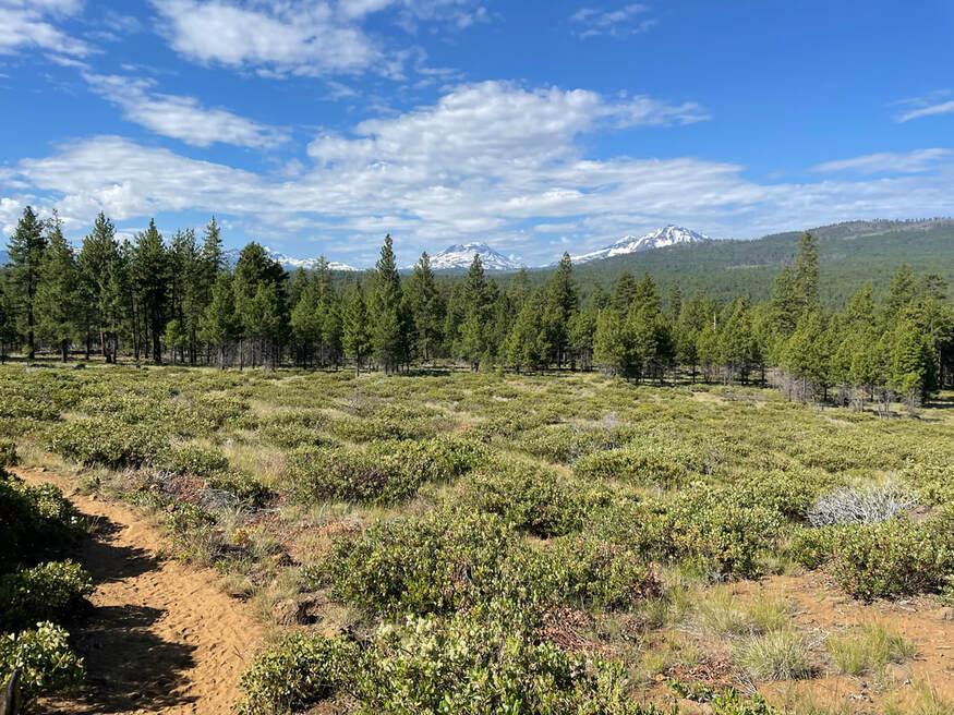
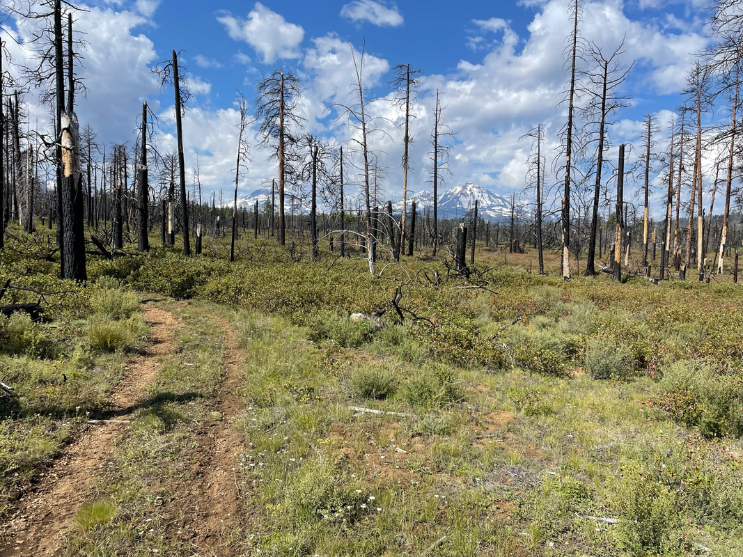
It was a clear day and we could see the mountains.
For the south leg of the loop it was mostly climbing hills. We only had brief stretches to trot as the footing was difficult to navigate.
|
|
We were both excited to cross Pole Creek and to stand in the creek for a while taking a break.
|
|
The rockiest part of the trail was just after crossing Pole Creek. I felt like we were back in the Colorado mountains! It was a steep incline and of course I gave Sam his head and rode fidgeting with my phone. The forest road looked like a tempting place to gallop but the pumice was tough on hooves so we walked.
|
|
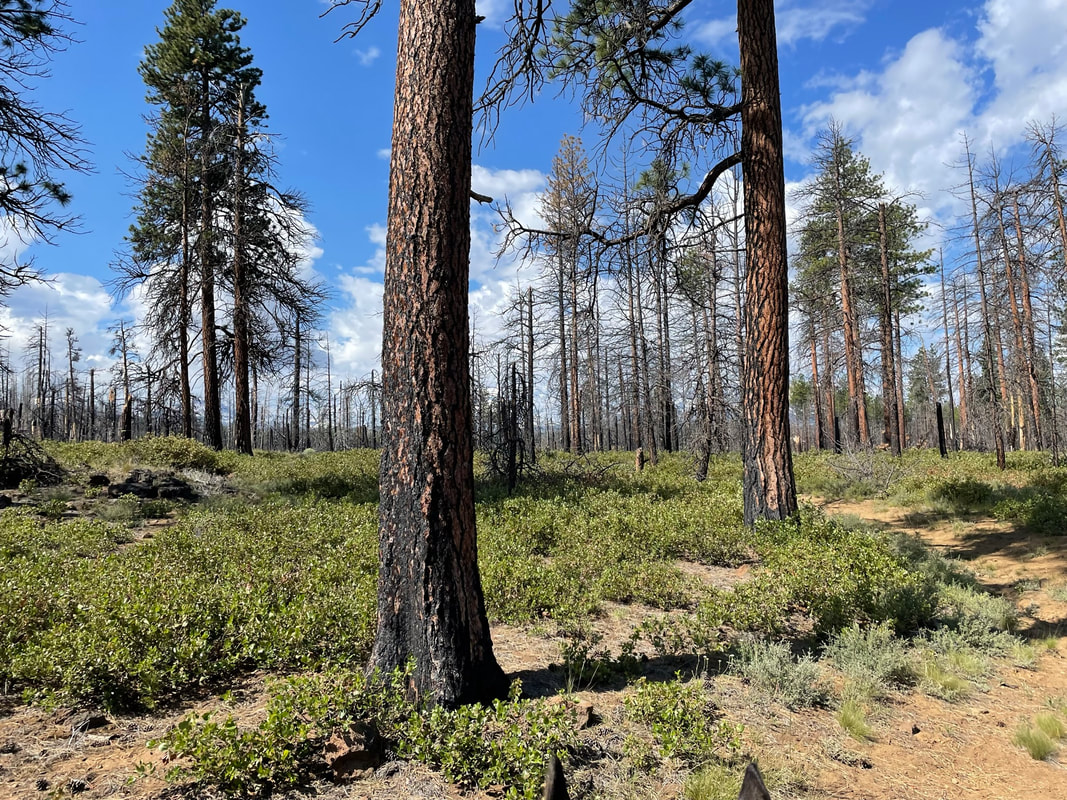
We rode through some burned trees. You can see how rocky the footing is.
|
|
The last section of the trail was a steep decline. We had to go slow and watch our footing. Below is the last stretch of level forest road before I put my phone away and held on.
Marquis Trail Variations
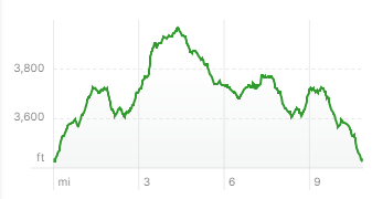
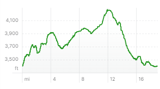
There are some other routes described in Kim McCarrel's NW Horse Trails book on central Oregon. I would not recommend these trails unless you know that they are cleared and safe for horses. Part of the route known as the Peterson Burn Trail was cleared as part of the endurance event in 6/2023. It was part of the 20 mile Pole Creek Loop. I would just proceed with caution if you don't know the status of the trail. You never know if you will come across a giant down tree 10 miles in and have to turn around. Both of these route options are difficult. They are rocky, dusty and the elevation change is significant.
|
|
|
Below Peterson Burn Loop
|
Pole Creek 20 mile Loop
|
Whychus Creek
If you are an adventurous trail blazer you may consider riding the Whychus Creek Loop. You can continue south on the met-win trail as shown in green but you cannot ride east on the Whychus Creek Loop. This trail is marked as not horse-friendly and is marked as hiker only, no bikes or horses. Usually if no horses are allowed there is a good reason for this even if it is not readily apparent. I am a rule-breaker to the core, but when no horses are noted on a trail it is good to pay attention to this!
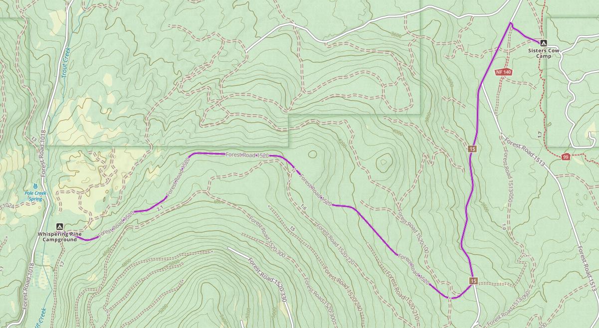
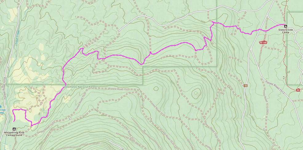
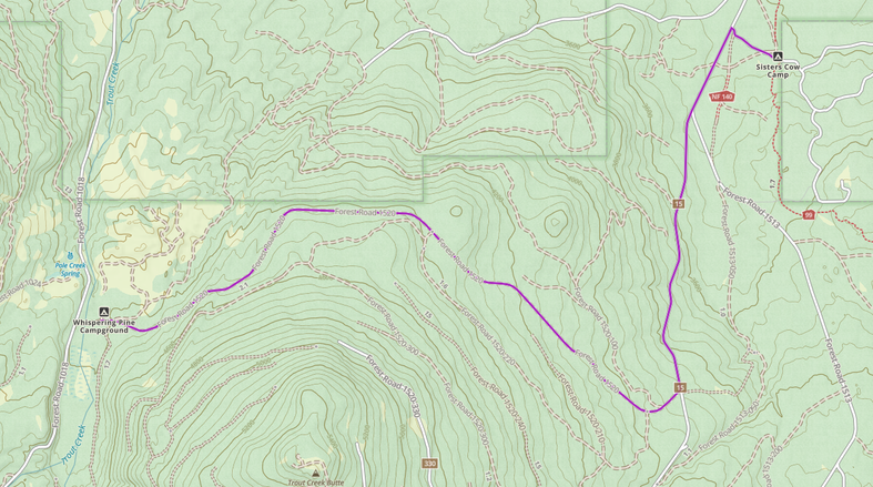
Cow Camp to Whispering Pines
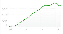
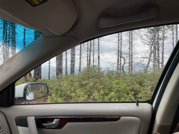
Do not drive this route in your car or trailer!! I know from experience. I drove my Volvo from one camp to the other to check out the route. There were sooo many rocks I was really lucky not to get a flat tire out in the middle of nowhere! I had many great views and the route was easy to follow and there were not a lot of turns to navigate. If you are on horse-back you might run into some fast moving off-road vehicles. I drove this route during a very pleasant thunder storm between rides.
|
|
|
|
Cow Camp to Whispering Pines Back-Roads
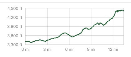
This route to Whispering Pines has more ascent and may be rockier footing. I have not personally ridden this route. I would use a GPS track so you make your route 6 miles and not 10 miles long with "getting lost extra miles."
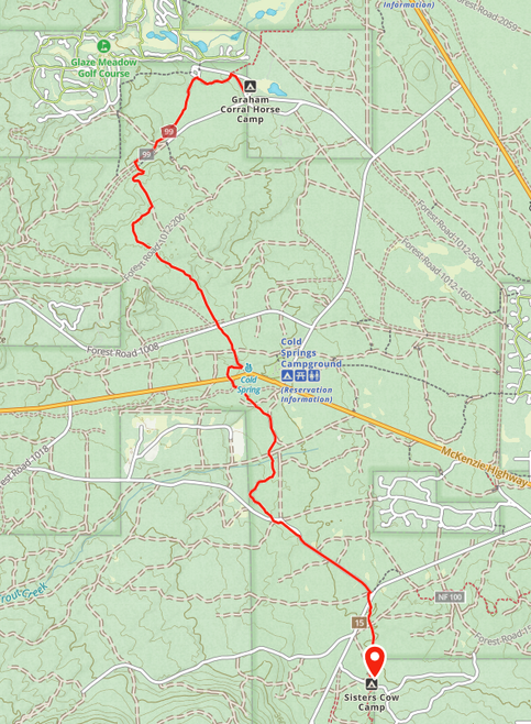
Sisters Cow Camp to Graham Corral Horse Camp
I have only ridden the very beginning of this trail on the met-win. Most of the elevation change is when you are close to Graham if you go from Cow Camp to Graham. Most of the trail is on the Met-Win so if you have getting lost trail anxiety like me, this is really easy route.
|

|
Mini Multi-Camp Trailer Packing
It would be fun to do a multi-camp, multi-day trailer packing trip where you ride from Graham Corral to Cow Camp to Whispering Pines. You would need a non-horsey trailer driver that drives your trailer from Graham Corral to Cow Camp then to Whispering Pines while you are riding. Ideally, you could ride from Graham Corral to Cow Camp then to Whispering Pines.
Graham Corral to Cow Camp - 7 miles
GPS Track Link
GPS Track Link
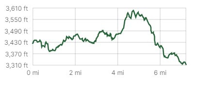
Cow Camp to Whispering Pines - 6 miles
GPS Track Link
GPS Track Link
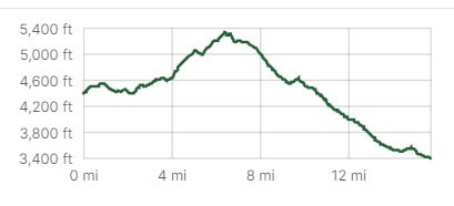
Endurance Horse Routes to Whispering Pines
These are tough routes. They have elevation, rocks and are extremely dusty in the summer. If you are training for Tevis, these routes will be perfect for you. I was very glad I did not ride the 30 mile loop. I saw some very tired, extremely fit, endurance Arabs, full out on their sides sleeping after riding this loop!
The trail was flagged for the endurance ride but riders still got lost. There is a sharp turn that is hard to see so check your GPS track. Even better, if you have the paid version of Ride with GPS your app will yell at you if you miss a turn! |
|
Endurance Lessons
1) Start Early - We do the intro rides so we are not officially competing with anyone. Our ride started at 9am and by 9am it was already warm. Next time I will start early when it is cooler. The trail was extremely dry and dusty and riding behind another horse was miserable. The horse in front kicked up so much dust Sam and I both were coughing. We had to go around them and pick up the pace so we could be out in front on the trail. I could have avoided this dilemma by starting our ride a little earlier in the cooler early morning temps.
2) Do the Shorter Mileage Ride - I thought we might do our first 30 mile ride here. That would have been a bad idea. The trails here are very challenging and many of the 30 mile riders and their horses were VERY tired after their ride. Experienced 50 milers came in slow. I talked to 30 mile riders that discussed how much they had to "endure" with the rocky footing, dust and heat. Of course endurance riders never take the short cut, call it quits or pull if they can help it. If you are a Tevis hopeful, go for it. For everyone else, take care of yourself and your horse and do the shorter ride.
3) Use Cavallos - I am just about done with my Scoot boots twisting or falling off. We lost a front boot and I didn't even notice. Sam did not miss a beat and the trail was rocky and rugged. Cavallos offer thicker sole protection and in the dry climate the velcro works to keep the boot on. I might even add a pad to my boots. The gravel roads were rough and the pumice soil is tough on hooves.
4) Track your Horse - Air Tags worked here with the patchy cell service. A rider lost her horse, found him, got back on AND finished the 30 mile ride. That is grit!! She tracked her horse and found him quickly. Her 30 mile horse did 42 miles! That is an incredible horse and rider team. We all come to that moment when you have to pee on the trail and you briefly let go of the reins. It could happen to anyone. Use a tracking device!!
5) Ride with GPS - Use pre-recorded tracks. I recently learned that if you have a paid subscription to "Ride with GPS" you can use the "navigate" option to have verbal directions when following tracks. This means your phone will yell at you if you go off track!! This is amazing and I will have to try it. You can join PNER, pacific northwest endurance riders and get a free upgraded subscription! Apparently Gaia has this option as well. You can read about it here.
Rating
I would absolutely go back! The best time to visit is during an OET fundraiser or an endurance ride. During these events the trail is flagged and cleared and you have some supervision in case your horse comes back to camp without you. The trails out of camp are challenging. Sam and I were fine but we had no time constraints and we have spent lots of time riding in the mountains of Colorado. The easiest ride is going north on the Met-Win to Graham Corral. However, even this ride is 14 miles long. My idea of "long" is gradually shifting. Previous to starting intro endurance rides I thought 14 miles was really long. Now I am pretty comfortable with 18 miles on easy terrain. The terrain here is not easy so I would plan your route so that you do not ride longer than your horse's fitness level.
