Wilkerson Horse Camp
|
Location: 65866 Apiary-Market Rd, Rainier, OR 97048
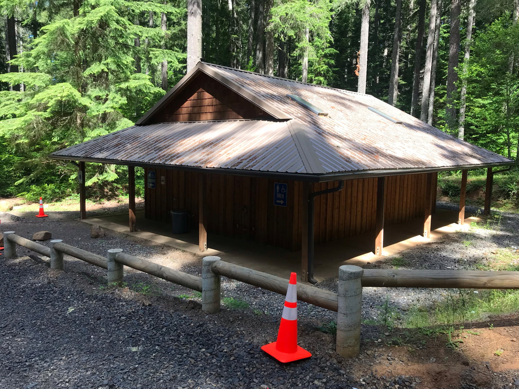
Facilities: Hot showers and electric outlets in restroom with AC, picnic pavilion Camp Site Amenities: picnic table, trash can, water spigot, 4 wooden horse corrals per site, Site Type: Pull-through sites, some could fit 2 trailers Water: Spigot available at each camp-site, can attach hose Footing: Liahona Trail is barefoot friendly and muddy, so muddy that hoof boots may fall off, Logging roads trails are rocky and boots are best Cell Signal: Att - 1 bar up the 5 mile trail at the 1st T, no signal in camp Dogs: Dogs allowedWebsite: https://www.columbiacountyor.gov/departments/ParksForestsRecreation/camp-wilkerson Reservations: https://www.reserveamerica.com/explore/camp-wilkerson/PRCG/1067150/campsites?lengthOfStay=1&lookingFor=3001&pageNumber=0 |
|
Getting There
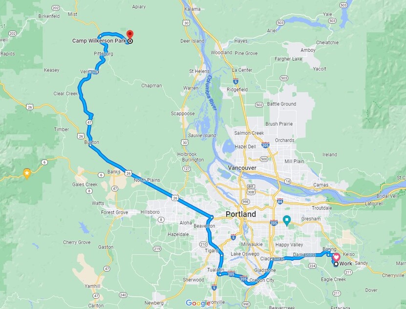
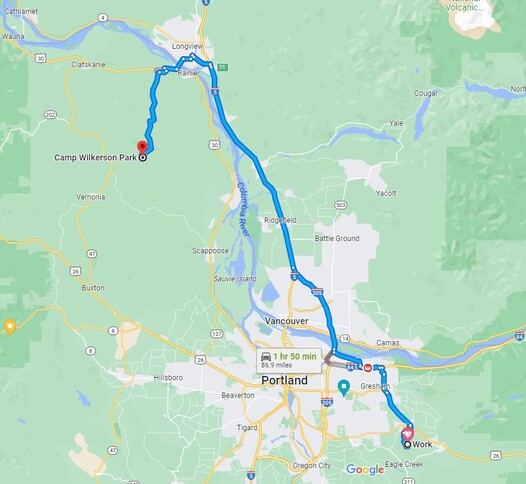
You have two options for getting to Camp Wilkerson from SE Portland. On the left if going around down-town Portland and going west on 26 and then north. On the bottom right google map you take 205 North up through Washington to I-5 then drop down south to the camp. For the choice of route on the bottom left shows staying in Oregon. For the OR only option, you have about 16 miles of curvy road roughly and it is a really pretty drive. For the route through Washington it is more like 12 miles of curvy roads and it is straight highway and not very pretty. I have gone both ways and I prefer to take the easy and straight I-5 through Washington. Additionally, nothing magical happens at the OR-WA border. I have heard all sorts of rumors but there is no magical tollbooth where they threaten to take away your horse. I have transported my own horses from Colorado to Oregon with no paperwork checks. The boarding barn I was moving to required a Coggins and health certificate and they are a good idea to have. However there is no threatening horse police that really wants to steal your non prize-winning, run of the mill, grade or no-name, better than few - but beloved trail horse. I happen to keep a permanent brand inspection, bill of sale and a more often than not a slightly out-of-date Coggins and Health Certificate in my glovebox just in case. However, I brought 2 dogs with me and did not have health certificates on them, so that is one more thing I will put on my to-do list.
|
|
Arrival to Horse Camp
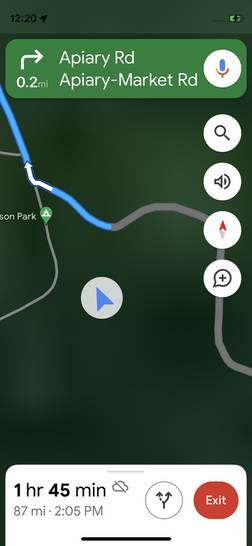
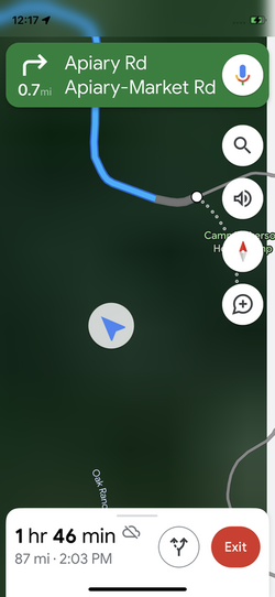
I arrived from the north, turned left onto to camp road as indicated by the Camp Wilkerson sign. As you go down the road the camp host's vehicle is on the left and you go through a gate that is open just wide enough to get a horse trailer through. Next you see your arrow on google maps diverge from the road that takes you to the horse camp. Do not panic! The first time I drove there I backed out thinking I had missed the turn. You did not, just stay calm and carry on and continue all the way past the camping and cabins to get to the horse camp.
|
|
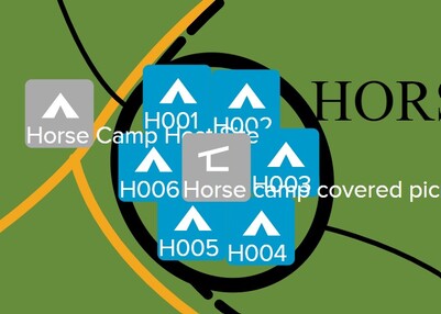
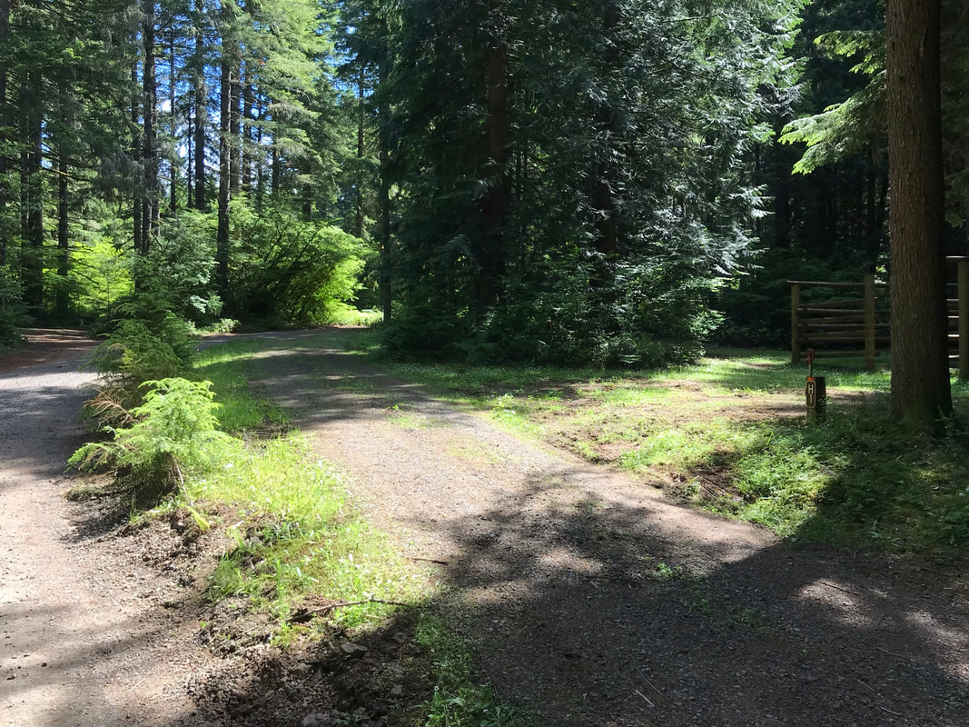
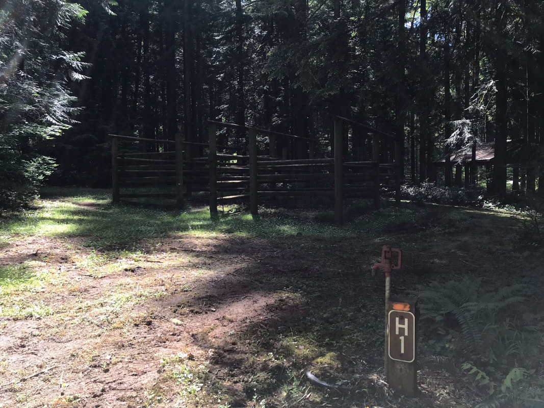
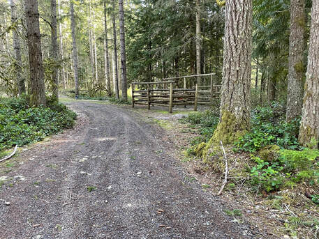
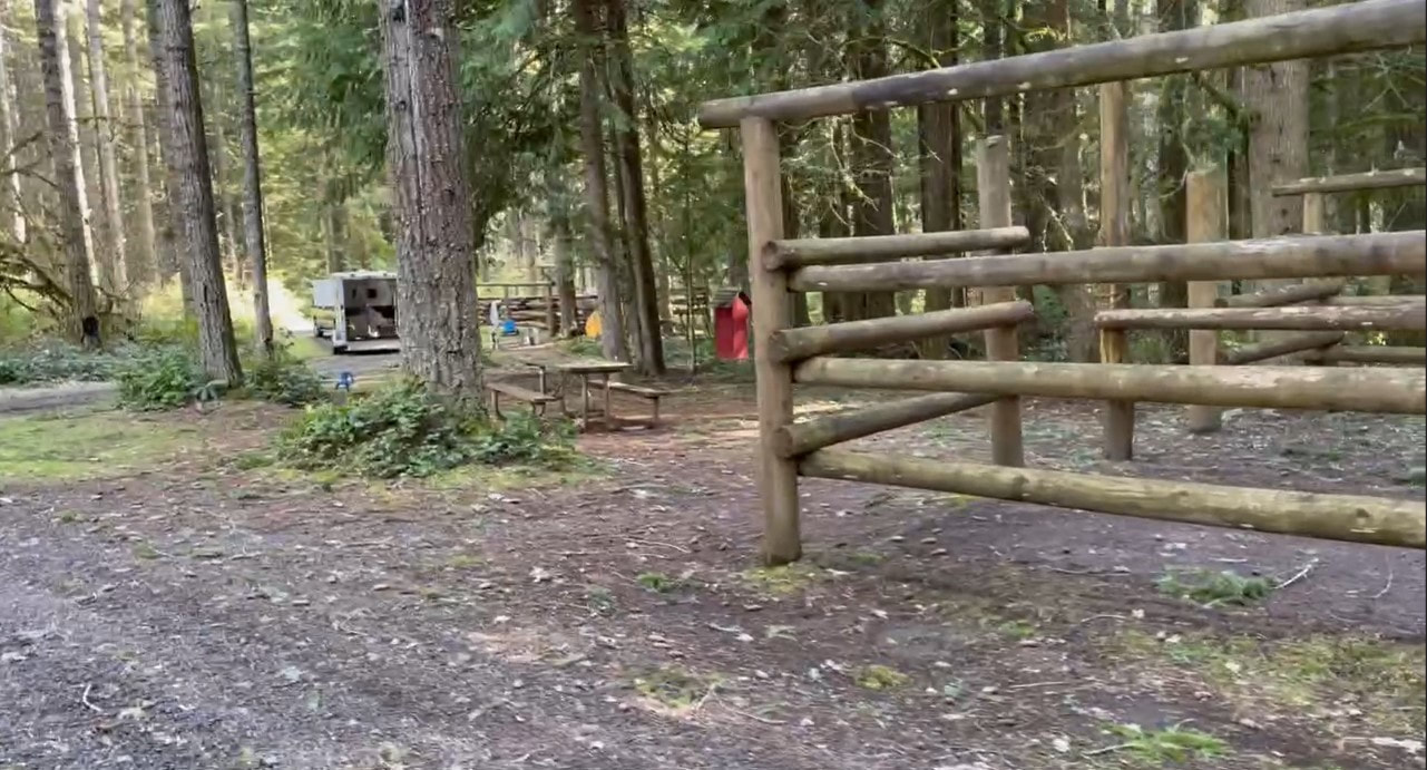
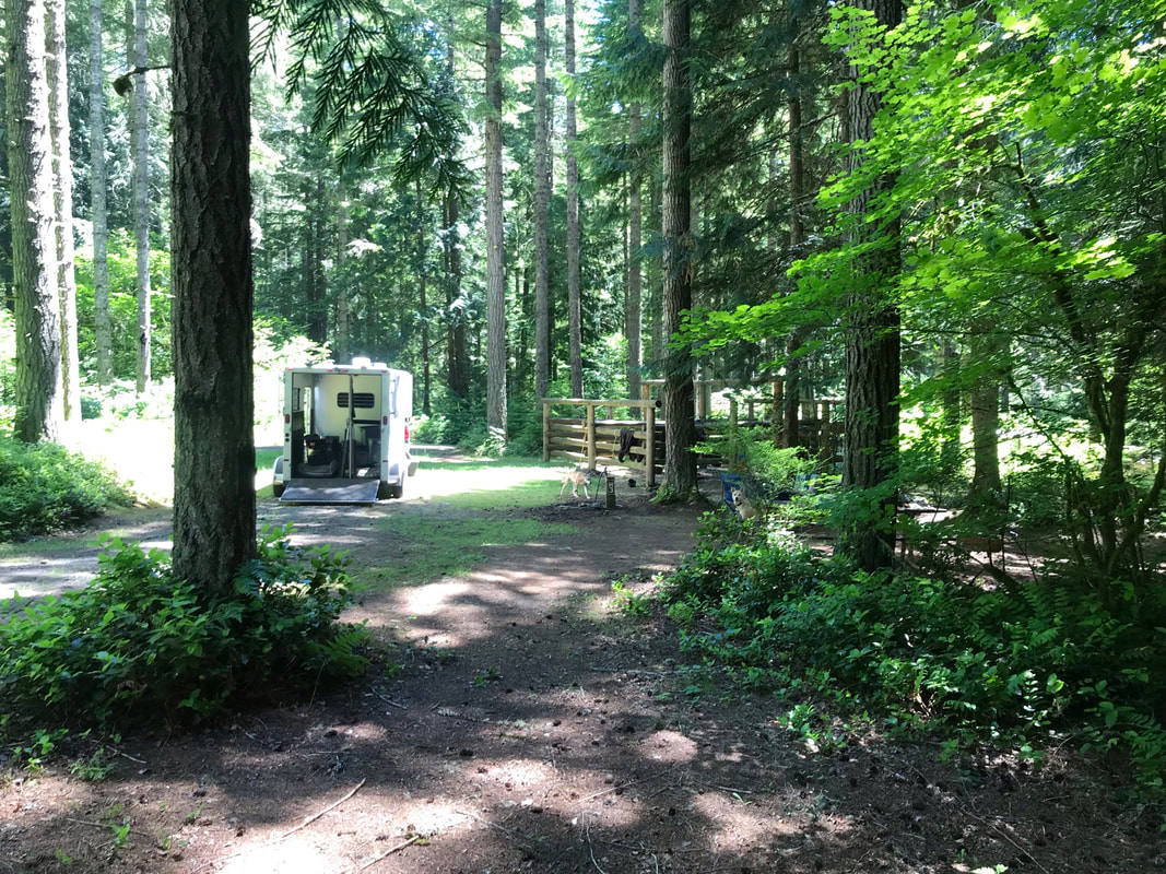
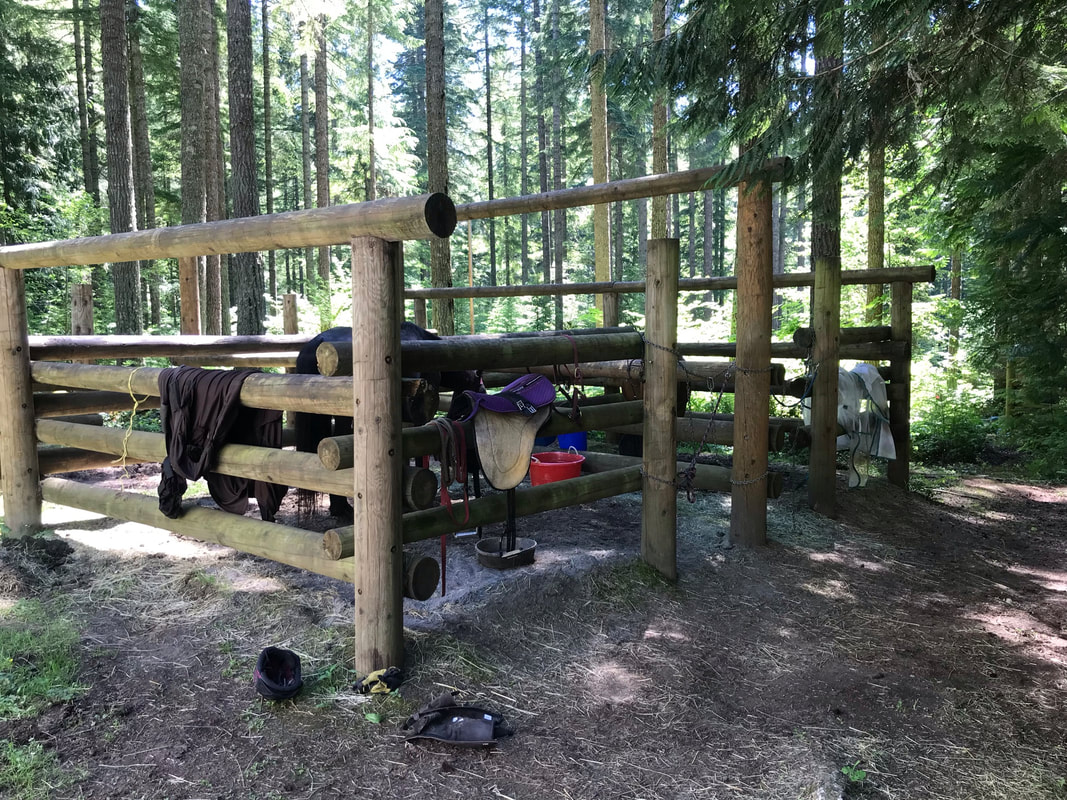
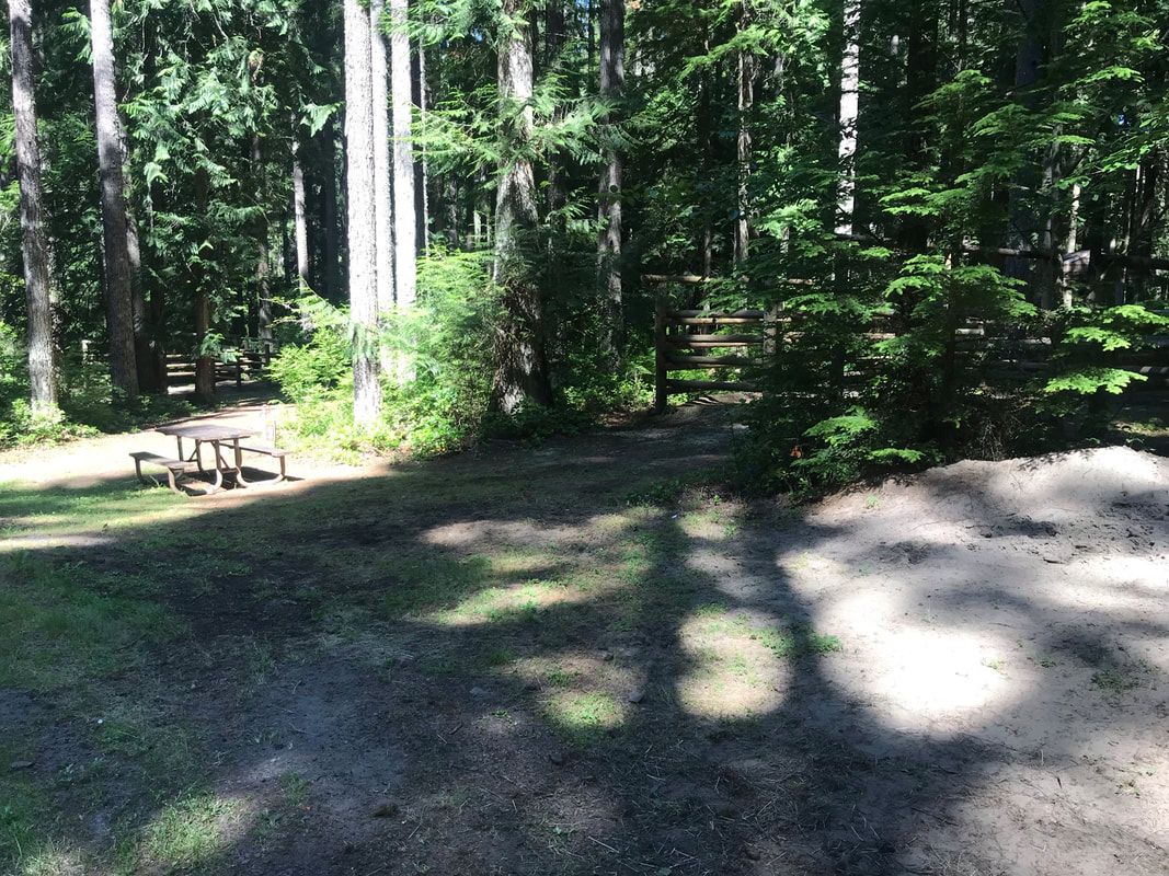
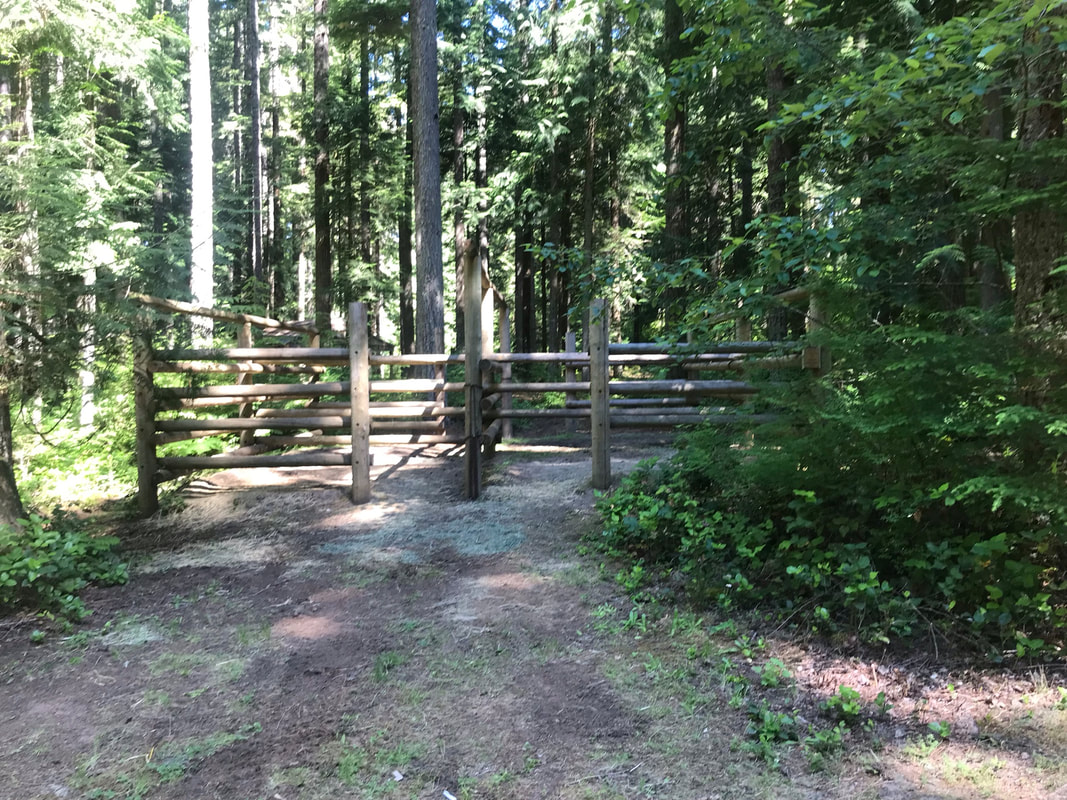
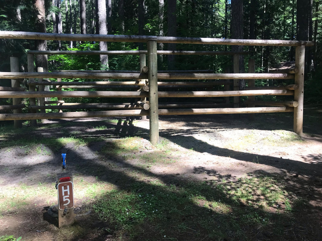
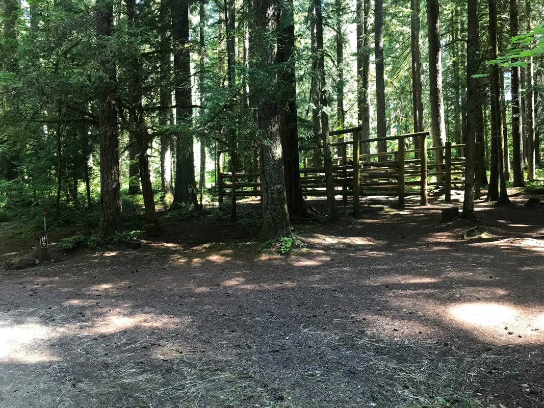
Horse Campsites
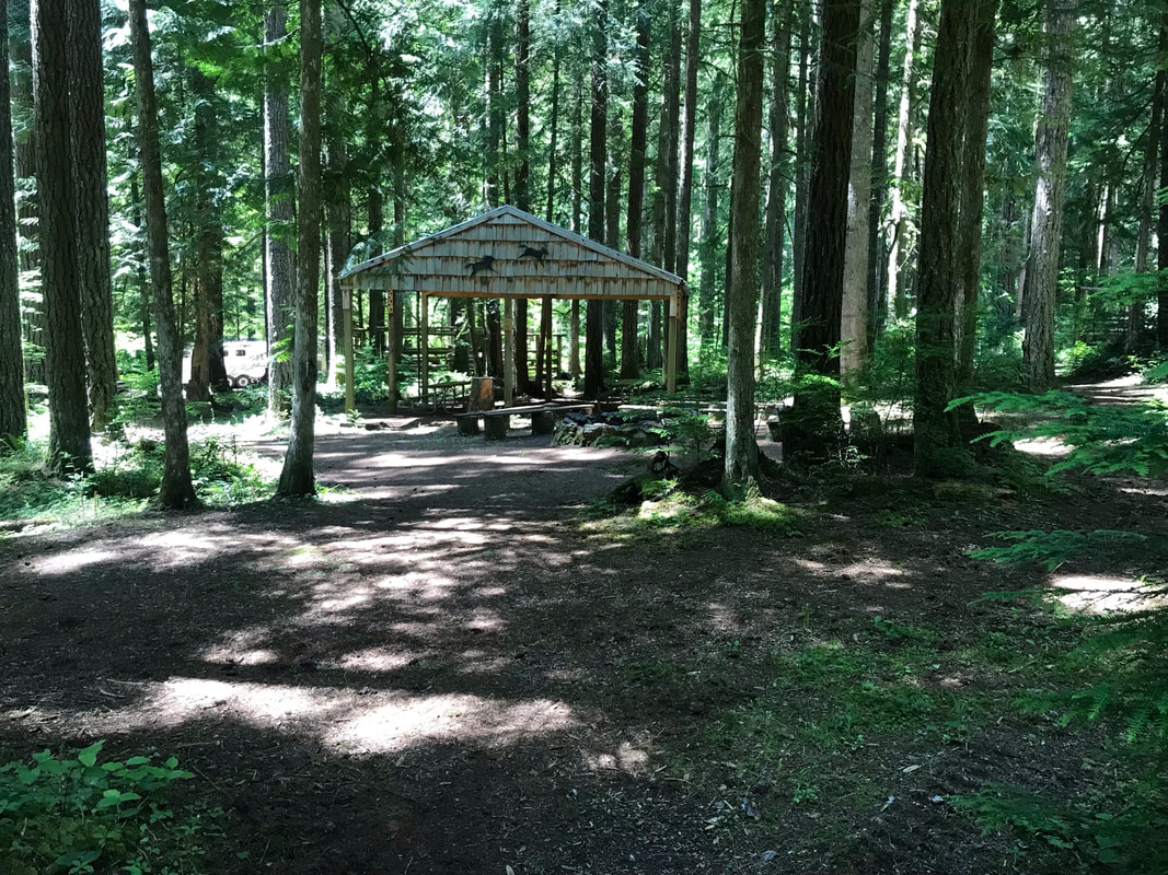
All of the horse campsites are shady and in the trees. They all had the old style wood corrals with chain gates. The corral footing was sand and there were piles of extra sand around the campground that you could use to refresh your corrals. There is a fire-box by site 3 and 2 that has a shovel in it that I used to move some sand into the corrals. They were all pull-though sites with plenty of room for two trailers per site. All the campsites have a short trail that leads to a covered shelter and amphitheater in the middle. They were primitive sites with a trash can, picnic table and potable water spigot but no electric. I did see one smart camper run an extension cord from the bathroom outlet to their horse trailer. I don't officially recommend this.
|
Site H1: 80 foot driveway, pull-through, sunniest site
Site H2: 75 foot driveway, pull-through Site H3: 80 foot driveway, pull-through Site H4: 60 foot driveway, pull-through Site H5: 100 foot driveway, pull-through Site H6: 100 foot driveway, pull-through, shadiest site, closest to restroom, |
|
Campsite Pictures
I have included links to videos of each campsite after the campsite title.
|
|
Site H2
Picnic table is nicely located so that you can see the horses in the corral and move items from the right side of the trailer to the picnic table.
Site Video
Picnic table is nicely located so that you can see the horses in the corral and move items from the right side of the trailer to the picnic table.
Site Video
|
|
Site H3
We set up our tent so that I could see Sam in the corral looking through the 2 trees. The ground was not level and Jon was sleeping on a small incline.
Site Video
We set up our tent so that I could see Sam in the corral looking through the 2 trees. The ground was not level and Jon was sleeping on a small incline.
Site Video
|
|
Site H4
I find that the picnic table to horse corral distance and placement is a little awkward. This site is within view of site H5 if you camp with a friend.
Site Video
I find that the picnic table to horse corral distance and placement is a little awkward. This site is within view of site H5 if you camp with a friend.
Site Video
|
|
|

|
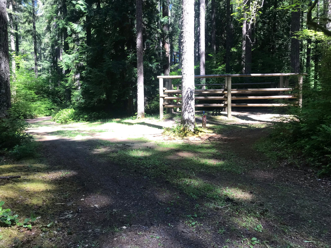
H6 and nearby restrooms with A/C, hot showers and electric outlets. Very shady site and a very long driveway parking area.
Site Video
Site Video
|
|
|
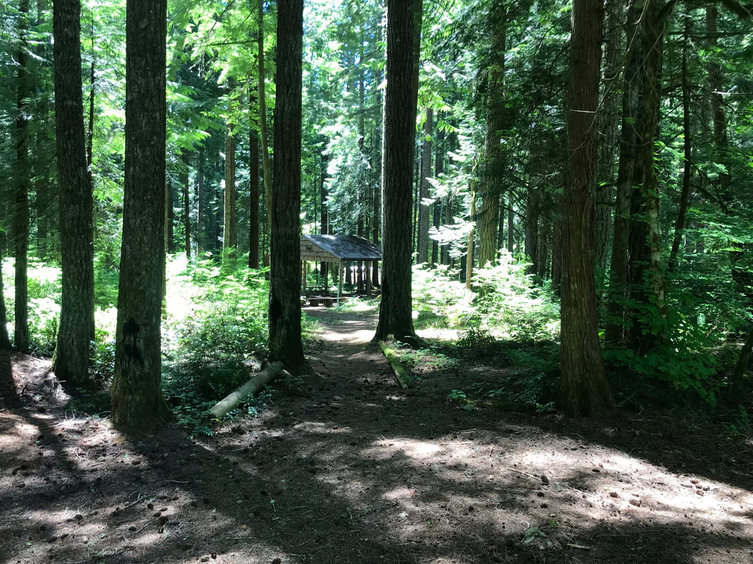
Trail from site H3 to center pavillion.
|
|
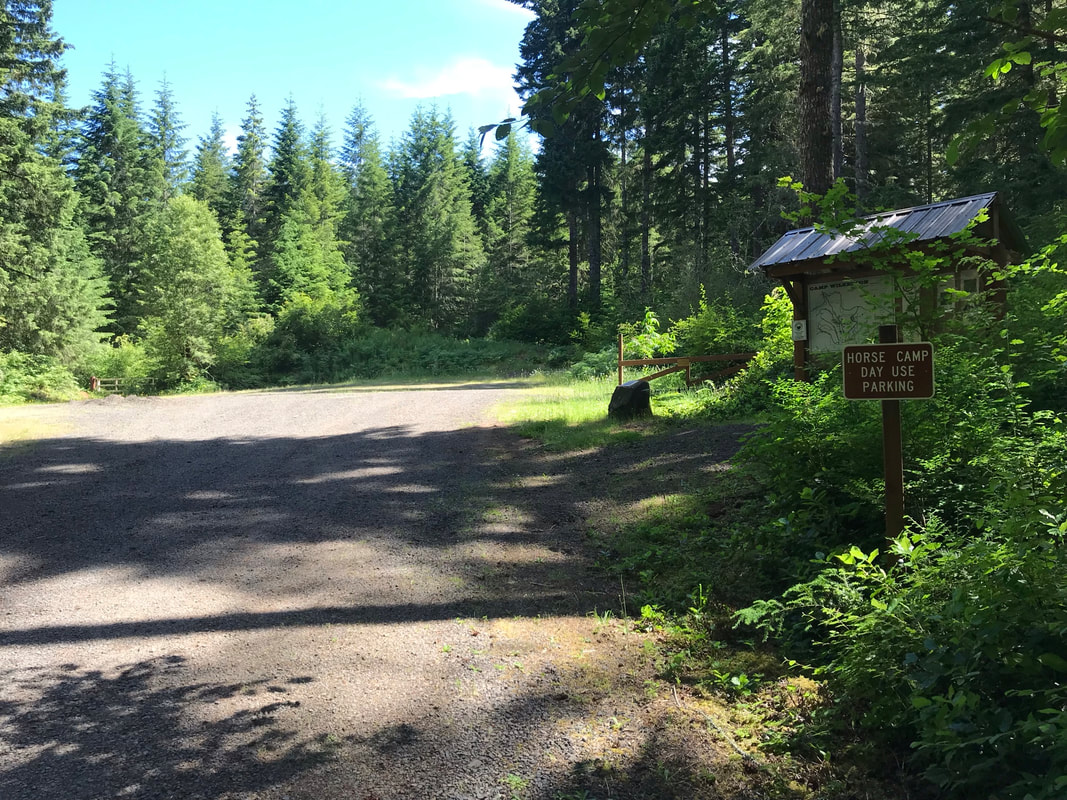
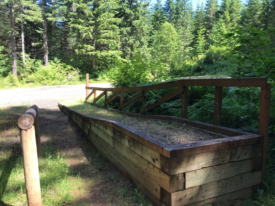
Day Use Area
There was a fairly large parking lot at the end of the horse campsite area for day use and parking. There is a mounting block that is a ramp and some hitch rails.
|
|
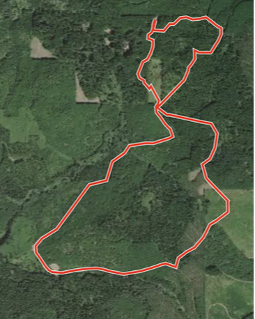
Riding
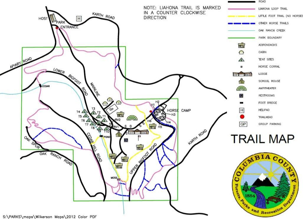
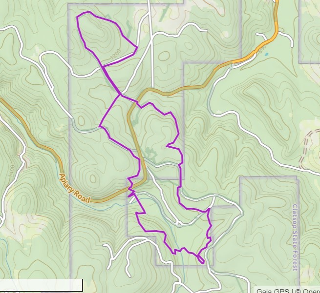
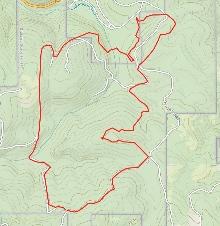
The below camp map seems to be the only available map of the trails in the area around the campsite. I tried Gaia and Avenza and All-Trails and none of the apps had the local trails. You can see the local logging roads but none of the hiking or horse trails. OET member Rory Hammond sent me this link.
Open this link on your phone in Google maps and it will show you all the trails. To keep the trails on your phone off line you do need to be a little tech savvy. There is no cell reception at camp. This means you need to download the whole area from google maps so you can use it off-line. I downloaded the actual GPS file raw data and used the drop box app to open it in Gaia. See how to do this here. I am also in my 40s and am not tech savvy so younger riders will probably know how to use this information better than I do.
Gaia is an even better app. I will share links for saved Gaia tracks on the trail write-ups below.
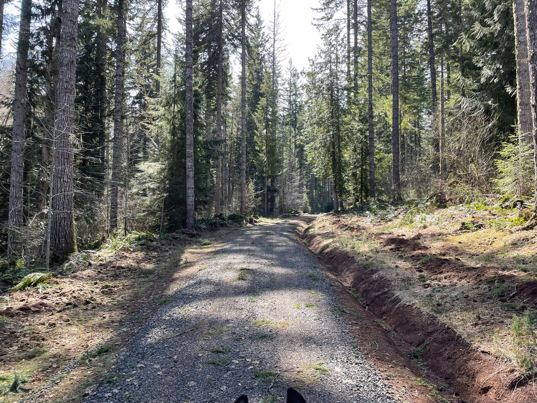
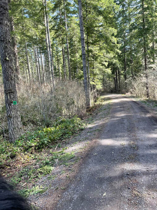
All of the gravel roads are not in the official park. This means you may meet motorcycles, hunters, or loggers. Be aware that you may be sharing the trail with non-horse traffic.
PDF Link Trail Map
Open this link on your phone in Google maps and it will show you all the trails. To keep the trails on your phone off line you do need to be a little tech savvy. There is no cell reception at camp. This means you need to download the whole area from google maps so you can use it off-line. I downloaded the actual GPS file raw data and used the drop box app to open it in Gaia. See how to do this here. I am also in my 40s and am not tech savvy so younger riders will probably know how to use this information better than I do.
Gaia is an even better app. I will share links for saved Gaia tracks on the trail write-ups below.
All of the gravel roads are not in the official park. This means you may meet motorcycles, hunters, or loggers. Be aware that you may be sharing the trail with non-horse traffic.
PDF Link Trail Map
Trail Clearing
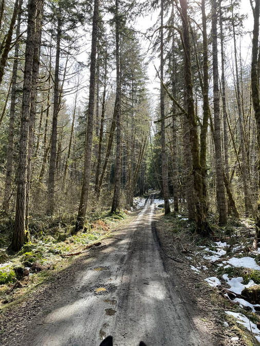
The best time to visit Wilkerson is the summer or fall after the single-track trails have been cleared by the OET. My most recent trip here was in March of 2023 and while I had a great time, we rode on the gravel roads as all of the single-track trails had branches down.
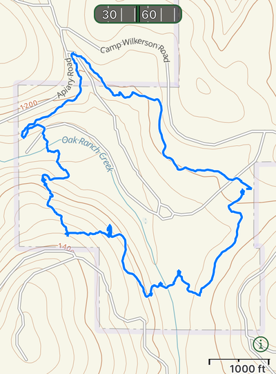
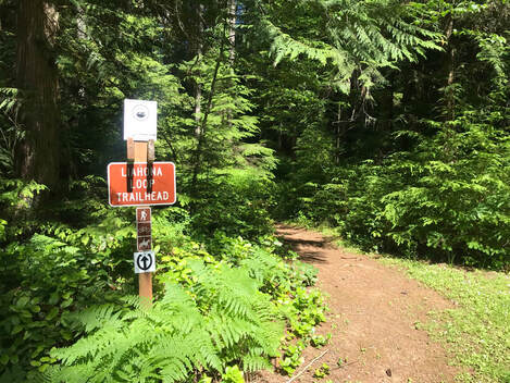
Liahona Trail Loop
Total Miles: 3.5
Time Taken: 1.5 hrs
GPS Track
Before you ride this loop download the Gaia app and then open the link on your phone. Save the track. Now you can see where you are in real-time as you ride without a cell signal! I got lost so you don't have to!
Time Taken: 1.5 hrs
GPS Track
Before you ride this loop download the Gaia app and then open the link on your phone. Save the track. Now you can see where you are in real-time as you ride without a cell signal! I got lost so you don't have to!
|
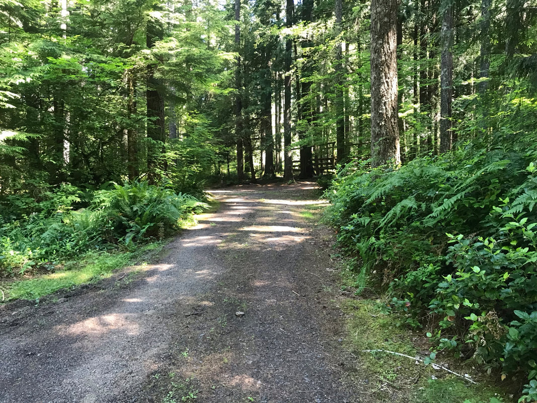
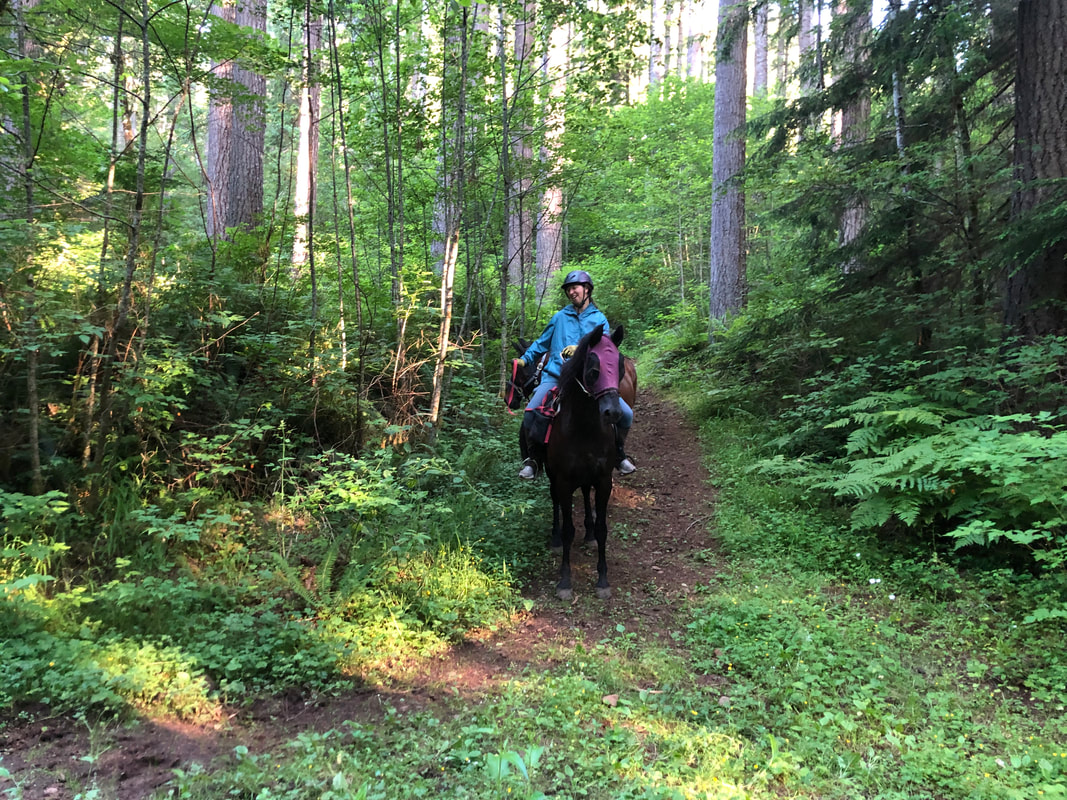
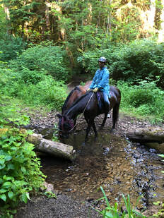
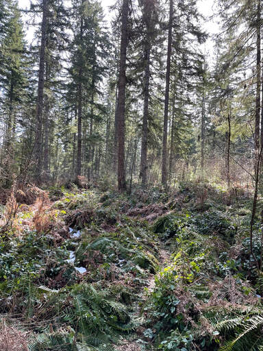
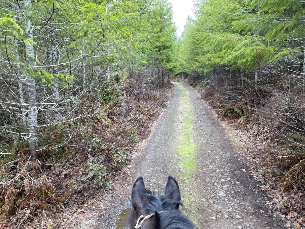
The Liahona trail is in pink on the main camp map and is 3.5 miles. I have a fast walking horse and it took us 1.5 hours due to the hills and feeling lost and consulting the map often. It is marked by pink horse-shoes but the color is pretty faded on the signs. You can start this loop by H1, or right below the manure bin by H4. I love Kim's book NW Horse trails but it is easy to feel lost if you don't know where you are going. When the trail forks with the "other horse trails" as indicated on the map it is confusing to follow. The good news is all of the forks lead back to camp so you can't get too lost. We started by H1 and went counter-clockwise. The trail was dirt that turns to some muddy sections. It goes up and down-hill a lot and it is a good work-out for your horse going up the substantially steep hills. There were sections of hoof-deep mud and we rode it in late June after a heat wave. I would not ride this trail in the spring or winter. I ponied my retired QH Bailey behind Sam by using a longer line so he could walk directly behind Sam. This is doable but only if you have advanced experience handling two horses and have horses that are used to being ponied. The rope laid against Sam's flank and didn't bother him and he felt better knowing Bailey was there with us.
Update- As of 3/2023 there are a few large trees down on this trail that will require a chain-saw to clear. |
|
|
|
|
Gaia does not have the Liahona trail marked. However, since I rode it I saved my trail map at this link:
You can go to the link on your phone, save the trail map, then you can use Gaia at the horse camp to see your location and follow the trail when you are riding. I strongly recommend wearing long sleeves on the Liahona loop due to the narrow trail and branches you brush up against.
You can go to the link on your phone, save the trail map, then you can use Gaia at the horse camp to see your location and follow the trail when you are riding. I strongly recommend wearing long sleeves on the Liahona loop due to the narrow trail and branches you brush up against.
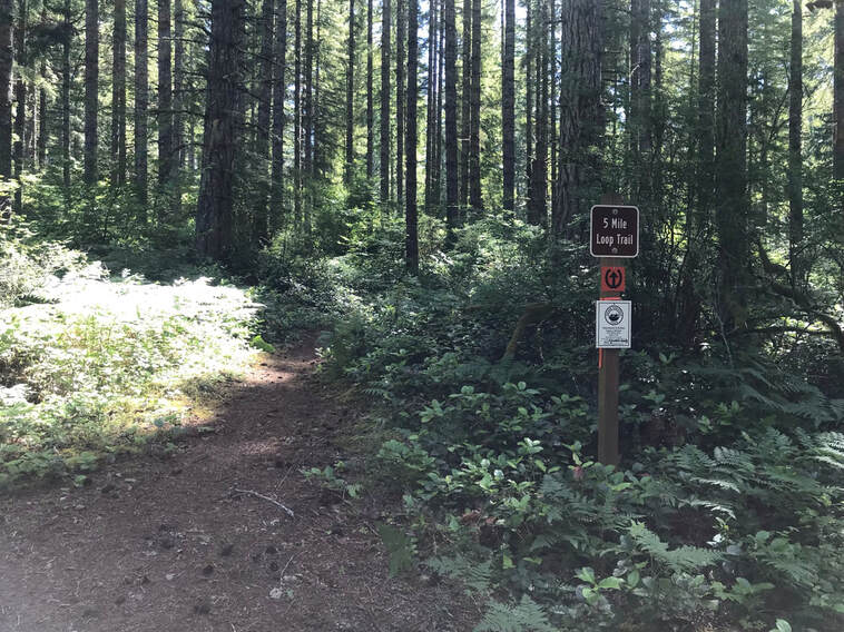
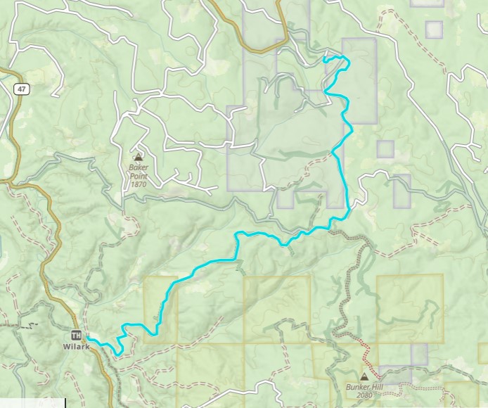
5 Mile Loop
Total Miles: 5.32 miles OET track
My Total Miles: 6.36 miles
Time Taken: 2 hrs 8 minutes
Ascent: 519 feet
OET GPS Track Link
My GPS Track Link
I have attempted the 5 mile loop twice. Once, after reading Kim's directions in the NW horse trail book. That was a complete fail. The directions were so confusing and I got completely lost. I do get lost in Costco so maybe it's not Kim's fault completely. I attempted this loop again in 3/2023 and did a little better. After my first trip the summer of 2021 Rory Hammond sent me some GPS tracks! Download the track to your phone, download the area map onto your phone so you can use it off-line. On my second trip in 3/2023 I used the track I was given to find my route along the 5 mile loop. I still got lost! I was a lot closer to the actual trail so let me tell you all about it.
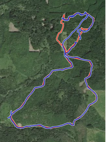
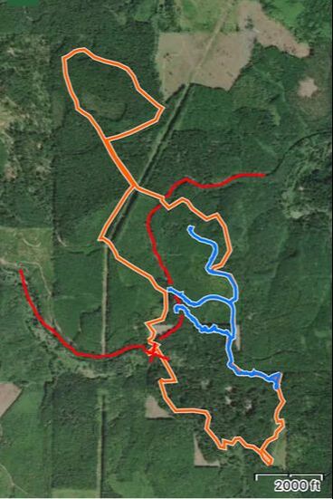
Below left: Proper OET Track,
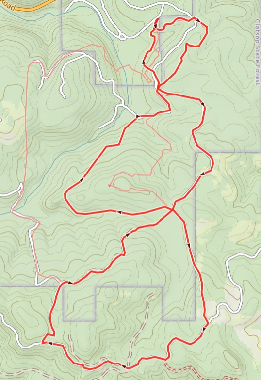
Below Right: My attempt at the 5 mile loop overlaid with the proper OET track. All of the jagged lines at the corners were me and Sam heading off in one direction then stopping when we realized we were off the gps track.
Below Right: My attempt at the 5 mile loop overlaid with the proper OET track. All of the jagged lines at the corners were me and Sam heading off in one direction then stopping when we realized we were off the gps track.
|
|
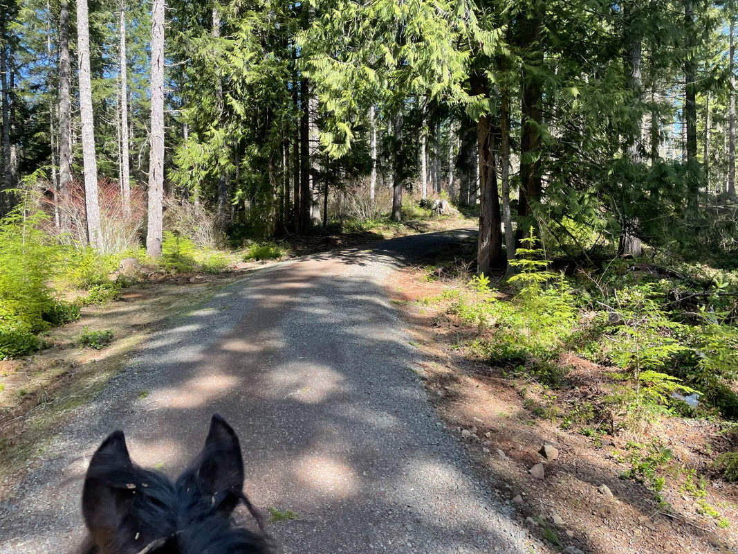
The OET marked this trail with a horse-shoe on different colors. I tried to follow the horseshoes but did not find them to be reliable. I started following an orange horse-shoe but the color changed to green then again to blue! Not all forks are marked and the signs are very hard to see. There doesn't appear to be a uniform place to look for signs or flags. However, download my track and I think you can follow the loop a little easier. Sometimes you have to walk a little in the wrong direction to see that you are going off track. We started out on the signed trail next to site H3. Right away there is a fork. We stayed left. The left fork is a single-track that goes up to Karth road to follow the gps track clockwise. Taking a right at the first fork would have taken me counter clockwise around the track. We went left to go clockwise. We followed a single track until we came out on a gravel road that connected to Karth road. Have I lost you yet? This is where you follow the GPS track and turn around if you go off-track.
|
|
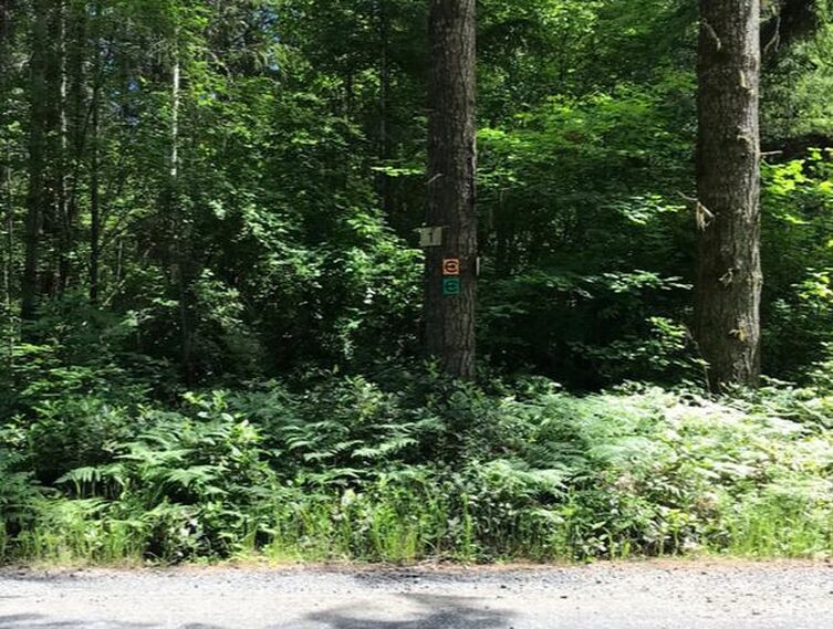
Below is an example of vague signage. This is a junction on Karth road. There are orange and green horseshoes on the tree but this road is at a fork. I don't find this as an example of very obvious directions. I thought I had to stay right at Karth Road but this was incorrect. I walked a ways, checked my GPS saw it was the wrong direction. So, I tried the 2nd to the right fork and rechecked my progress along the GPS track to find the right trail.
|
|
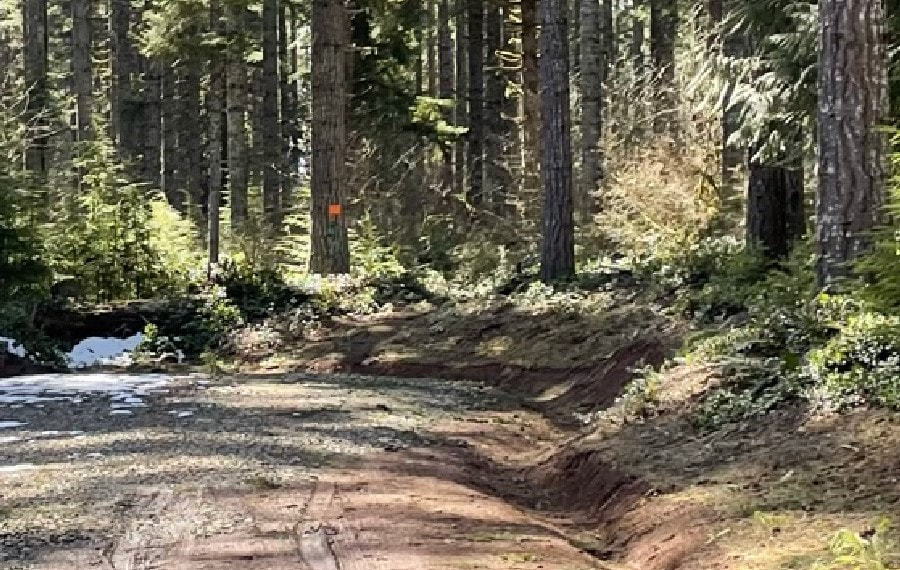
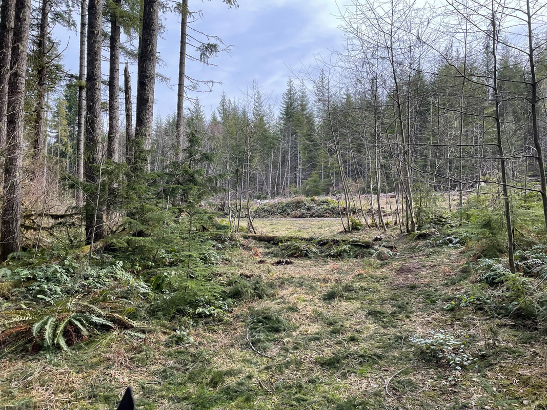
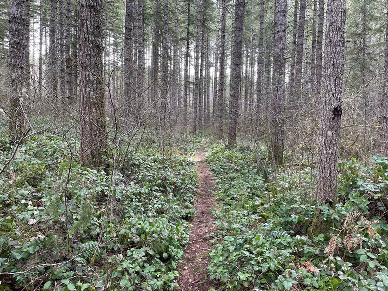
We followed a gravel road to a dirt road then picked up a single-track. You can see a very faint orange horseshoe pointing out the trail. This is the only the 2nd single-track we rode. Most of the trail was gravel road.
|
|
The trail was very overgrown but visible. We did some trail trimming along the way.
|
|
The single-track met up with the gravel road. We came to many forks, not many of them with clear signage! The fork pictured in the lower left had a green horseshoe. One of the forks had at least 5 different road options. I kept mostly right, walked down the fork and double-checked on my GPS track that I was going the right direction. There is something better about wooden trail signs stuck directly on the road. I wish these trails could be re-labeled using actual signs and words.
|
|
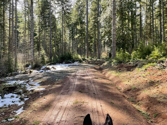
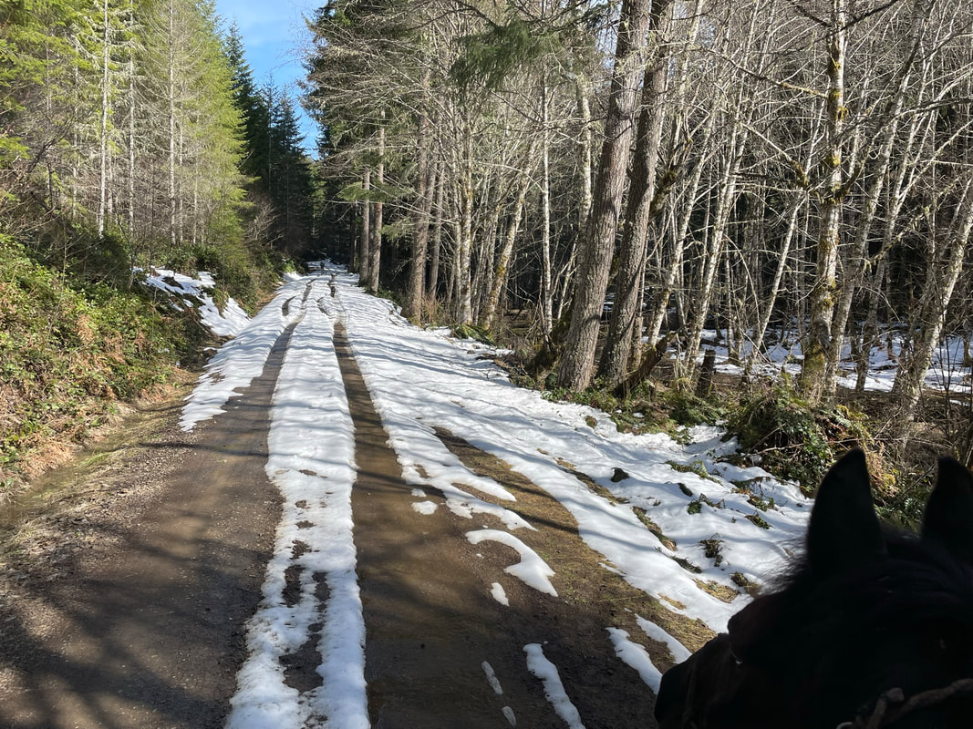
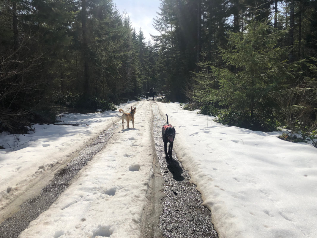
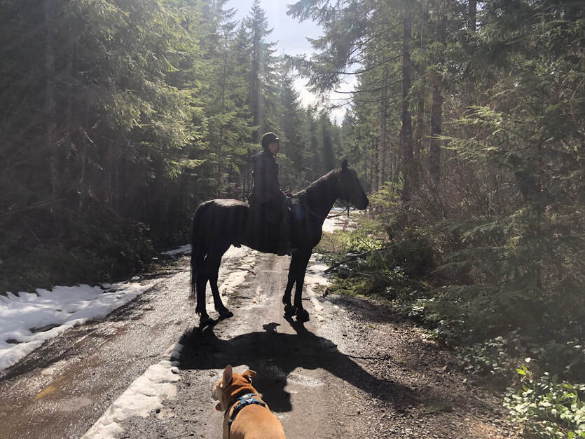
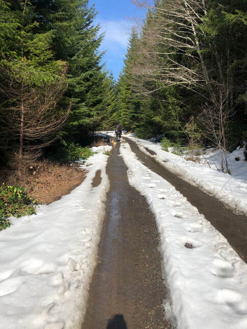
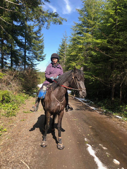
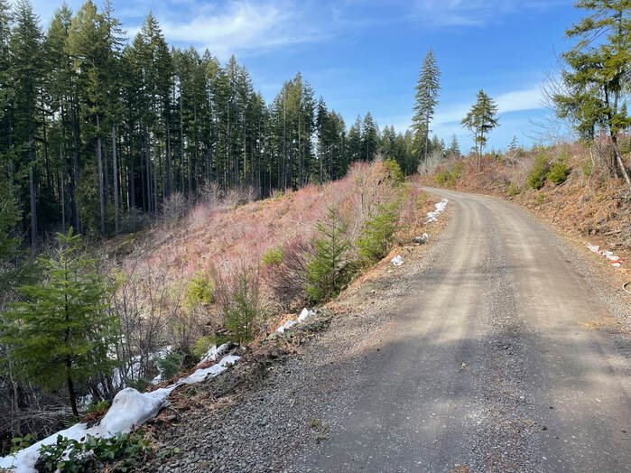
It was 60 degrees and there was snow on the trail. The gravel road was lovely and Sam wanted to walk in the snow. Our dogs zoomed back and forth between Sam and I and my husband Jon. Zooming black and yellow dogs often go behind Sam or between his legs and he always maintains his calm.
|
|
|
|
Somewhere around the picture on the right we missed our left turn onto a single-track which would have taken us back to camp. I saw I missed the turn but kept going to meet up with the Karth road junction that we took originally when we left camp. I called this ride a success. I knew where we were relative to camp and the other trails thanks to Gaia and the OET GPS track.
Other Trails
I would download the Gaia and the GPS tracks and follow the trail on your phone or ride with someone that knows the way. It is very easy to get lost. Do you need more help downloading GPS tracks? I have a chapter about how to do this here.
New Fish Pond
Total Miles: 7 miles
GPS Track Link
User beware! I tried to follow this route on a weekend trip in 3/2023. I have a few tips. This track is not user friendly and I will explain a few of the challenges we encountered.
GPS Track Link
User beware! I tried to follow this route on a weekend trip in 3/2023. I have a few tips. This track is not user friendly and I will explain a few of the challenges we encountered.
During our trip I had talked to other riders that said the Liahona trail was impassable due to down trees. This area of downed trees is marked with the red x. Apiary road is the red curvy line, it is a pretty busy road with fast moving cars.
|
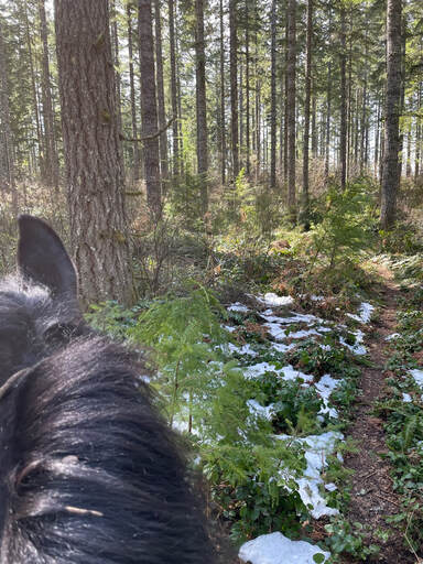
There is no magical bridge that I could find to cross Apiary road. Instead we attempted to ride the track going counter-clockwise. I missed a turn which went from gravel road to single-track. I found the turn but trees were down everywhere and it was not feasible to ride. There was also a huge heap of trash along the blue trail going north from the Liahona trail. It looked like someone had tried to live there or someone thought it was ok to dump a dumpster full of trash right on the trail.
We tried to cut west on the gravel road to ride the western leg of the track but ran into Apiary road. We also ran into a jeep and an extremely scary motorized dirt bike not once but twice as the dirt bike rider was also lost. The dirt biker rider was very polite and he turned off his bike for us to pass. Sam held it together just barely. It could have ended very differently on any other horse. We got back onto the Liahona trail and followed it until we couldn't get pass the downed trees. I was totally fine with turning around and we headed back to the horse camp with some good steep hills on the single-track to help let off some steam. |
|
Below left is where we crossed from the Liahona trail onto the gravel road. The bottom right is the gravel road when I got a section of trail that did not have trash everywhere.
|
|
Below, back on the Liahona trail after surviving our encounter with the dirt bike.
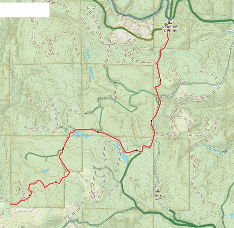
Possible 10 Mile Loop
Total Miles: 7.8 miles
GPS Track Link
If you see the total miles as less than 10 miles and are confused then I am glad I am not the only one. I guess I just need to ride this loop to figure this out. I would caution skepticism unless you have ridden this trail before. After my failed fish pond attempt I would be cautious in recommending any of the OET tracks. I will probably go back to Wilkerson and try this loop before I recommend it to others.
Actual 10 mile Loop
Total Miles: 9.54 miles
GPS Track Link
I would not ride this unless you have an experienced rider with you who has done this loop before. If they have done this loop before, take your downloaded Gaia map and GPS tracks. Most likely you will still get lost.
GPS Track Link
I would not ride this unless you have an experienced rider with you who has done this loop before. If they have done this loop before, take your downloaded Gaia map and GPS tracks. Most likely you will still get lost.
Trail to Camp 8
Gunner's Lake
Rating
Overall the campsites are nice and shady and a short walk down and uphill to the restrooms with flush toilets and hot showers. The trails are not easy and not well marked. I would ride in the dryer times of the summer as the trails that are not on the gravel roads get really muddy. OET claims the trails are well marked but I strongly disagree. This is not a place for beginners or riders just starting out horse camping. You really should ride with someone that knows the trails to be confident in your location. I also could hear periodic gun shots during our stay and some horses may find this frightening. However, even with all of the above comments I really would like to go back to ride the longer loops with my GPS tracks. The gravel trails make for good trotting with hoof boots. The trails are beautiful, the camp is shady and there is nothing better than a hot shower after a long day on the trail.
